MyTopo
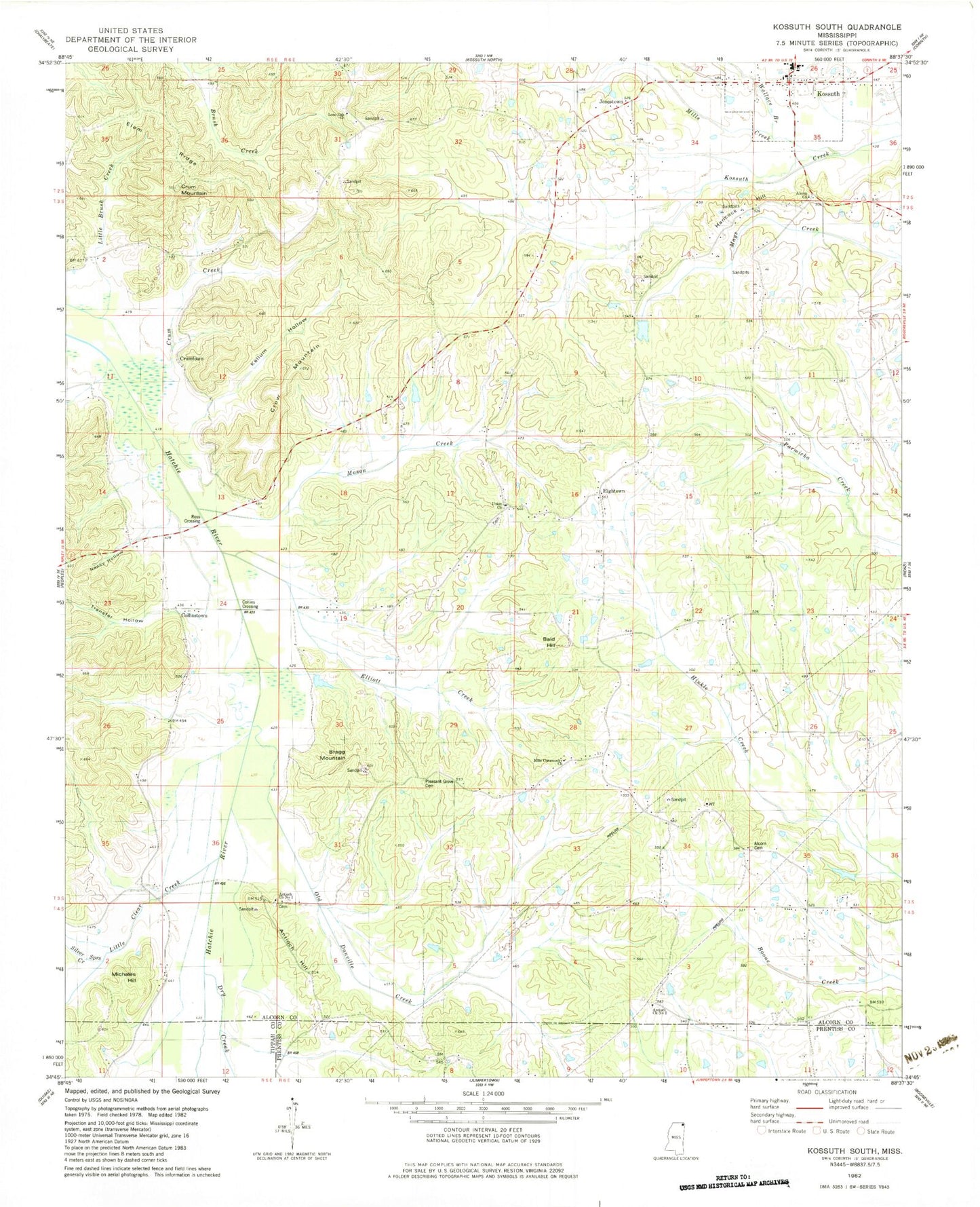
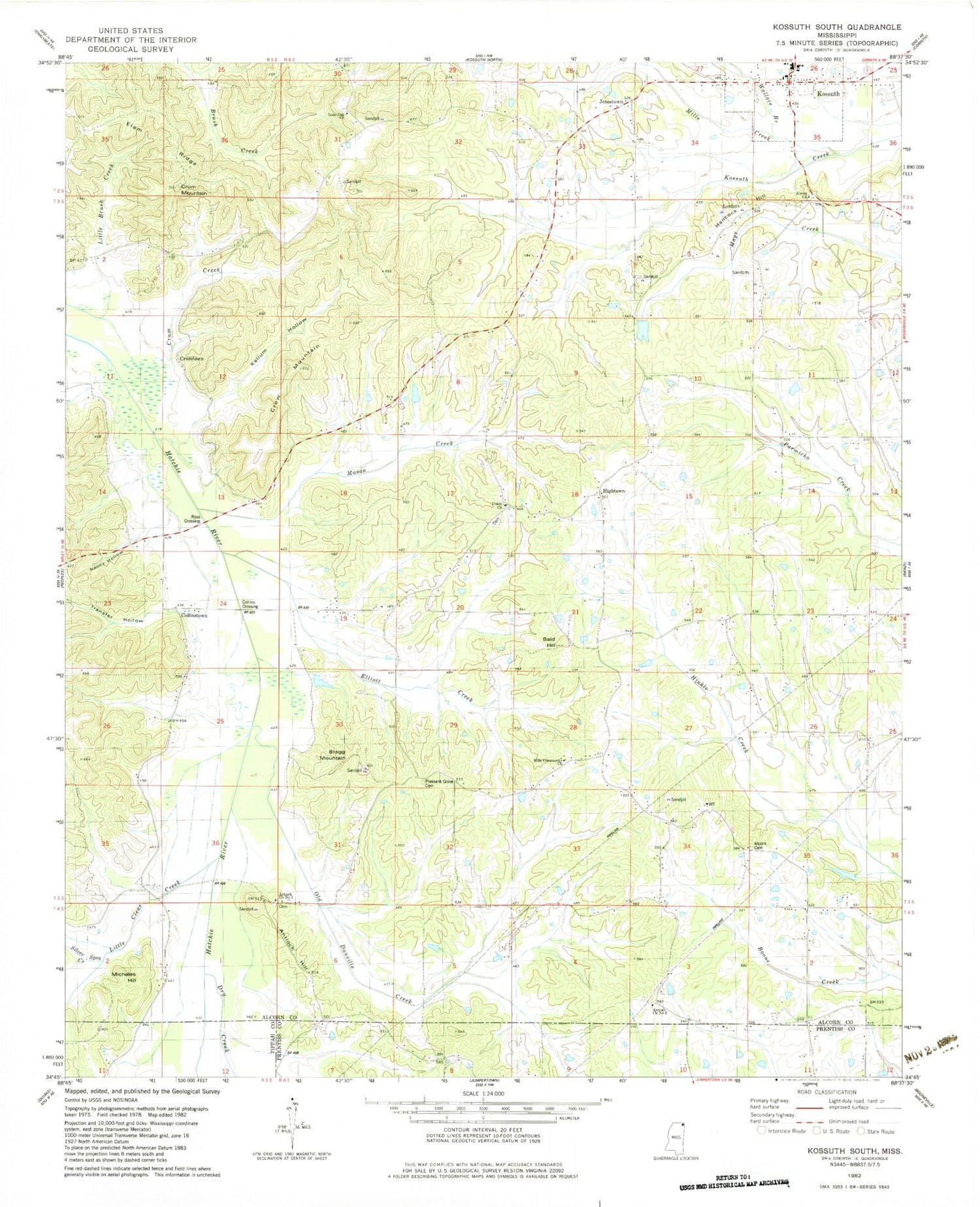
Classic USGS Kossuth South Mississippi 7.5'x7.5' Topo Map
Couldn't load pickup availability
Historical USGS topographic quad map of Kossuth South in the state of Mississippi. Map scale may vary for some years, but is generally around 1:24,000. Print size is approximately 24" x 27"
This quadrangle is in the following counties: Alcorn, Prentiss, Tippah.
The map contains contour lines, roads, rivers, towns, and lakes. Printed on high-quality waterproof paper with UV fade-resistant inks, and shipped rolled.
Contains the following named places: Alcorn Cemetery, Alcorn Church, Alcorn Missionary Baptist Church, Antioch, Antioch Church Number 1, Antioch Church Number 2, Antioch Hill, Bald Hill, Blissdale Swamp, Bragg Mountain, Bumpus Lake Dam, Collins Crossing, Collinstown, Crow, Crow Mountain, Crow School, Crum Mountain, Crum School, Crumtown, Dilworth Store, Dixon School, Dry Creek, Elam Ridge, Elbethel Church, Elbethel School, Elliott Creek, Griffin School, Hancock Hill, Henderson Store, Hightown, Honno Two School, Jonestown, Kellum Hollow, Kossuth, Kossuth High School, Kossuth Missionary Baptist Church, Kossuth United Methodist Church, Kossuth Volunteer Fire Department, Little Brush Creek, Little Clear Creek, Lone Oak Church, Mason Creek, Mattox School, Melvin School, Michales Hill, Mills Chapel, Mills Community Church, Mills Creek, Nancy Hollow, Old Danville Creek, Palmichie School, Pleasant Grove Cemetery, Plesant Grove Church, Progress School, Robinson Creek, Ross Crossing, Shadmon School, Silver Springs Creek, Transfer Hollow, Turnpike Bridge, Union Baptist Church, Union Cemetery, Union Elementary School, Village of Kossuth, Walker School, Wallace Branch