MyTopo
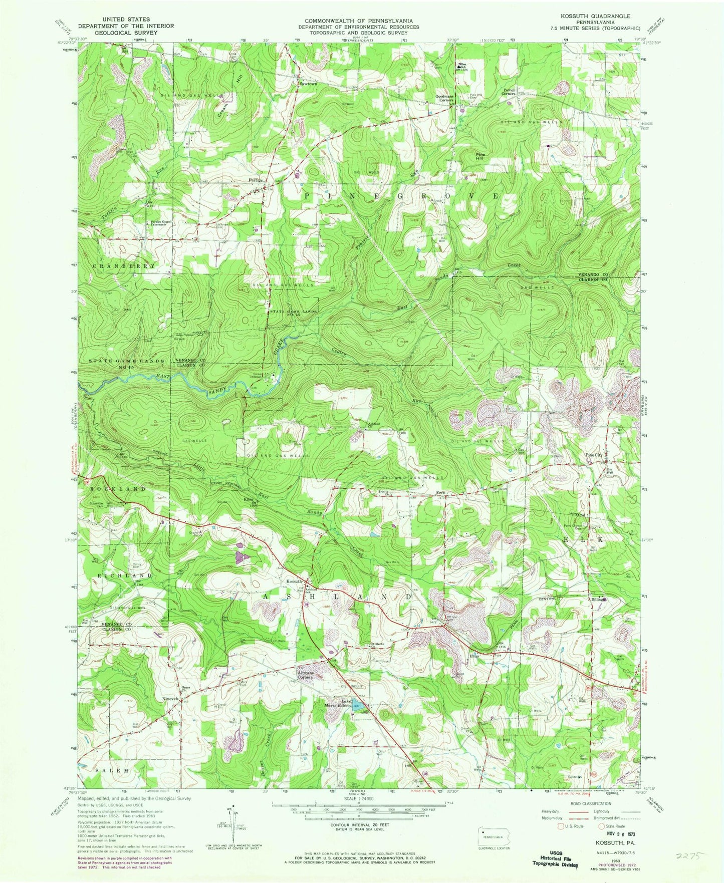
Classic USGS Kossuth Pennsylvania 7.5'x7.5' Topo Map
Couldn't load pickup availability
Historical USGS topographic quad map of Kossuth in the state of Pennsylvania. Map scale may vary for some years, but is generally around 1:24,000. Print size is approximately 24" x 27"
This quadrangle is in the following counties: Clarion, Venango.
The map contains contour lines, roads, rivers, towns, and lakes. Printed on high-quality waterproof paper with UV fade-resistant inks, and shipped rolled.
Contains the following named places: Altmans Corners, Ashland Church, Ashland School, Ashland United Methodist Cemetery, Billing, Billings Station, Black School, Blauser School, Carnes School, Coffman Camp, Cogley Run, Craig Cemetery, Cream Hill, Elmo, Fern, Fern Trinity Evangelical Congregational Churchyard, Fertigs, Fertigs Gospel Tabernacle, Fertigs Post Office, Goodmans Corners, Grace Church, Hi Level Golf Course, Kapp School, Kline, Kossuth, Kossuth Post Office, Little East Sandy Creek, Marie-Eileen Lake, Nineveh, O B Perry Corners, Old Dutch Cemetery, Perry Cemetery, Perry Chapel Cemetery, Phipps Cemetery, Pine City, Pine Hill, Pine Hill Cemetery, Pine Hill School, Pine School, Powell Corners, Prairie Run, Saint Mark's Cemetery, Saint Marks Church, Sawtown, Schreffler Cemetery, Starr Cemetery, Township of Ashland, Township of Pinegrove, Trinity Church, Valley Cemetery, Wise School, ZIP Codes: 16319, 16331, 16364