MyTopo
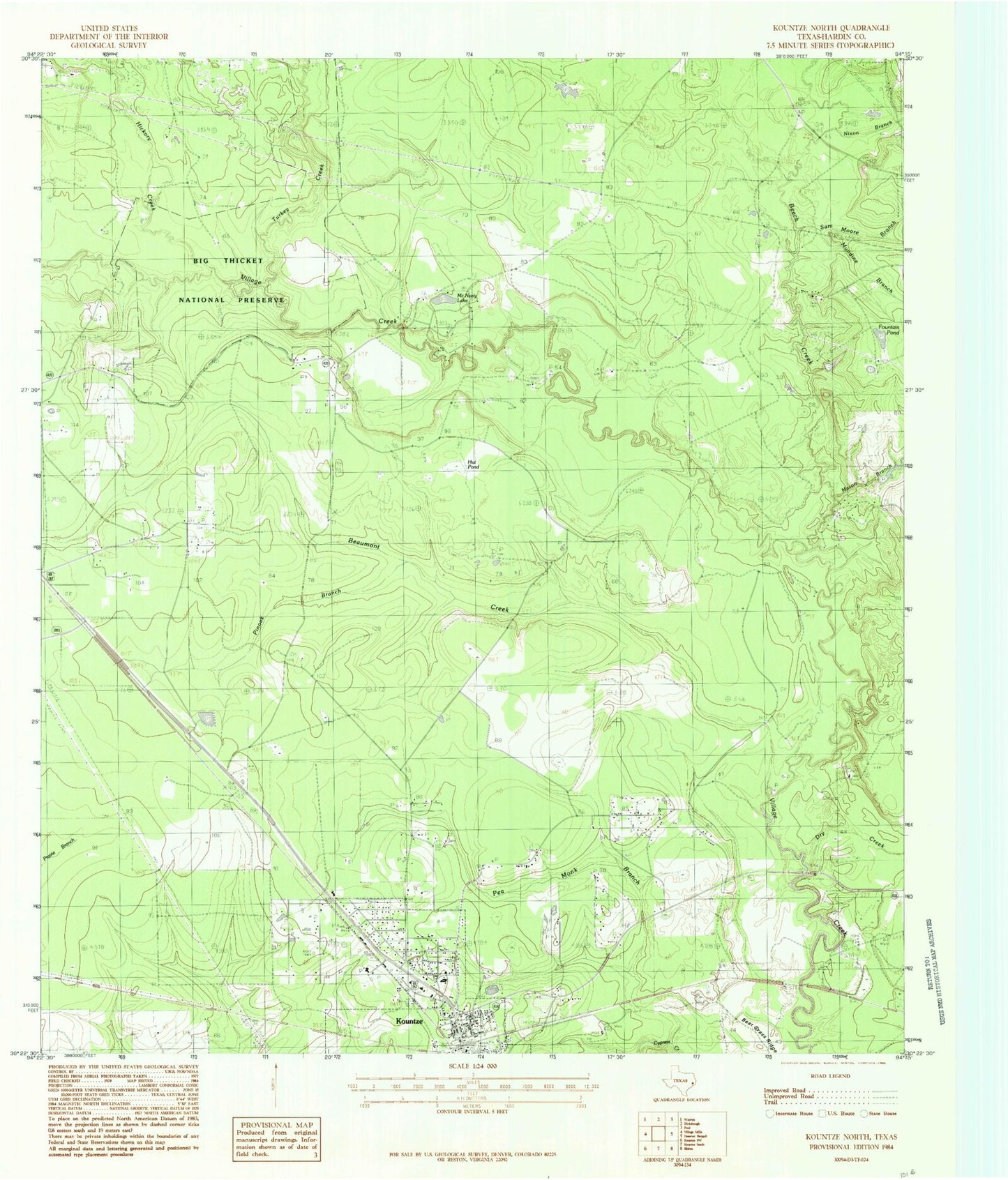
Classic USGS Kountze North Texas 7.5'x7.5' Topo Map
Couldn't load pickup availability
Historical USGS topographic quad map of Kountze North in the state of Texas. Map scale may vary for some years, but is generally around 1:24,000. Print size is approximately 24" x 27"
This quadrangle is in the following counties: Hardin.
The map contains contour lines, roads, rivers, towns, and lakes. Printed on high-quality waterproof paper with UV fade-resistant inks, and shipped rolled.
Contains the following named places: Beaumont Creek, Beech Creek, Big Thicket - Kirby Nature Trail, Camp Matigwa, Daniels Cemetery, Dry Creek, East Village Mills Oil Field, Fountain Pond, Hester Branch, Hickory Creek, Kountze City Hall, Mason Branch, McNeely Cemetery, McNeely Lake, Mundine Branch, Nixon Branch, Old Olive Cemetery, Pea Monk Branch, Pinoak Branch, Providence Church, Sam Moore Branch, Turkey Creek, William W. Hart Cemetery, ZIP Code: 77625