MyTopo
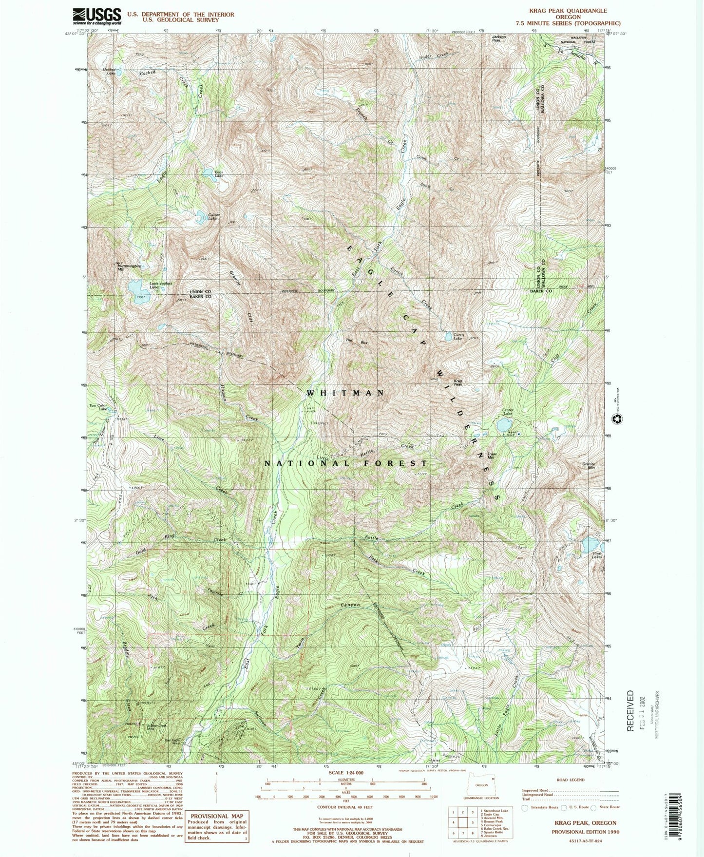
USGS Classic Krag Peak Oregon 7.5'x7.5' Topo Map
Couldn't load pickup availability
Historical USGS topographic quad map of Krag Peak in the state of Oregon. Scale: 1:24000. Print size: 24" x 27"
This quadrangle is in the following counties: Baker, Union, Wallowa.
The map contains contour lines, roads, rivers, towns, lakes, and grids including latitude / longitude and UTM / MGRS. Printed on high-quality waterproof paper with UV fade-resistant inks.
Contains the following named places: Bear Lake, Bradley Creek Mine, Cached Lake, Coon Creek, Crater Lake, Culver Lake, Curtis Creek, Curtis Lake, Dodge Creek, East Eagle Mine, French Creek, Gold King Creek, Granite Cliff, Hudson Creek, Hummingbird Mountain, Jack Creek, Kettle Creek, Krag Peak, Lawson Creek, Lime Creek, Little Kettle Creek, Lookingglass Lake, Main Creek Trail, Papoose Creek, Park Creek, Pine Lakes, Snow Creek, Sullivan Creek, The Box, Truax Mountain, Twin Canyon, Two Color Lake, Lookingglass Lake Dam, Crater Lake Dam, Lower Pine Lake, Lower Pine Lake Dam, Upper Pine Lake, Upper Pine Lake Dam, East Eagle Trailhead