MyTopo
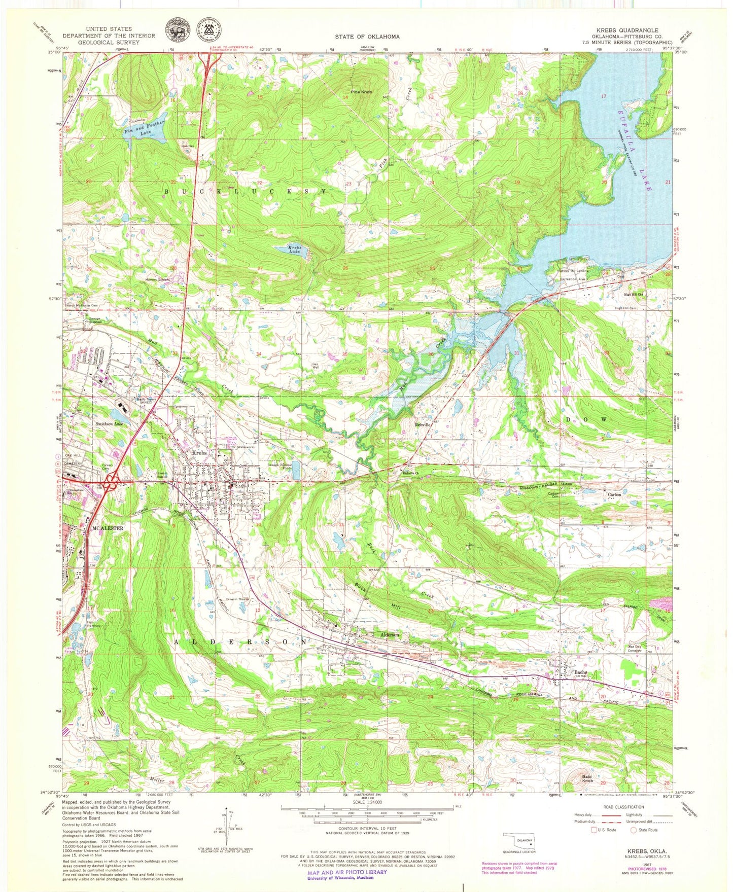
Classic USGS Krebs Oklahoma 7.5'x7.5' Topo Map
Couldn't load pickup availability
Historical USGS topographic quad map of Krebs in the state of Oklahoma. Map scale may vary for some years, but is generally around 1:24,000. Print size is approximately 24" x 27"
This quadrangle is in the following counties: Pittsburg.
The map contains contour lines, roads, rivers, towns, and lakes. Printed on high-quality waterproof paper with UV fade-resistant inks, and shipped rolled.
Contains the following named places: Alderson, Alderson Cemetery, Alderson Post Office, Alderson Volunteer Fire Department, Bache, Bache Census Designated Place, Bache Red Oak Cemetery, Bald Knob, Buck Creek, Buck Hill, Calvary Cemetery, Carbon, Carbon Cemetery, City of Krebs, Fin and Feather Lake, Fin Feather Lake Dam, Gaines Creek Volunteer Fire Department Station 1, Gaines Creek Volunteer Fire Department Station 2, High Hill Cemetery, High Hill Church, Highway 31 Landing Recreation Area, Kiamichi Technology Center Mcalester, KMCO-FM (McAlester), KNED-AM (McAlester), Krebs, Krebs Fire Department, Krebs Lake, Krebs Police Department, Krebs Post Office, Krebs Public School, Lakewood Christian School, Lakewood Christian School Church, McAlester High School, McAlester Regional Hospital Heliport, Memory Gardens, Mud Creek, Oak Hill Cemetery, Oknoname 121012 Dam, Oknoname 121012 Reservoir, Oknoname 121013 Dam, Oknoname 121013 Reservoir, Pine Knob, Pittsburg County, Richville, Richville Church, Smithson Lake, Smithson Lake Dam, Town of Alderson, ZIP Codes: 74522, 74554