MyTopo
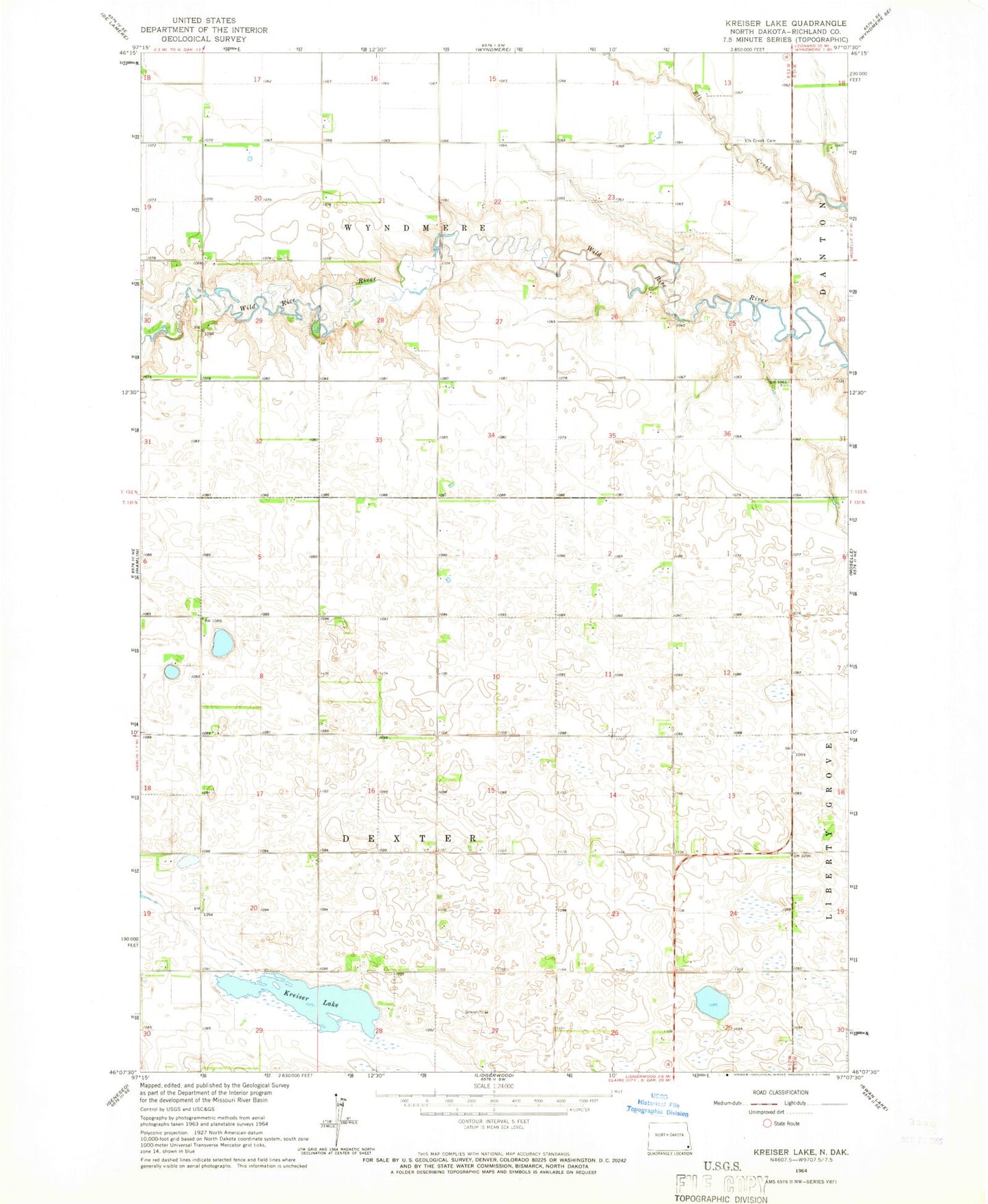
Classic USGS Kreiser Lake North Dakota 7.5'x7.5' Topo Map
Regular price
$16.95
Regular price
Sale price
$16.95
Unit price
per
Couldn't load pickup availability
Historical USGS topographic quad map of Kreiser Lake in the state of North Dakota. Map scale may vary for some years, but is generally around 1:24,000. Print size is approximately 24" x 27"
This quadrangle is in the following counties: Richland.
The map contains contour lines, roads, rivers, towns, and lakes. Printed on high-quality waterproof paper with UV fade-resistant inks, and shipped rolled.
Contains the following named places: Dexter Town Hall, Elk Creek Cemetery, Krause Private Airport, Kreiser Lake, Otterburn Cemetery, Tesch Strip, Thompson Private Airport, Township of Dexter, Township of Wyndmere, Wyndmere Town Hall