MyTopo
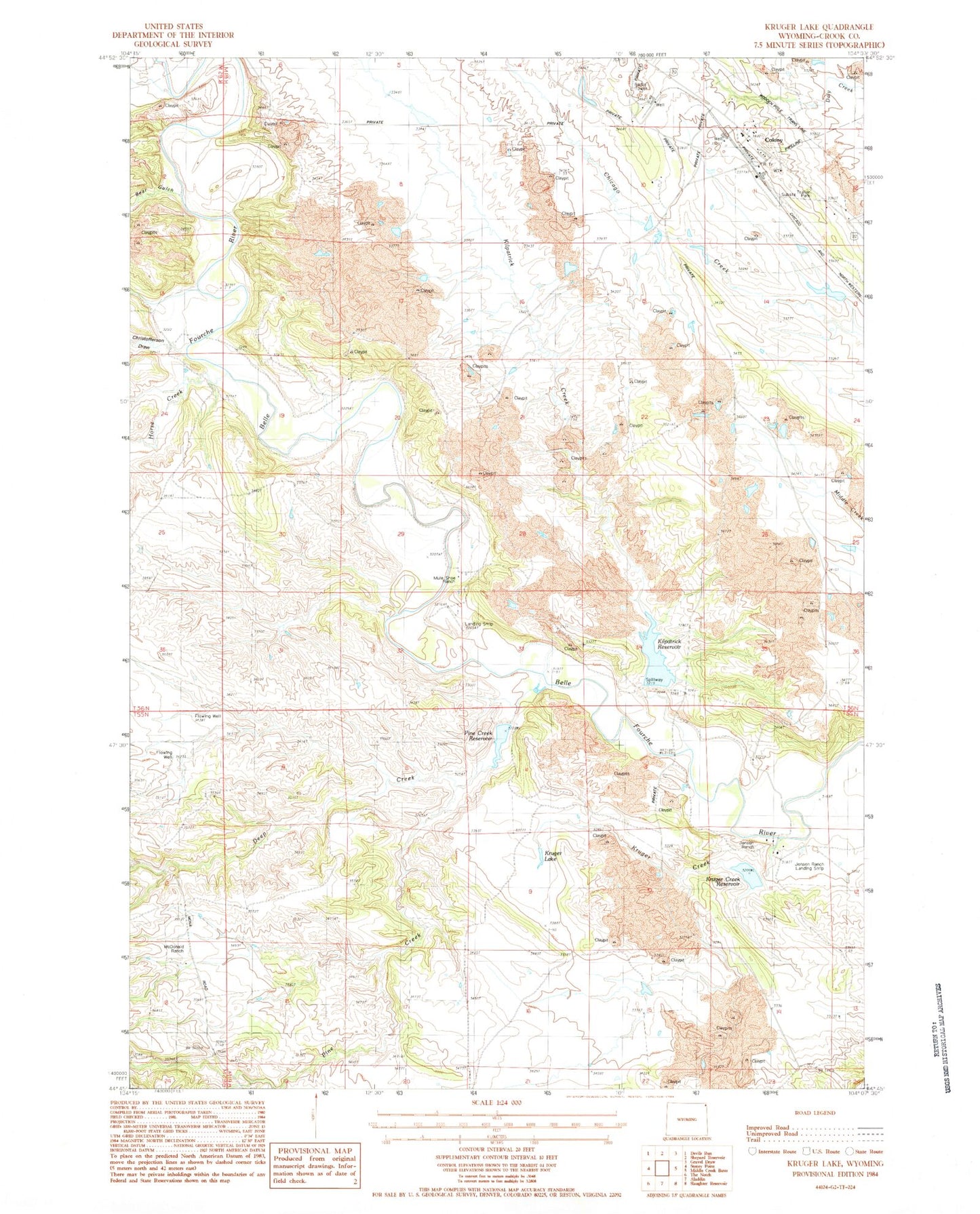
Classic USGS Kruger Lake Wyoming 7.5'x7.5' Topo Map
Couldn't load pickup availability
Historical USGS topographic quad map of Kruger Lake in the state of Wyoming. Map scale may vary for some years, but is generally around 1:24,000. Print size is approximately 24" x 27"
This quadrangle is in the following counties: Crook.
The map contains contour lines, roads, rivers, towns, and lakes. Printed on high-quality waterproof paper with UV fade-resistant inks, and shipped rolled.
Contains the following named places: Baroid School, Bear Gulch, Belle Fourche River Number One Mine, Bentonite Spur, Christofferson Draw, Colony, Deep Creek, Deep Creek Dam, Deep Creek Reservoir, Horse Creek, Kilpatrick Creek, Kilpatrick Dam, Kilpatrick Reservoir, Kruger Creek Dam, Kruger Creek Reservoir, Kruger Lake, Lillian Jensen Ranch, McDonald Ranch, Pine Creek, Thorval Jensen Ranch, Viergutz One Mine