MyTopo
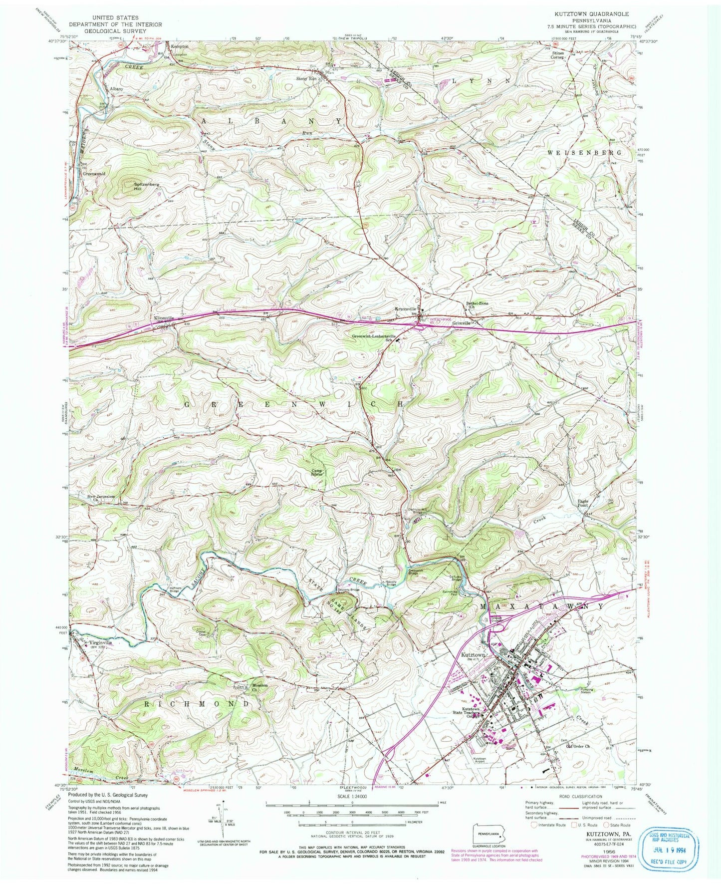
Classic USGS Kutztown Pennsylvania 7.5'x7.5' Topo Map
Couldn't load pickup availability
Historical USGS topographic quad map of Kutztown in the state of Pennsylvania. Map scale may vary for some years, but is generally around 1:24,000. Print size is approximately 24" x 27"
This quadrangle is in the following counties: Berks, Lehigh.
The map contains contour lines, roads, rivers, towns, and lakes. Printed on high-quality waterproof paper with UV fade-resistant inks, and shipped rolled.
Contains the following named places: Academic Forum, Admissions Center, Albany, Albany Elementary School, Beck Hall, Beekey Education Building, Berks Hall, Bethel Church of the Nazarene, Bethel-Zions Church, Boeshm Science Center, Bonner Hall, Borough of Kutztown, Boxwood House, Camp Edmar, Christopher House, Communication Design Building, Communication Design House, Community Fire Company Virginville Station 33, Cornerstone Community Baptist Church, Deatrick Hall, DeFrancesco Building, Deturks Bridge, Dietrichs Mill Bridge, Dunkels Church Cemetery, Eagle Point, Education House, Fairview Cemetery, Fraternal Order of Eagles 839, Friedens Cemetery, Georgian Room of Old Main, Golden Bear Village South, Golden Bear Village West, Grace Evangelical Congregational Church, Graduate Center, Greenawald, Greenwich Bridge, Greenwich Township Hall, Greenwich-Lenhartsville Elementary School, Grim Science Building, Grimville, Health and Wellness Center, Heffners Bridge, Highland Estates Mobile Home Park, Hoch-Balthaser American Legion Post 480, Honors Building, Hope Cemetery, John B White Multicultural Center, Johnson Hall, Kemp Burial Ground, Kempton Fire Company Social Hall, Kempton Fire Company Station 44, Kempton Post Office, Keystone Field House, Keystone Hall, Klinesville, Krumsville, KUF Professional Building, Kutztown, Kutztown Airpark, Kutztown Area High School, Kutztown Area Junior High School, Kutztown Area Senior High School, Kutztown Area Transport Service, Kutztown Borough Hall, Kutztown Elementary School, Kutztown Fair Speedway, Kutztown Fairgrounds, Kutztown Fire Company Station 46, Kutztown Historical Society, Kutztown Park, Kutztown Police Department, Kutztown Post Office, Kutztown Swimming Pool, Kutztown University Census Designated Place, Kutztown University of Pennsylvania, Kutztown University Police, Lawrence M Stratton Adminstration Center, Lehigh Hall, Lehigh Valley Chinese Christian Church, Lehigh Valley MedEvac Station 1, Levan Burial Ground, Louisa Gonser Community Library, Luthern Center, Lytie Hall, Maple Manor, McFarland Student Union, Mill Creek, Moselem Church, Multicultural Center, New Bethel Zion Church Cemetery, New Jerusalem Church, New Jerusalem Zion United Church of Christ, Old Main, Old Order Church, Old Order Mennonite Church Cemetery, Pennsylvania German Cultural Heritage Center, Pine Creek, Pine Hill RV Park, Poplar House, President's Home - Kutztown University, Presidents House, Reading Hospital and Medical Center-Kutztown Laboratory, Rickenbach Research and Learning Center, Risley Hall, Robin Hill Camping Resort, Rohrbach Library, Rothermel Hall, Sacony Bridge, Sacony Creek, Sacony Park Campsites and Cabins, Saint Barnabas Episcopal Church, Saint John's Lutheran Church, Saint Johns United Church of Christ Cemetery, Saint Mary Roman Catholic Church, Saucony Bridge, Saucony Cross Apartments, Schaeffer Auditorium, Schuylkill Hall, Sharadin Building, South Dining Hall, South Dining Hall and Food Court, Spitzenberg Hill, State Game Lands Number 182, Stines Corner, Stony Run, Stratton Administration Center, Student Recreation Center, Township of Greenwich, Trinity Evangelical Lutheran Church, University Field, University Place, Virginville, Virginville Census Designated Place, Virginville Post Office, Walnut Cottage, Wiesenberger Alumni Center and Walnut Cottage, Zion Moselem Church Cemetery, ZIP Code: 19530


