MyTopo
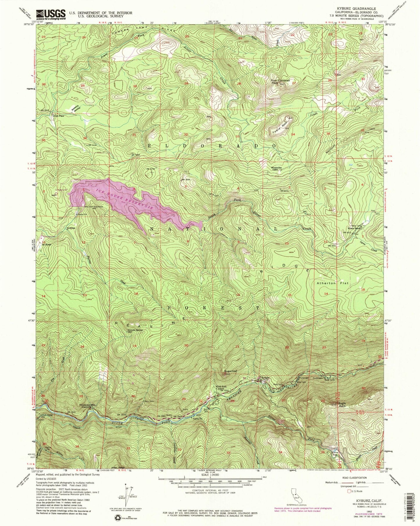
Classic USGS Kyburz California 7.5'x7.5' Topo Map
Couldn't load pickup availability
Historical USGS topographic quad map of Kyburz in the state of California. Typical map scale is 1:24,000, but may vary for certain years, if available. Print size: 24" x 27"
This quadrangle is in the following counties: El Dorado.
The map contains contour lines, roads, rivers, towns, and lakes. Printed on high-quality waterproof paper with UV fade-resistant inks, and shipped rolled.
Contains the following named places: Atherton Flat, Beanville Creek, Bosworth Meadow, Carpenter Creek, Cheese Camp Ridge, China Flat, Ditch Camp One, Eagle Rock, Four Cornered Peak, Fry Creek, Granite Spring, Ice House, Ice House Reservoir, Kyburz, Lyons Creek, Middle Creek, Peavine Creek, Screech Owl Canyon, Silver Fork Elementary School, Silver Fork American River, Sugarloaf, Table Rock, Twentynine Mile Guard Station, Wilson Ranch, Windmiller Cabin, Windmiller Trail, Ice House Vista, Ice House Campgound, Crystal Basin Station, Cal Aggie Camp, China Flat Campground, Eagle Rock Campground, Sugarloaf Organ Camp, Digger Indian Spring Campground, Sand Flat Campground, Jones Place, Ice House 1009 Dam, Strawberry Flat, Eldorado National Forest, Kyburz Post Office (historical), El Dorado County Fire Protection District Station 16, Chinese Camp Ridge, Kyburz Post Office