MyTopo
Classic USGS Kyune Utah 7.5'x7.5' Topo Map
Regular price
$16.95
Regular price
Sale price
$16.95
Unit price
per
Couldn't load pickup availability
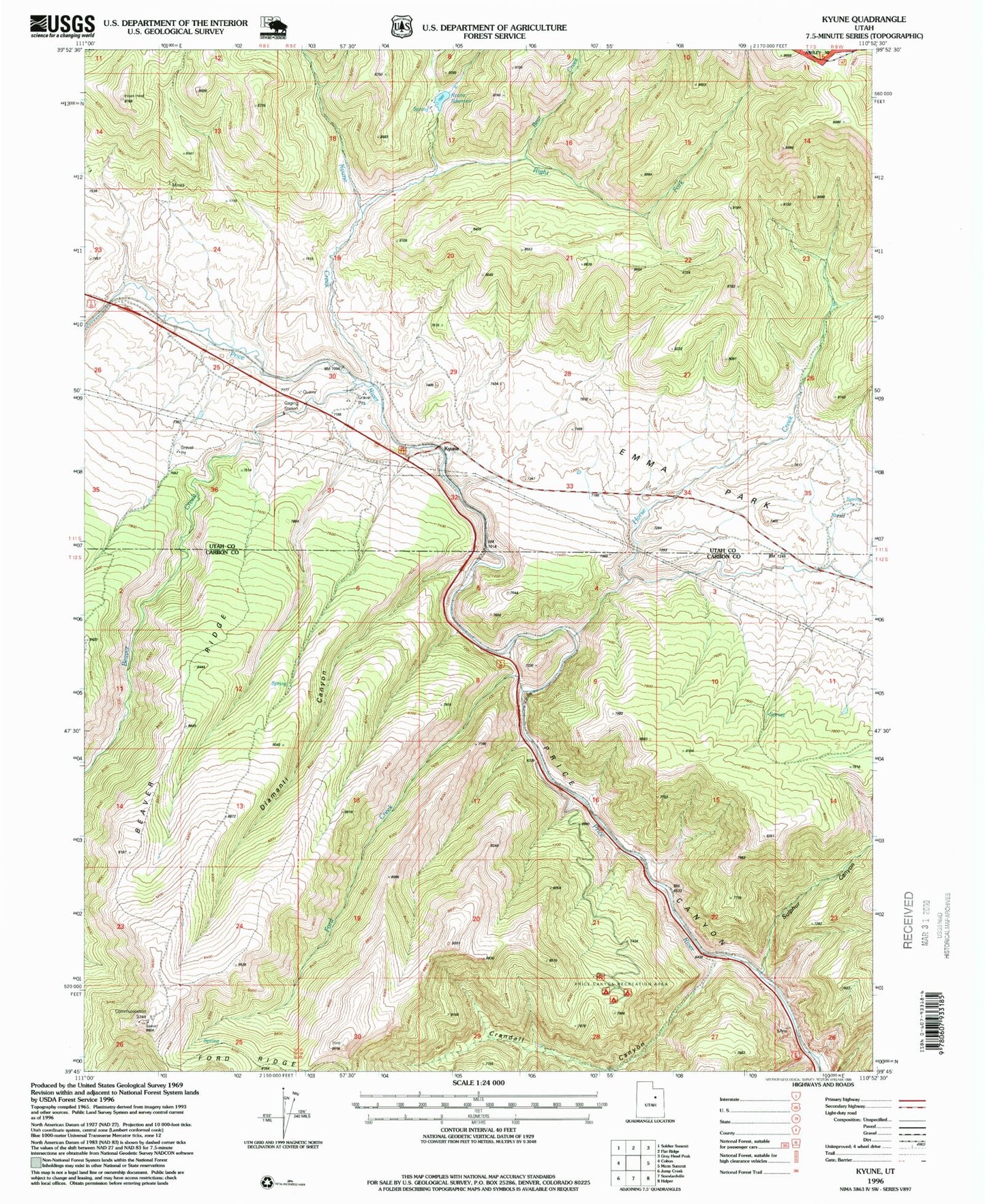
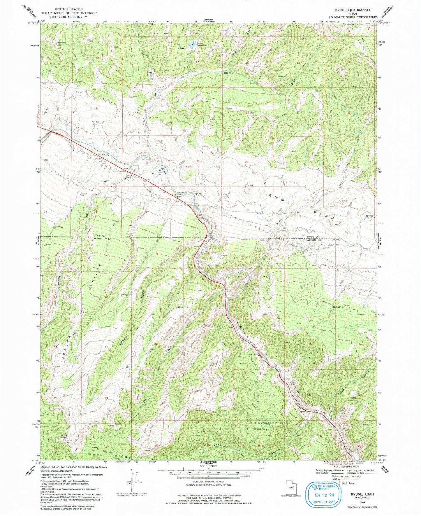
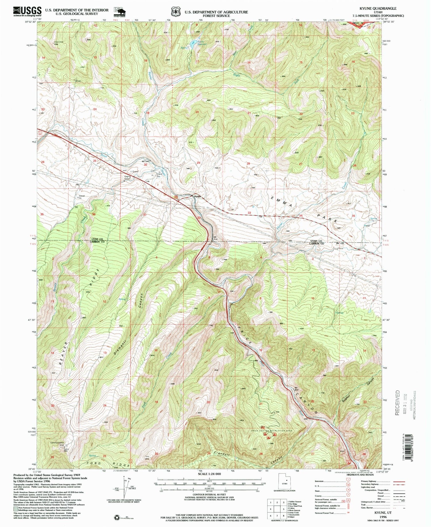
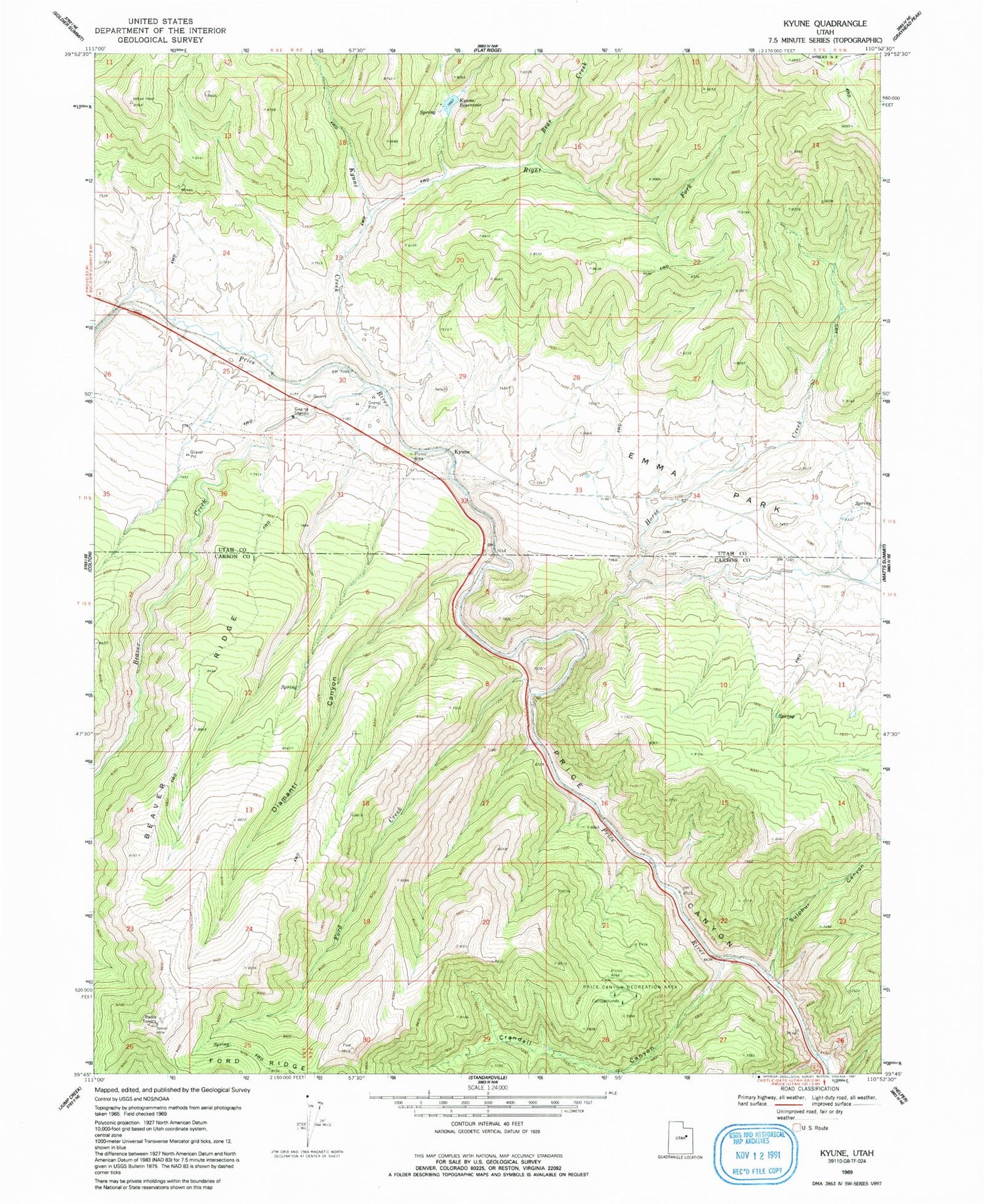
Historical USGS topographic quad map of Kyune in the state of Utah. Map scale may vary for some years, but is generally around 1:24,000. Print size is approximately 24" x 27"
This quadrangle is in the following counties: Carbon, Utah.
The map contains contour lines, roads, rivers, towns, and lakes. Printed on high-quality waterproof paper with UV fade-resistant inks, and shipped rolled.
Contains the following named places: Bear Creek, Beaver Creek, Beaver Ridge, Crandall Canyon, Diamanti Canyon, Ford Creek, Ford Ridge, Horse Creek, Indian Head Peak, Kyune, Kyune Creek, Kyune Reservoir, Price Canyon Campgrounds, Price Canyon Recreation Area, Right Fork Kyune Creek, Sulphur Canyon