MyTopo
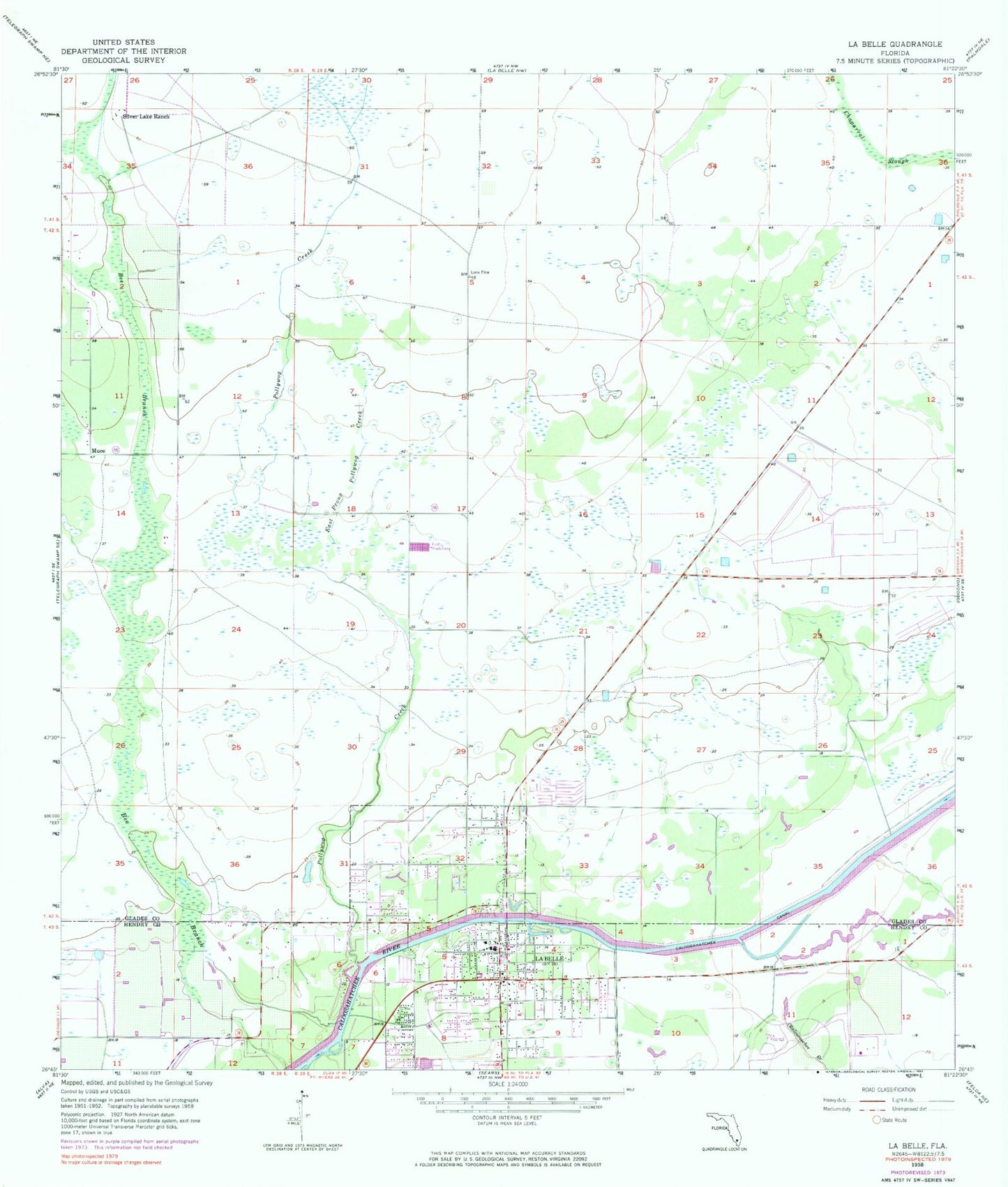
Classic USGS La Belle Florida 7.5'x7.5' Topo Map
Couldn't load pickup availability
Historical USGS topographic quad map of La Belle in the state of Florida. Map scale may vary for some years, but is generally around 1:24,000. Print size is approximately 24" x 27"
This quadrangle is in the following counties: Glades, Hendry.
The map contains contour lines, roads, rivers, towns, and lakes. Printed on high-quality waterproof paper with UV fade-resistant inks, and shipped rolled.
Contains the following named places: Bee Branch, Belle Hatchee Marina, Caloosa Baptist Church, Central Church of Christ, Christ the King Lutheran Church, Church of God of Labelle, Church of Peace, Colony Heliport, Community Christian School of LaBelle, County Line Trailer Park, East Prong Pollywog Creek, Firehouse Cultural Center, First Baptist Church of Labelle, Glades County Emergency Medical Services Station 3, Hendry County Sheriff's Office Main, Highlands Grace Reformed Church, Kellys Trailer Park Number 1, Kellys Trailer Park Number 3, La Belle Bridge, La Belle Fire Department, LaBelle, LaBelle Community School, LaBelle Intermediate School, LaBelle Middle School, LaBelle Plaza, LaBelle Post Office, Lykes Lookout Tower, Marion Mobile Home Park, Muse, Muse Volunteer Fire Department, Okaloacoochee Branch, Pollywog Creek, Port La Belle Marina, Port LaBelle, Port LaBelle Census Designated Place, Silver Lake Ranch, Sundance Farms Airport, Upthegrove Elementary School, ZIP Code: 33935