MyTopo
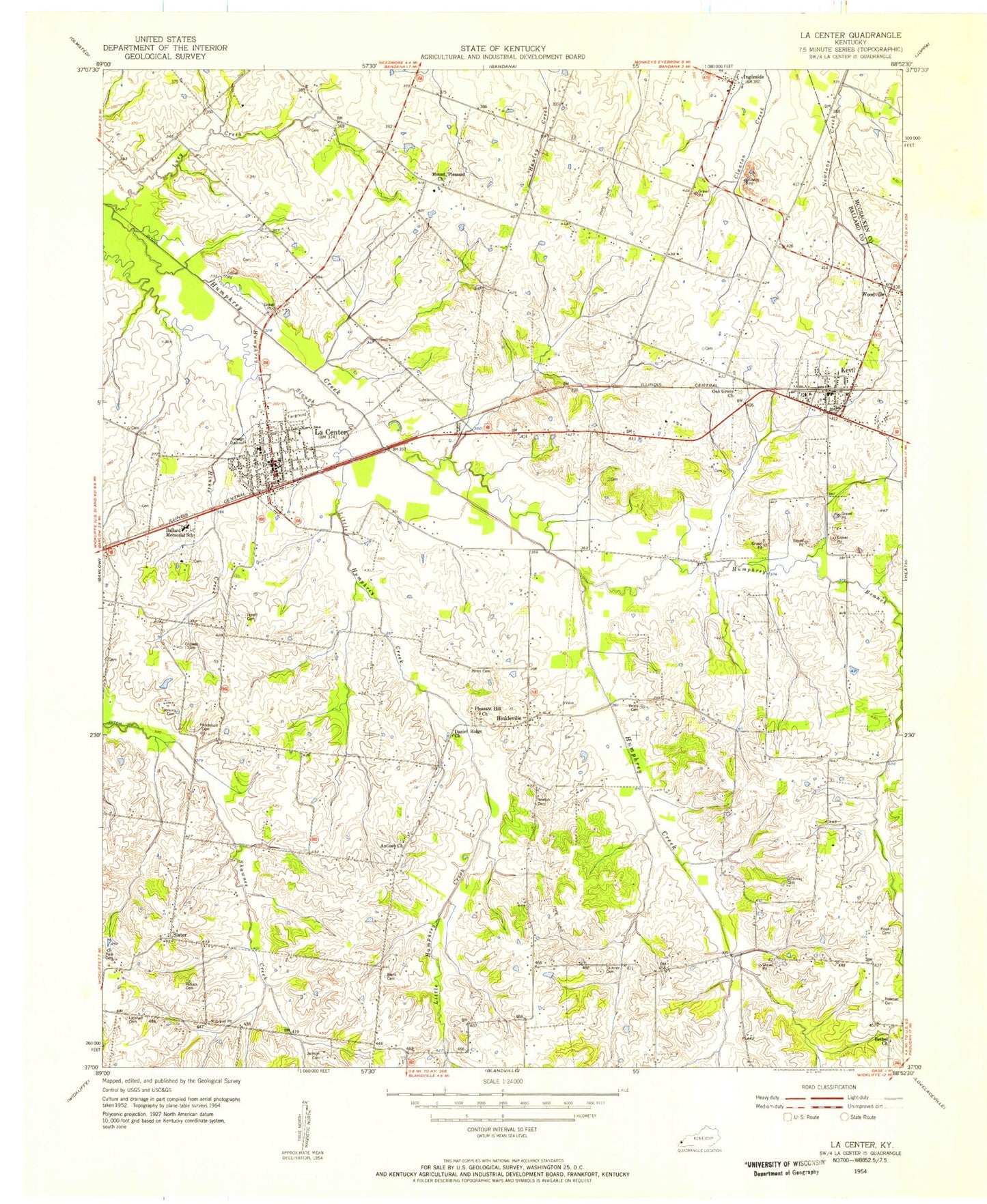
Classic USGS La Center Kentucky 7.5'x7.5' Topo Map
Couldn't load pickup availability
Historical USGS topographic quad map of La Center in the state of Kentucky. Map scale may vary for some years, but is generally around 1:24,000. Print size is approximately 24" x 27"
This quadrangle is in the following counties: Ballard, McCracken.
The map contains contour lines, roads, rivers, towns, and lakes. Printed on high-quality waterproof paper with UV fade-resistant inks, and shipped rolled.
Contains the following named places: Antioch Cemetery, Antioch Church, Ballard County, Ballard County Ambulance Services, Ballard Memorial School, Bethel Cemetery, Bethel Cumberland Presbyterian Church, Blank Cemetery, City of Kevil, City of La Center, Criswell Cemetery, Dam Number 3-A, Henderson Cemetery, Hines Cemetery, Hinkle Creek, Hinkleville, Hook Cemetery, Humphrey Branch, Humphrey Slough, Ingleside, Jackson Cemetery, Jenkins Cemetery, Kevil, Kevil Fire Department, Kevil Post Office, La Center, La Center Division, La Center Fire Department, La Center Gardens Cemetery, La Center Police Department, La Center Post Office, La Center Rural Fire Department, Little Humphrey Creek, Lockhart Cemetery, Lucy Creek, Mount Pleasant Cemetery, Mount Pleasant Church, Newman Cemetery, Newton Cemetery, Oak Grove Church, O'Donely Cemetery, Pace Cemetery, Pleasant Hill Cemetery, Pleasant Hill Church, Pollock Cemetery, Skinner Cemetery, Slater, Terrell Cemetery, Vance Cemetery, ZIP Codes: 42053, 42056