MyTopo
Classic USGS La Cinta Mesa New Mexico 7.5'x7.5' Topo Map
Couldn't load pickup availability
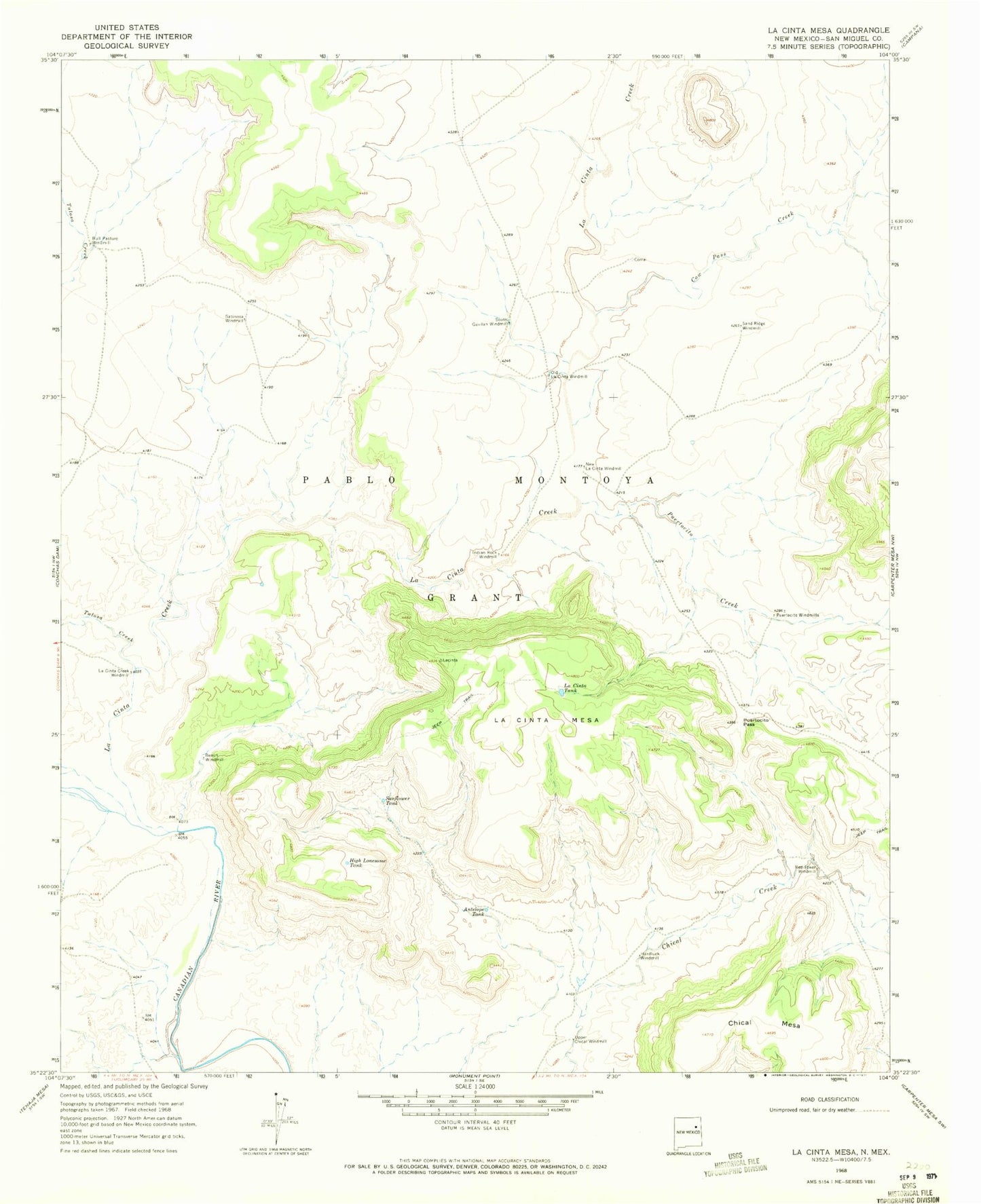
Historical USGS topographic quad map of La Cinta Mesa in the state of New Mexico. Map scale may vary for some years, but is generally around 1:24,000. Print size is approximately 24" x 27"
This quadrangle is in the following counties: San Miguel.
The map contains contour lines, roads, rivers, towns, and lakes. Printed on high-quality waterproof paper with UV fade-resistant inks, and shipped rolled.
Contains the following named places: Antelope Tank, Bench Windmill, Bull Pasture Windmill, Chical Mesa, Conchas Dam Division, Cow Pass Creek, Hardluck Windmill, High Lonesome Tank, Indian Rock Windmill, La Cinta Creek, La Cinta Creek Windmill, La Cinta Mesa, La Cinta Tank, New La Cinta Windmill, Old La Cinta Windmill, Pablo Montoya Grant, Puertocito Creek, Puertocito Pass, Puertocito Windmills, Red Tower Windmill, Sabinosa Windmill, Sand Ridge Windmill, South Gavilan Windmill, Sunflower Tank, Tulosa Creek, Upper Chical Windmill