MyTopo
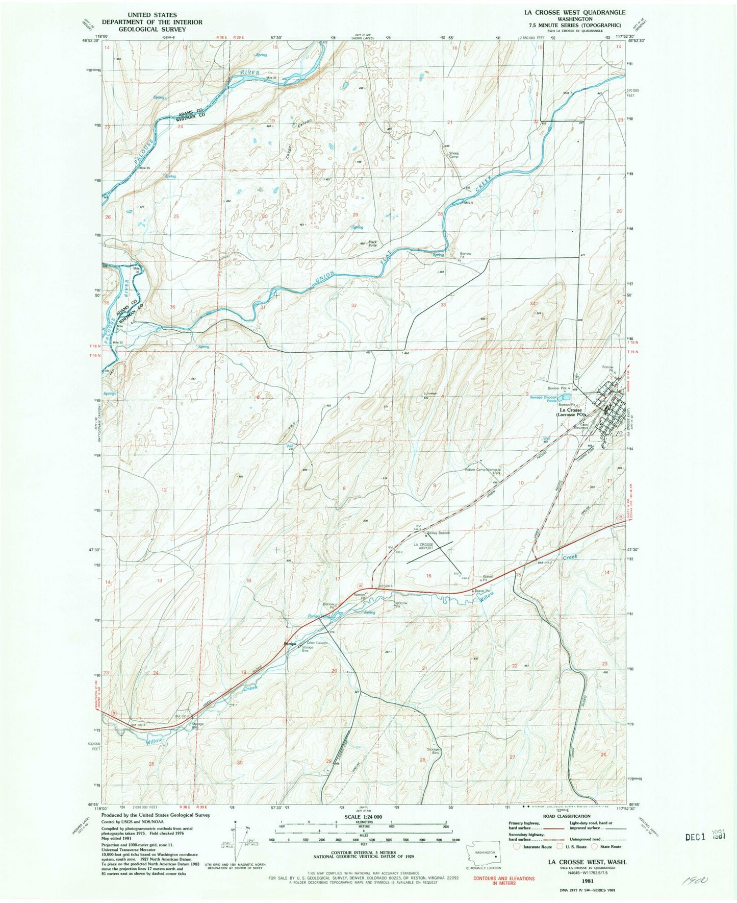
Classic USGS La Crosse West Washington 7.5'x7.5' Topo Map
Regular price
$16.95
Regular price
Sale price
$16.95
Unit price
per
Couldn't load pickup availability
Historical USGS topographic quad map of La Crosse West in the state of Washington. Map scale may vary for some years, but is generally around 1:24,000. Print size is approximately 24" x 27"
This quadrangle is in the following counties: Adams, Whitman.
The map contains contour lines, roads, rivers, towns, and lakes. Printed on high-quality waterproof paper with UV fade-resistant inks, and shipped rolled.
Contains the following named places: Black Butte, Cougar Canyon, La Crosse, Lacrosse City Fire Department, Lacrosse Municipal Airport, LaCrosse Post Office, Pampa, Pampa Pond, Robert Camp Memorial Track, Town of LaCrosse, Union Flat Creek