MyTopo
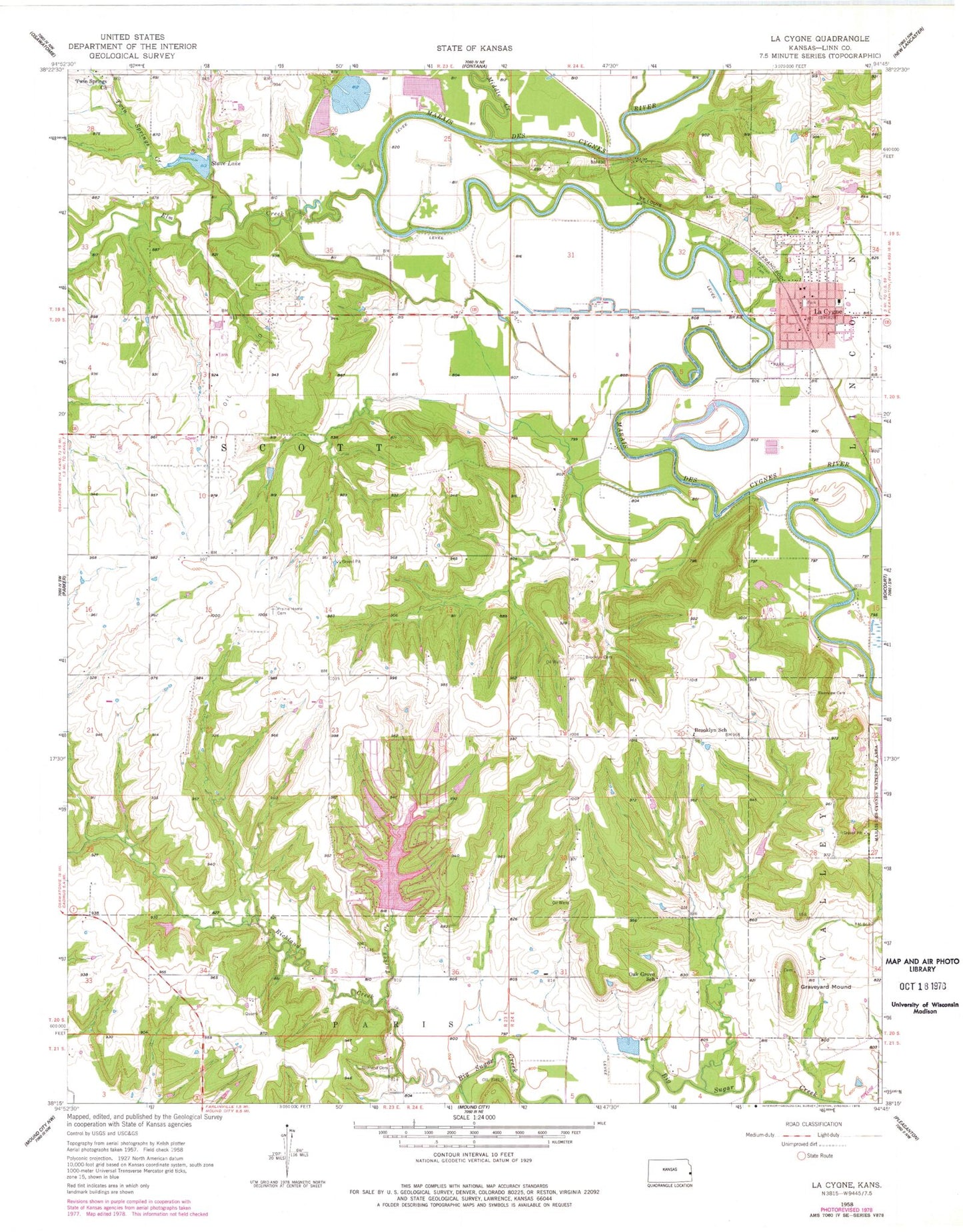
Classic USGS La Cygne Kansas 7.5'x7.5' Topo Map
Couldn't load pickup availability
Historical USGS topographic quad map of La Cygne in the state of Kansas. Map scale may vary for some years, but is generally around 1:24,000. Print size is approximately 24" x 27"
This quadrangle is in the following counties: Linn.
The map contains contour lines, roads, rivers, towns, and lakes. Printed on high-quality waterproof paper with UV fade-resistant inks, and shipped rolled.
Contains the following named places: Beachner Grain Elevator Number 24, Brooklyn Cemetery, Brooklyn School, Calvary Baptist Church, City of La Cygne, Elm Creek, Emergystat Ambulance of Linn County, Graveyard Mound, Hickory Creek, Hurley Field, La Cygne, La Cygne Christian Church, La Cygne City Hall, La Cygne Community Building, La Cygne Historical Society Museum, La Cygne Police Department, La Cygne Post Office, La Cygne Senior Center, La Cygne Sewer Treatment Plant, La Cygne United Methodist Church, La Cygne Volunteer Fire Department, La Cygne Water Treatment Plant, LaCygne Elementary School, Lacygne Industrial Park, Linn County Library District Number 2, Middle Creek, Oak Grove School, Oaklawn Cemetery, Our Lady of the Lourdes Catholic Church, Prairie Home Cemetery, Prairie Home School, Prairie View High School, Prairie View High School Police United School District 362, Prairie View Middle School, Richland Cemetery, Richland Creek, Riverview Cemetery, Stave Lake, Tanglewood Lakes Wastewater Treatment Plant, Township of Scott, Turkey Creek, Twin Springs Church, Twin Springs Creek