MyTopo
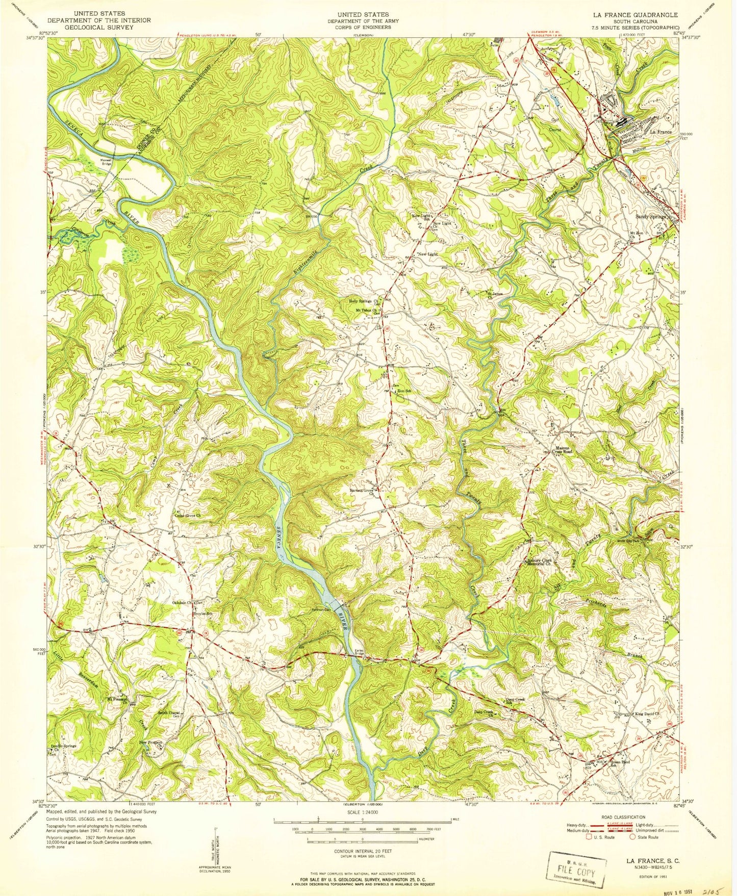
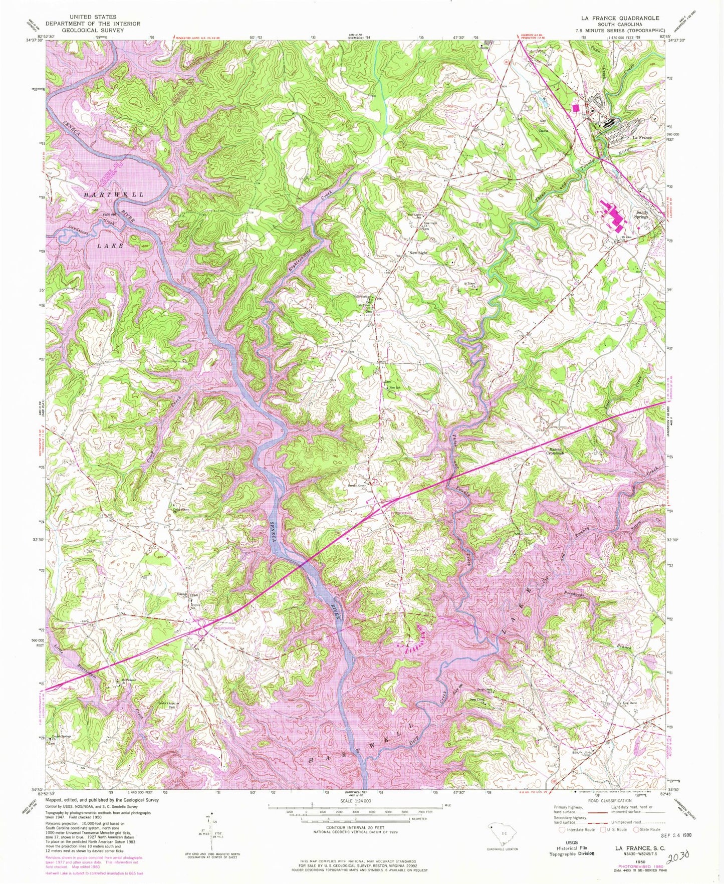
Classic USGS La France South Carolina 7.5'x7.5' Topo Map
Couldn't load pickup availability
Historical USGS topographic quad map of La France in the state of South Carolina. Typical map scale is 1:24,000, but may vary for certain years, if available. Print size: 24" x 27"
This quadrangle is in the following counties: Anderson, Oconee, Pickens.
The map contains contour lines, roads, rivers, towns, and lakes. Printed on high-quality waterproof paper with UV fade-resistant inks, and shipped rolled.
Contains the following named places: Asbury Clark Memorial Church, Camp Creek, Cedar Grove Church, Deep Creek, Deep Creek School, Earles Bridge (historical), Eighteenmile Creek, Green Pond School, Maxwell Bridge, New Light, New Light Church, New Light School, New Prospect Church, Oakdale Church, Portman Dam, Prichards Branch, Saint James Church, Salem Creek, Steel Creek, Three and Twenty Creek, White City Park, Zion School, Masons Cross Road, Bridgewater, Caravelle Heights, Portman Marina, Portman Shoals, Pritchard Creek, Quail Creek, Ready School (historical), Ready School (historical), Rock Creek Acres, Shadow Wood, Shallow Ford (historical), Smiths Chapel Cemetery, The Shoals, West Gate, Zion United Methodist Church, Asbury Church, Creekwood, Denver School (historical), Fairfield Acres, Green Pond School (historical), Hidden Lake, Homestead Estates, Huntington Heights, Indian Hills, La France Elementary School, Leisure Village, McDaniels Ferry (historical), Mount Pleasant School (historical), New Prospect Church, Oakdale, V T Truck Pond Dam D-3266, Sandy Springs Church, Oconee Point, Barnett Grove Church, Holly Springs Church, King David Baptist Church, La France, Millwee Creek, Broyles School, Coneross Creek, Deep Creek Church, Double Springs Baptist Church, Mount Pleasant Church, Mount Tabor Baptist Church, Mount Zion Church, Six and Twenty Creek, Smith Chapel, Town Creek, Bruces Ford (historical), East Prong Little Beaver Dam Creek, Harris Ferry (historical), Prospect Baptist Church (historical), West Prong Little Beaver Dam Creek, Cedar Grove Methodist Cemetery, Zion Fire Department Anderson County Station 14, Lodge's Greenhouses and Nursery, La France Census Designated Place