MyTopo
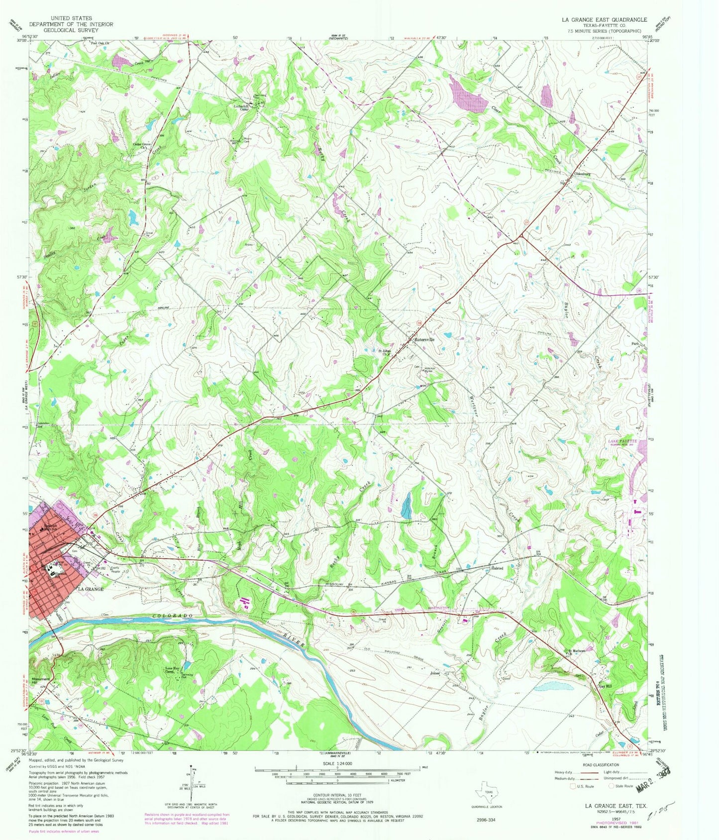
Classic USGS La Grange East Texas 7.5'x7.5' Topo Map
Couldn't load pickup availability
Historical USGS topographic quad map of La Grange East in the state of Texas. Map scale may vary for some years, but is generally around 1:24,000. Print size is approximately 24" x 27"
This quadrangle is in the following counties: Fayette.
The map contains contour lines, roads, rivers, towns, and lakes. Printed on high-quality waterproof paper with UV fade-resistant inks, and shipped rolled.
Contains the following named places: Air Evac 47, Blue Branch, Cedar Creek, Cedar Grove Church, Double D Farms Airport, Farmers Industries Dam, Farmers Industries Lake, Fayette County Emergency Medical Services, Fayette Heritage Museum and Archives, Gay Hill, Gravelly Branch, Halsted, Henry L Kreische Brewery and House, Hermes Elementary School, Hermes School, High Hill Creek, Joiner, KBUK-FM (La Grange), Kiest Branch Library, KVLG-AM (La Grange), La Grange High School, La Grange Intermediate School, La Grange Magnetic Station, La Grange Middle School, La Grange Police Department, Lake Chapparal, Lake Chapparal Dam, Lester Park, Lone Star Camp, Lower Colorado River Authority - Fayette Power Project, Lutherhill Camp, Martin Luther King Junior Library, Moore Cemetery, N W Faison Home and Museum, North Oak Cliff Branch Library, Oak Lawn Branch Library, Oldenburg, Park, Park Forest Branch Library, Post Oak Church, Randolph High School, Rocky Creek, Rocky Creek Ranch Airport, Rocky Creek Ranch Lake, Rocky Creek Ranch Lake Dam, Rutersville, Saint James Episcopal Church, Saint Johns Church, Saint Matthews Church, Soil Conservation Service Site 21 Dam, Soil Conservation Service Site 21 Reservoir, Soil Conservation Service Site 22 Dam, Soil Conservation Service Site 22 Reservoir, Texas Forest Service - LaGrange Office, Thunderbird Southwest Airport, Wertzner Creek