MyTopo
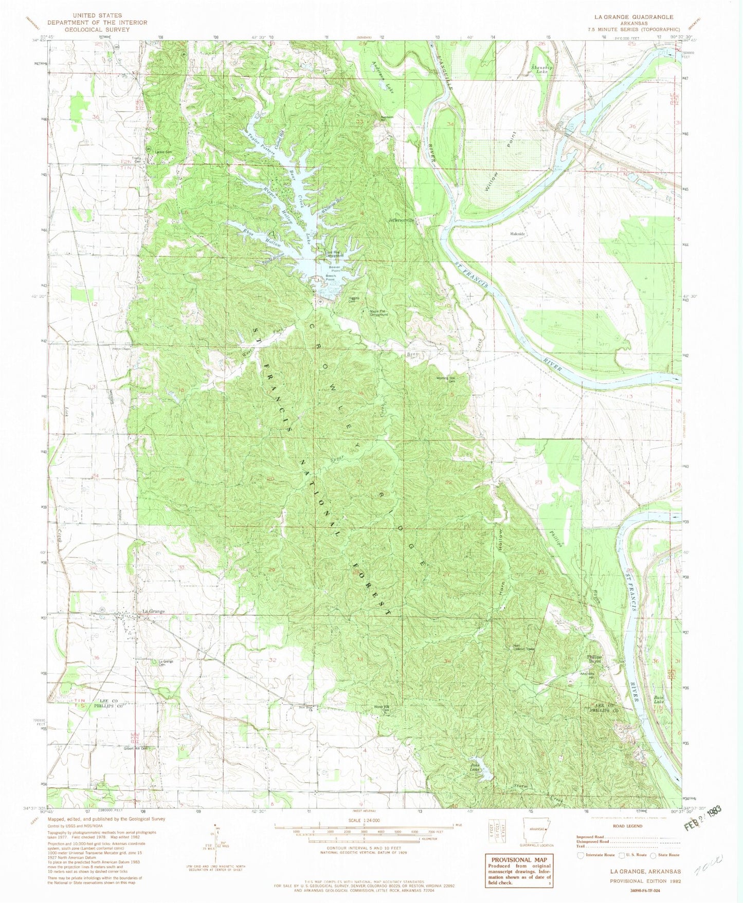
Classic USGS La Grange Arkansas 7.5'x7.5' Topo Map
Couldn't load pickup availability
Historical USGS topographic quad map of La Grange in the state of Arkansas. Map scale may vary for some years, but is generally around 1:24,000. Print size is approximately 24" x 27"
This quadrangle is in the following counties: Lee, Phillips.
The map contains contour lines, roads, rivers, towns, and lakes. Printed on high-quality waterproof paper with UV fade-resistant inks, and shipped rolled.
Contains the following named places: Anderson Lake, Bain Lake, Bear Creek, Bear Creek Lake, Bear Creek Lake Dam, Bear Creek Lake Recreation Site, Beaver Point, Beech Point, Blendsoe Bend, Browns Bend, Casteel Hollow, Double Bend Bar School, Ebos Hollow, Gilbert Hill Cemetery, Hale Bend, Hale Point, Haleside, Higgins Cemetery, High Bank Bend, High Banks Landing, Honor Hill Cemetery, Horn Hollow, Horn Lookout Tower, Huxtable Dam, Jake Lake, Jakes Lake Dam, Jeffersonville, Jeffersonville Bend, Jeffersonville Cemetery, Jeffersonville Church, Jeffersonville School, La Grange, Lackie Cemetery, LaGrange Cemetery, LaGrange Post Office, L'Anguille River, Lone Pine Campground, Maple Flat Campground, Morning Star Cemetery, Morning Star Church, Morrells Hill, New Hope Church, Oakwood, Peters Rock Church, Pettys Chapel Baptist Church, Phillips Bayou, Phillips Bayou Ferry, Phillips Bayou School, Ripper Hollow, Robinson Hill, Saint Francis National Forest, Shenship Lake, Sugar Creek, Swede Hollow, Taylor Pasture, Town of LaGrange, Township of Bear Creek, Trinity Cemetery, Trinity Church, West Fork Bear Creek, Whiteside Hollow, Willow Point