MyTopo
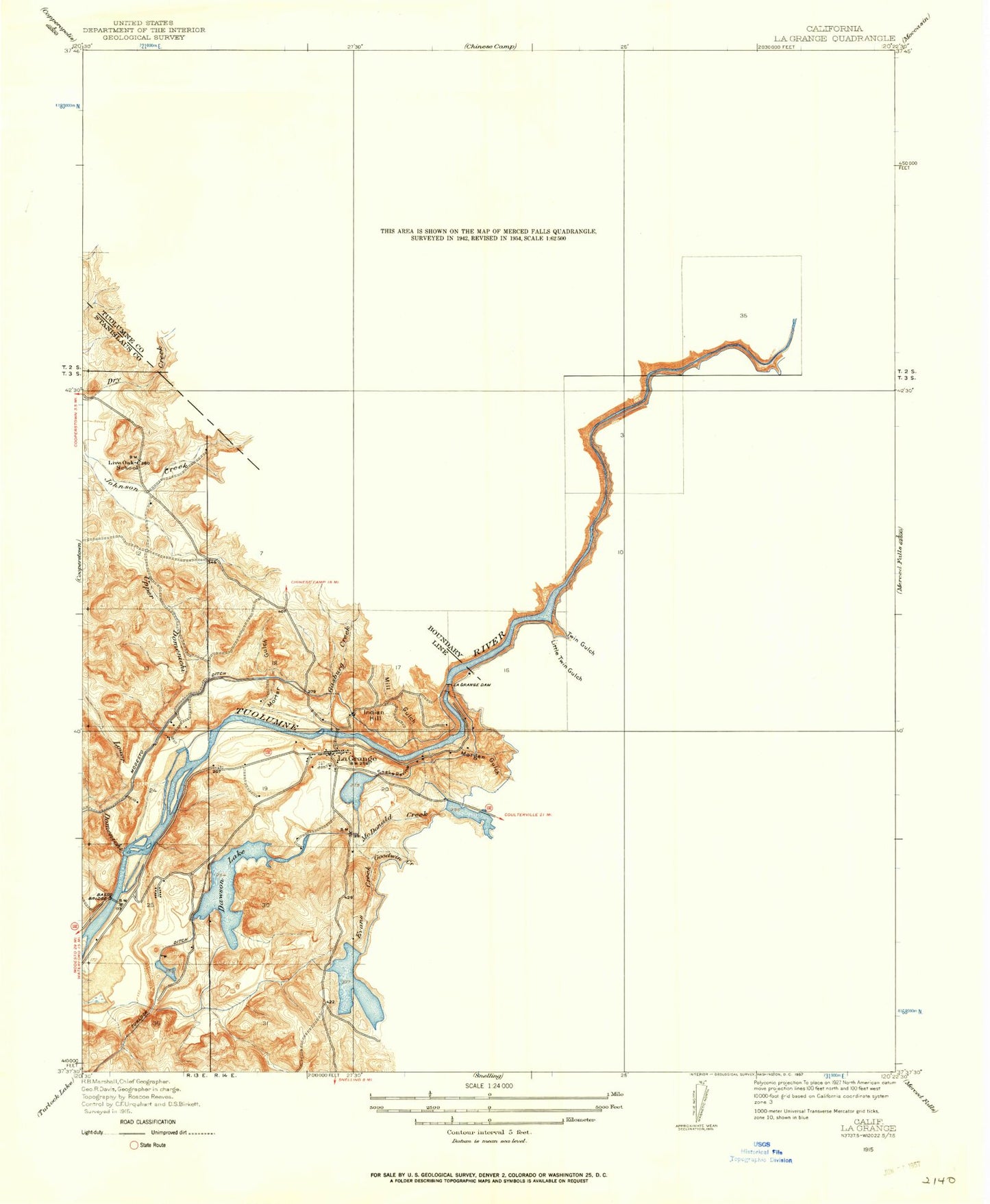
Classic USGS La Grange California 7.5'x7.5' Topo Map
Couldn't load pickup availability
Historical USGS topographic quad map of La Grange in the state of California. Map scale may vary for some years, but is generally around 1:24,000. Print size is approximately 24" x 27"
This quadrangle is in the following counties: Mariposa, Merced, Stanislaus, Tuolumne.
The map contains contour lines, roads, rivers, towns, and lakes. Printed on high-quality waterproof paper with UV fade-resistant inks, and shipped rolled.
Contains the following named places: Basso Bridge, Beltz Lake, Ben Brow Hill, Big Creek, Big Island, Brush Gulch, Butcher Knife Pocket, Buzzard Point, Cardoza Lake, Cardoza Ridge, Corner School, Dawson Lake, Dawson Lake 68-004 Dam, Don Pedro Camp, Don Pedro Dam, Don Pedro Reservoir, Dunn Creek, Dunn Ridge, Eagle Island, Evans Creek, Floto Lake, Fortynine Mine, Frank Young Gulch, Freeze-Out Spring, French Bar Cemetery, French Pit, Gasburg Creek, Gillman Gulch, Goodwin Creek, Indian Hill, Jenkins Hill, La Grange, La Grange Cemetery, La Grange Census Designated Place, La Grange Dam, La Grange Elementary School, La Grange Pit, La Grange Post Office, La Grange Regional Park, La Grange Reservoir, Laughlin Ridge, Little Twin Gulch, Lone Gulch, Lower Dominici Creek, Lucas Gulch, Lucky Point, McDonald Creek, McNulty Ridge, McNulty Spring, Mexican Gulch, Mill Gulch, Mitchell Mine, Morgan Gulch, Morton Gulch, New Don Pedro Dam, Oak Hill Mine, Old La Grange Schoolhouse, Riley Ridge, Saint Louis Catholic Church, Saint Louis Catholic Mission Cemetery, Salt Spring, Salt Spring Creek, Snake Ravine, Stanislaus Consolidated Fire Protection District Station 35, Twin Gulch, Upper Dominici Creek, Vizard Creek, ZIP Code: 95329