MyTopo
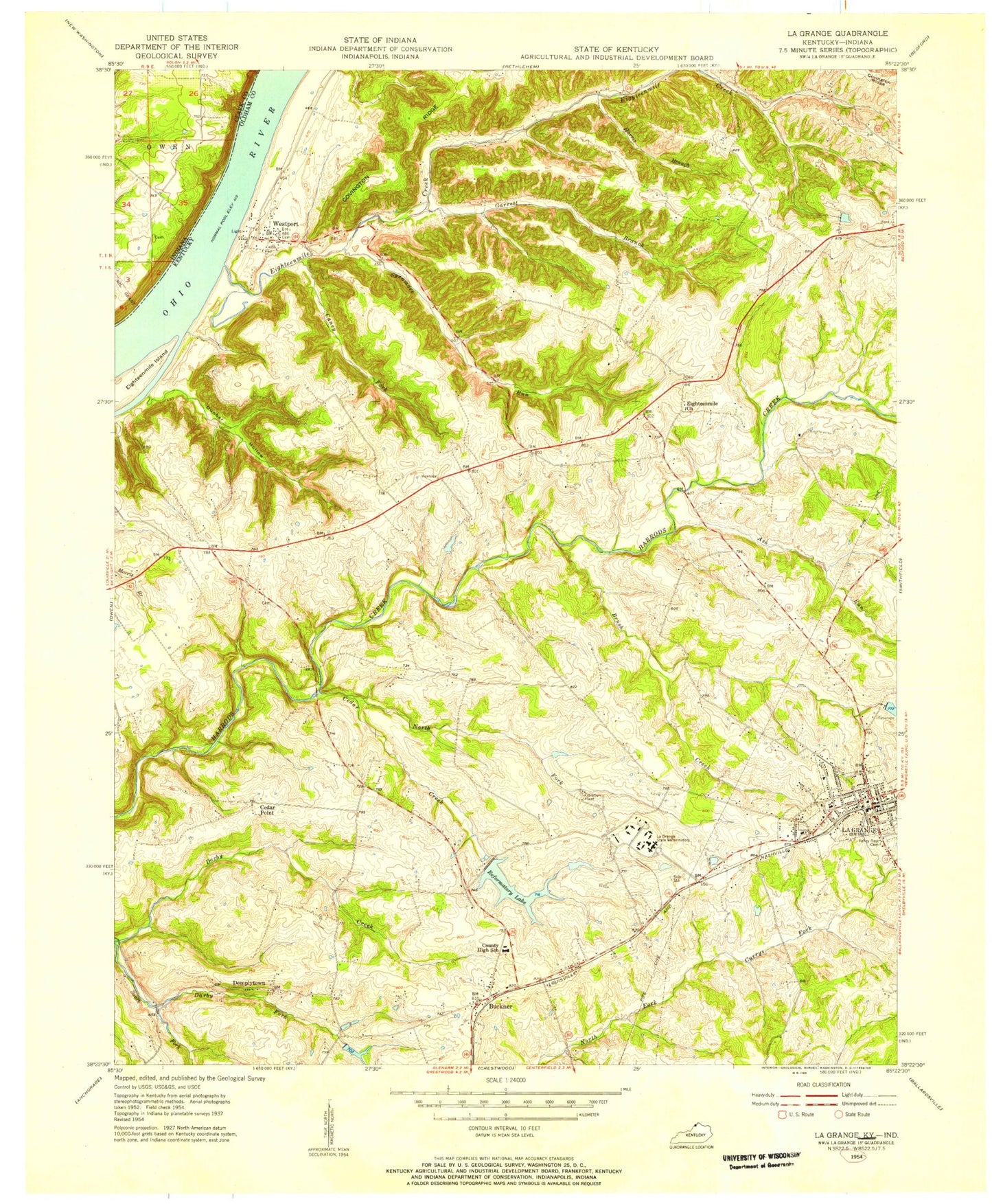
Classic USGS La Grange Kentucky 7.5'x7.5' Topo Map
Couldn't load pickup availability
Historical USGS topographic quad map of La Grange in the state of Kentucky. Typical map scale is 1:24,000, but may vary for certain years, if available. Print size: 24" x 27"
This quadrangle is in the following counties: Clark, Oldham.
The map contains contour lines, roads, rivers, towns, and lakes. Printed on high-quality waterproof paper with UV fade-resistant inks, and shipped rolled.
Contains the following named places: Ash Run, Brush Creek, Buckner, Caney Fork, Cedar Creek, Cedar Point, Circle Dart Lake, Darby Fork, Dunbar Hollow, Eighteenmile Church, Eighteenmile Creek, Eighteenmile Island, Garrett Branch, Harris Branch, La Grange, Lake Lotawata, North Fork Cedar Creek, Reformatory Lake, Smith Ridge, Sycamore Run, Valley of Rest Cemetery, Westport, Cedar Point, Demplytown, Greenhaven, Oldham, Russell Corner, Oldham County, WAVE-TV (Louisville), La Grange Division, Buckner Census Designated Place, City of La Grange, Baptist Health La Grange, La Grange Square Shopping Center, La Grange Post Office, Westport Post Office, La Grange Elementary School, Westport Census Designated Place, La Grange Fire and Rescue Department Station 2, La Grange Fire and Rescue, Westport Volunteer Fire Department, Oldham County Emergency Medical Services, Anita Springs, Dunbar Branch, Green Hill, Oldham County Police Department, Oldham County Sheriff's Office, Kentucky State Reformatory, La Grange Police Department, Luther Luckett Correctional Complex, Roederer Correctional Complex, Ash Run, Brush Creek, Buckner, Caney Fork, Cedar Creek, Cedar Point, Circle Dart Lake, Darby Fork, Dunbar Hollow, Eighteenmile Church, Eighteenmile Creek, Eighteenmile Island, Garrett Branch, Harris Branch, La Grange, Lake Lotawata, North Fork Cedar Creek, Reformatory Lake, Smith Ridge, Sycamore Run, Valley of Rest Cemetery, Westport, Cedar Point, Demplytown, Greenhaven, Oldham, Russell Corner, Oldham County, WAVE-TV (Louisville), La Grange Division, Buckner Census Designated Place, City of La Grange, Baptist Health La Grange, La Grange Square Shopping Center, La Grange Post Office, Westport Post Office, La Grange Elementary School, Westport Census Designated Place, La Grange Fire and Rescue Department Station 2, La Grange Fire and Rescue, Westport Volunteer Fire Department, Oldham County Emergency Medical Services, Anita Springs, Dunbar Branch, Green Hill, Oldham County Police Department, Oldham County Sheriff's Office, Kentucky State Reformatory, La Grange Police Department, Luther Luckett Correctional Complex, Roederer Correctional Complex