MyTopo
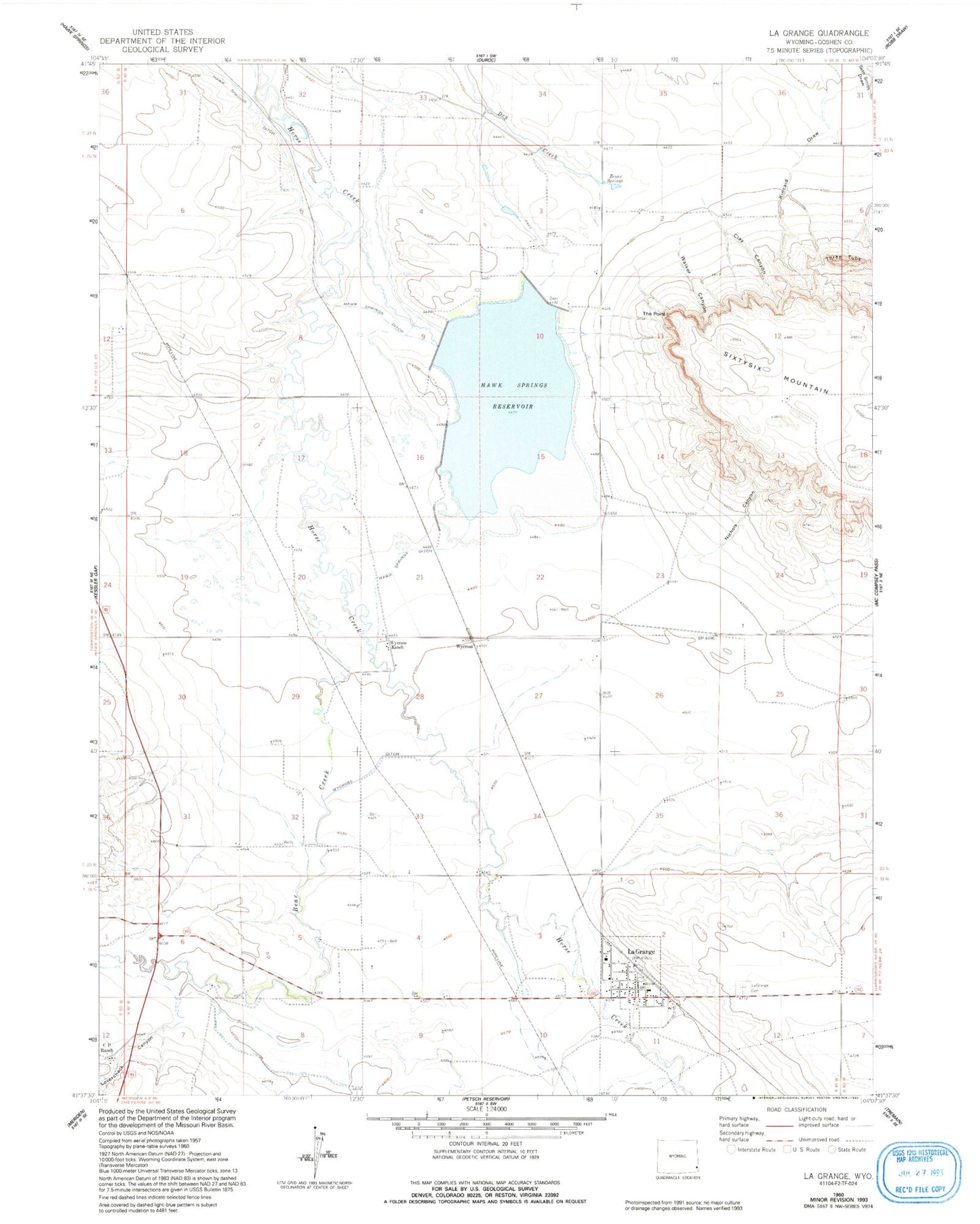
Classic USGS La Grange Wyoming 7.5'x7.5' Topo Map
Couldn't load pickup availability
Historical USGS topographic quad map of La Grange in the state of Wyoming. Map scale may vary for some years, but is generally around 1:24,000. Print size is approximately 24" x 27"
This quadrangle is in the following counties: Goshen.
The map contains contour lines, roads, rivers, towns, and lakes. Printed on high-quality waterproof paper with UV fade-resistant inks, and shipped rolled.
Contains the following named places: Bear Creek, C P Ranch, Clay Canyon, Hawk Springs, Hawk Springs Dam Number 1, Hawk Springs Reservoir, Kincaid Draw, La Grange, La Grange Cemetery, La Grange Post Office, La Grange School, LaGrange Fire Department, Nichols Canyon, The Point, Three Tubs, Town of LaGrange, Walker Canyon, Wycross, Wycross Ditch, Wycross Ranch, Zenor Springs