MyTopo
Classic USGS La Harpe Illinois 7.5'x7.5' Topo Map
Couldn't load pickup availability
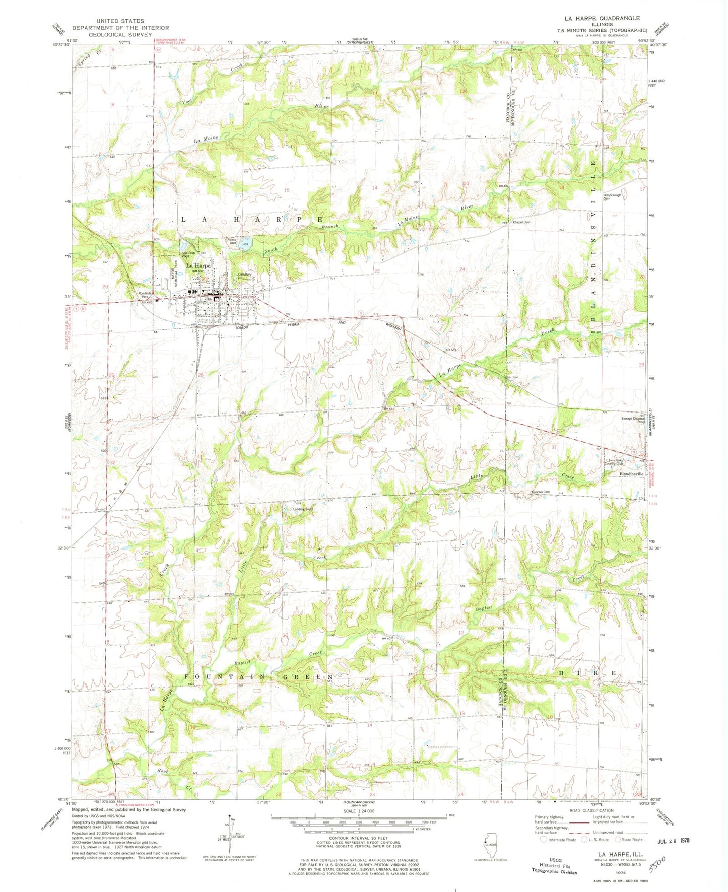
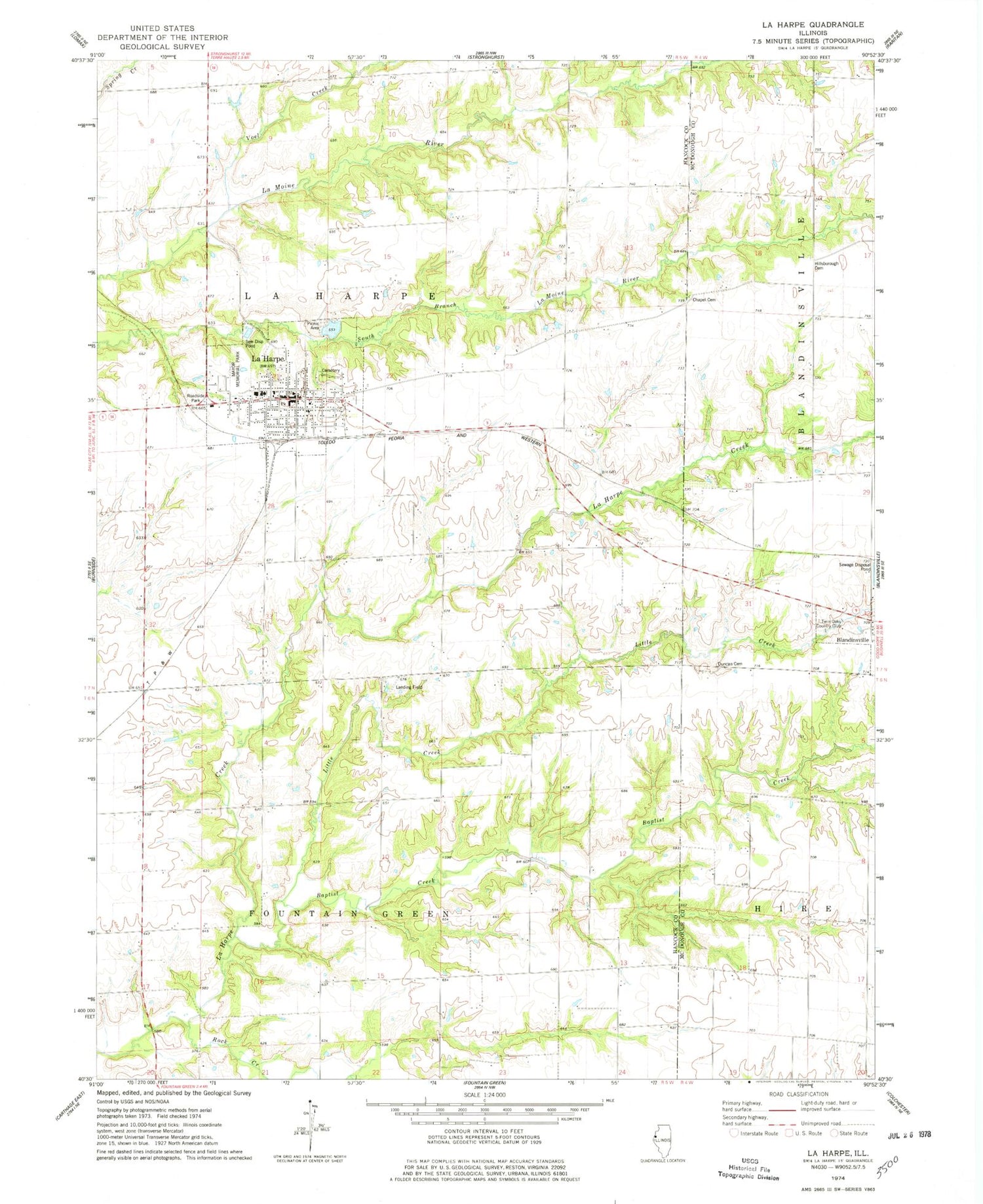
Historical USGS topographic quad map of La Harpe in the state of Illinois. Map scale may vary for some years, but is generally around 1:24,000. Print size is approximately 24" x 27"
This quadrangle is in the following counties: Hancock, McDonough.
The map contains contour lines, roads, rivers, towns, and lakes. Printed on high-quality waterproof paper with UV fade-resistant inks, and shipped rolled.
Contains the following named places: Baptist Creek, Chapel Cemetery, City of La Harpe, Duncan Cemetery, Eagle School, Elder Grove School, Elm Grove School, Gilead School, Harris School, Hickory Grove School, Hillsborough Baptist Church, Hillsborough Cemetery, La Harpe, La Harpe Ambulance Service, La Harpe Cemetery, La Harpe Fire Protection District Station 1, La Harpe High School, La Harpe Historic District, La Harpe Police Department, La Harpe Post Office, Little Creek, Mayor Memorial Park, Morton Airport, Mount Pleasant School, North Prairie School, Oak Hill School, Robin Glenn School, Rock Creek, Rock Creek Methodist Episcopal Church, Rock Creek School, Rossville School, Spiker School, Tarman School, Township of Fountain Green, Township of La Harpe, Twin Oaks Country Club, Voel Creek, Wesley Chapel, Wilson Cemetery, ZIP Code: 61450