MyTopo
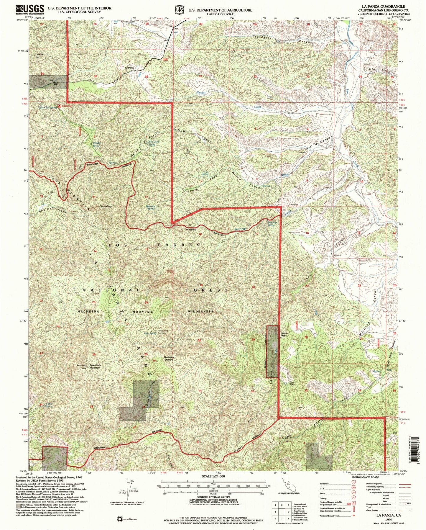
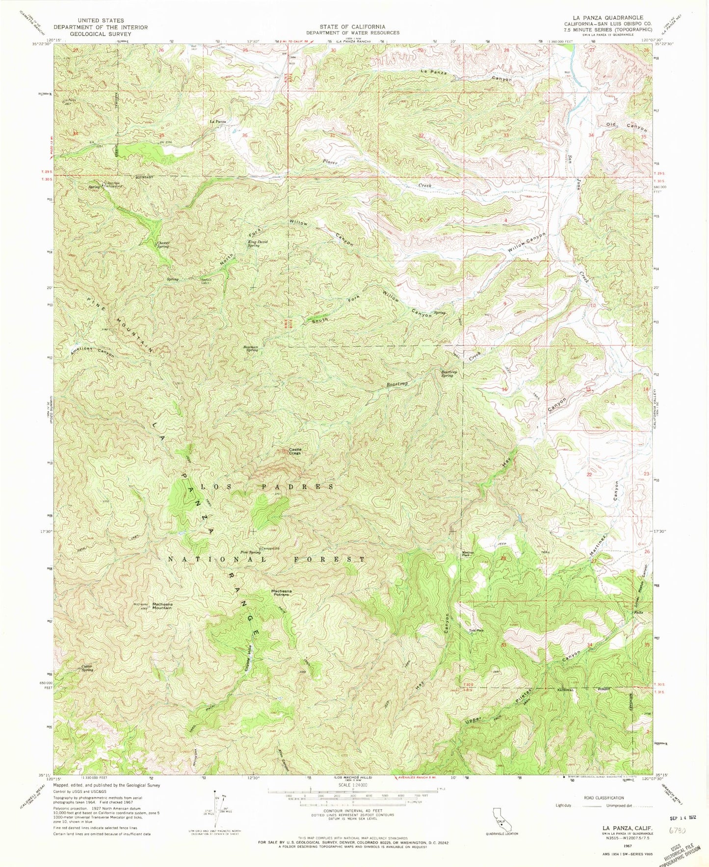
Classic USGS La Panza California 7.5'x7.5' Topo Map
Couldn't load pickup availability
Historical USGS topographic quad map of La Panza in the state of California. Typical map scale is 1:24,000, but may vary for certain years, if available. Print size: 24" x 27"
This quadrangle is in the following counties: San Luis Obispo.
The map contains contour lines, roads, rivers, towns, and lakes. Printed on high-quality waterproof paper with UV fade-resistant inks, and shipped rolled.
Contains the following named places: Beartrap Creek, Beartrap Spring, Bowman Spring, Castle Crags, Chester Spring, Cotter Spring, Coyote Hole, Hay Canyon, King David Spring, La Panza Canyon, Machesna Potrero, Martinez Canyon, Old Canyon, Placer Creek, Queen Bee Campground, Saylors Cabin, Pine Spring, South Fork Willow Canyon, North Fork Willow Canyon, Willow Canyon, La Panza Range, Pine Mountain, Upper Piletas Canyon, La Panza, Machesna Mountain, Martinez Place, Todd Place, Machos Spring, Pole Spring, Machesna Mountain Wilderness