MyTopo
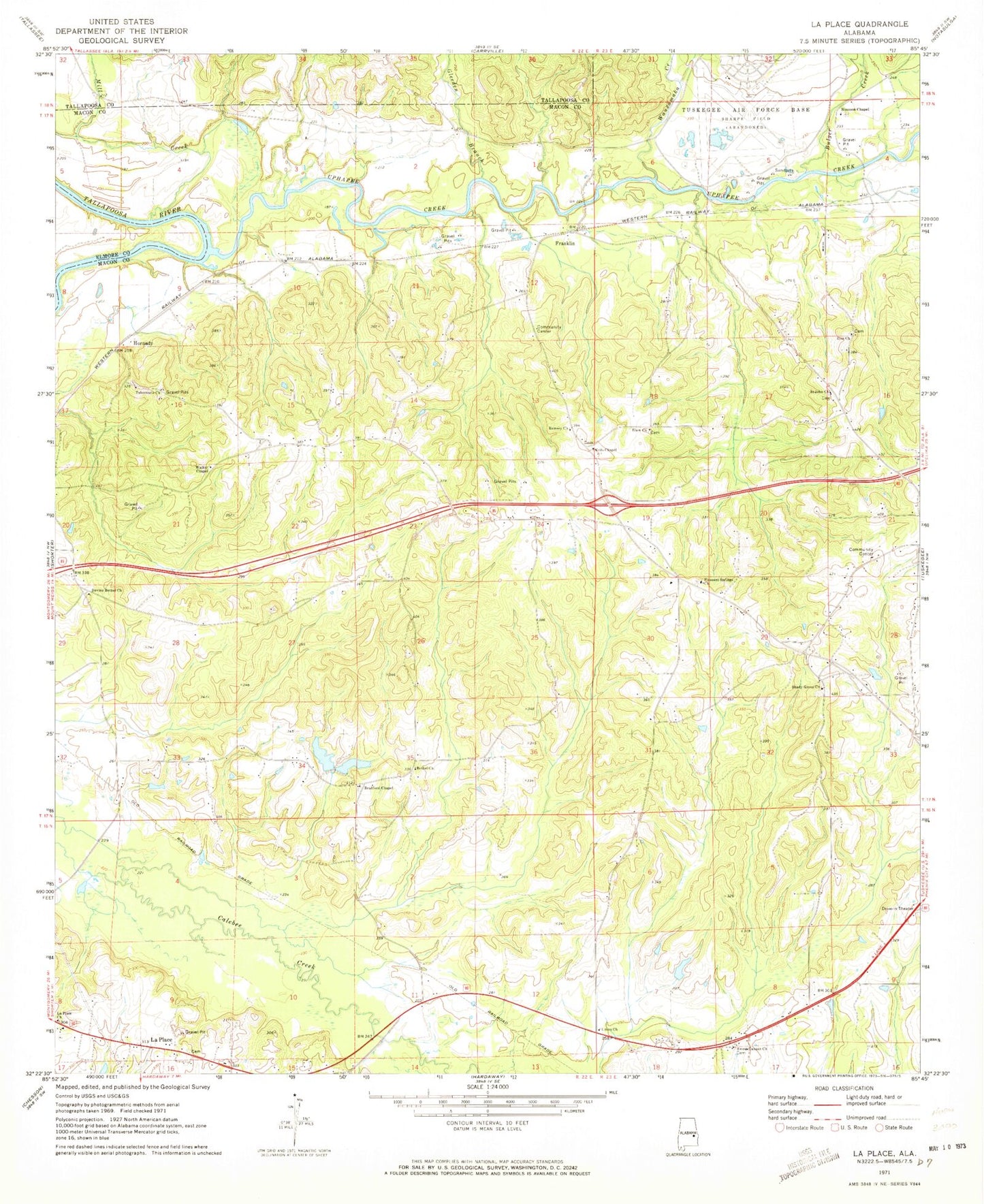
Classic USGS La Place Alabama 7.5'x7.5' Topo Map
Couldn't load pickup availability
Historical USGS topographic quad map of La Place in the state of Alabama. Map scale may vary for some years, but is generally around 1:24,000. Print size is approximately 24" x 27"
This quadrangle is in the following counties: Elmore, Macon, Tallapoosa.
The map contains contour lines, roads, rivers, towns, and lakes. Printed on high-quality waterproof paper with UV fade-resistant inks, and shipped rolled.
Contains the following named places: Antioch Church, Apostolic Faith Mission Church, Baldwin Farms, Baldwin School, Bethel Cemetery, Bethel Church, Bradford Chapel, Bradford Chapel Cemetery, Bradford Chapel School, Bulger Creek, Callabee Battle Ground, Clough, Cole Station School, Devine Bethel Church, Divine Church, Elam Cemetery, Elam Church, Franklin, Franklin School, Franklin Volunteer Fire Department, Gabbett, Gleeden Branch, Green-Cook Cemetery, Harris Barrett School, Holley Mitchell Church, Hornady, La Place, La Place Church, Lake Carrona Number 1 Dam, Lake Carrona Number 2 Dam, Lake Carrona Number One, Lake Carrona Number Two, Mill Creek, Neils Chapel, Neils Chapel Cemetery, Pleasant Springs Baptist Church, Ramsey Cemetery, Ramsey Church, Rising Star School, Saint John Cemetery, Saint John Church, Shady Grove Cemetery, Shady Grove Missionary Baptist Church, Sharpe Field, Simmon Chapel, Sweet Canaan Church, Sweet Gum Cemetery, Tabernacle Church, Talasse, Town of Franklin, Tuckahatchee, Tuskegee Division, Union Church, Uphapee Creek, Walker Chapel, Walker Chapel Cemetery, Wauxamaka Creek, Yufali, Zion Cemetery, Zion Church