MyTopo
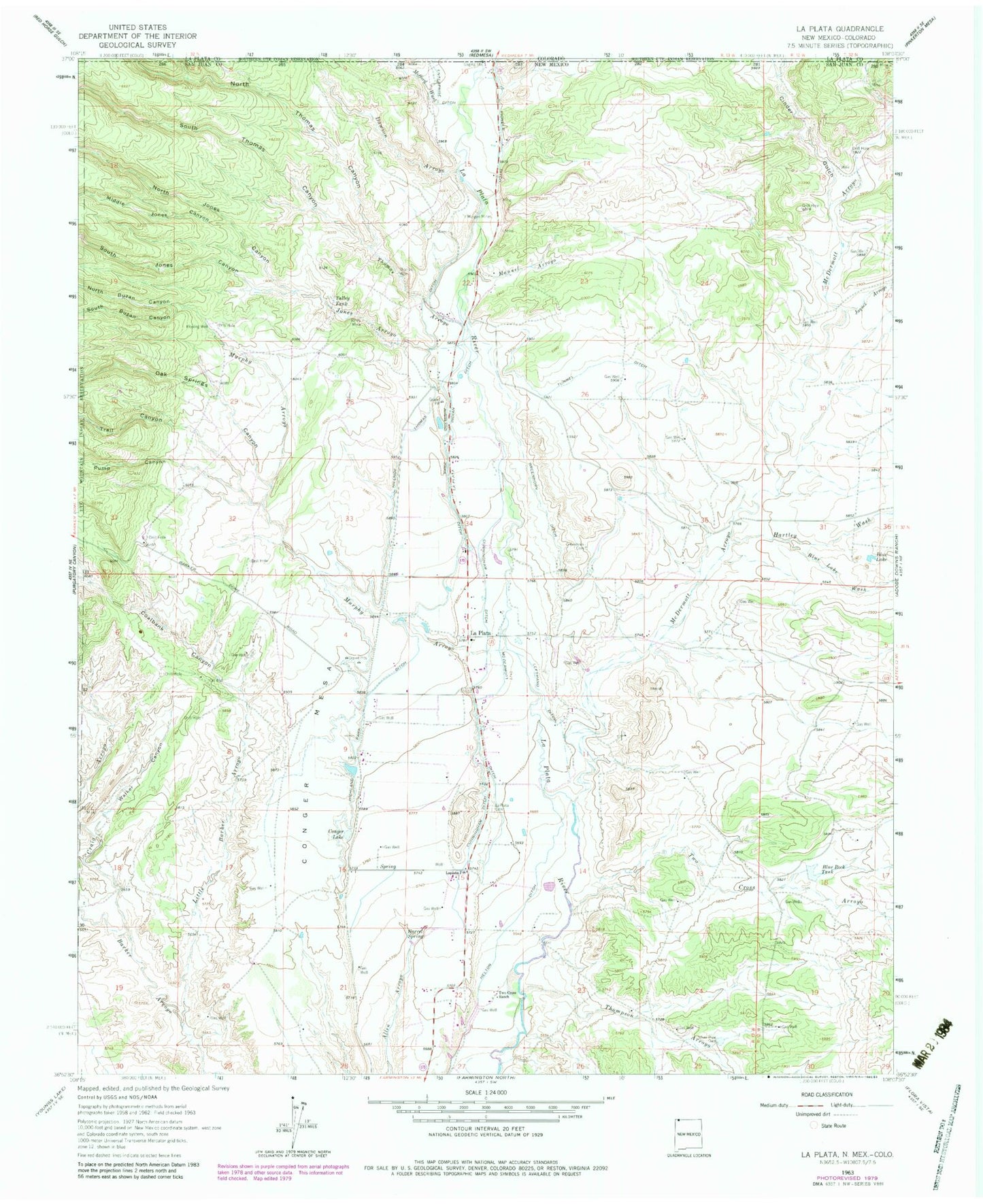
Classic USGS La Plata New Mexico 7.5'x7.5' Topo Map
Couldn't load pickup availability
Historical USGS topographic quad map of La Plata in the states of New Mexico, Colorado. Map scale may vary for some years, but is generally around 1:24,000. Print size is approximately 24" x 27"
This quadrangle is in the following counties: La Plata, San Juan.
The map contains contour lines, roads, rivers, towns, and lakes. Printed on high-quality waterproof paper with UV fade-resistant inks, and shipped rolled.
Contains the following named places: Barrel Spring, Bill Thomas Mine, Blue Lake, Blue Lake Wash, Blue Rock Dam, Blue Rock Tank, Burt Thomas Mine, Cinder Gulch, Coalbank Canyon, Conger Lake, Conger Mesa, Craig Arroyo, Cunningham Ditch, Dawson Arroyo, Deep Water Well Number 1, Enterprise Ditch, Enterprise Mine, Fields Mine, Freedom Baptist Church, Greenhorn Cemetery, Greenhorn Ditch, Hartley Wash, Helton Ditch, Highland Park Ditch, Hillside Thomas Ditch, Jaquez Arroyo, Jones Arroyo, Jones Mine, Kempton-Prewitt, La Plata, La Plata Cemetery, La Plata Census Designated Place, La Plata Indian Ditch, La Plata Mine, La Plata Post Office, Lefthand Ditch, Manuel Arroyo, McDermott Arroyo, McDermott Ditch, Mefford Wash, Middle Jones Canyon, Morgan Mine, Morgan Mines, Murphy Arroyo, North Buzan Canyon, North Jones Canyon, North Thomas Canyon, Oak Springs Canyon, PC-1 Water Well, Pioneer Ditch, Pruitt Mine, Pump Canyon, Ridge Historic Site, San Juan County Fire District 4 - La Plata Station 1, Silver Pipe Dam, South Buzan Canyon, South Jones Canyon, South Thomas Canyon, Talley Tank, Thomas Arroyo, Thomas Mine, Thompson Arroyo, Trail Canyon, Tunnel Ditch, Two Cross Arroyo, Two Cross Ranch, Walker Canyon, ZIP Code: 87418