MyTopo
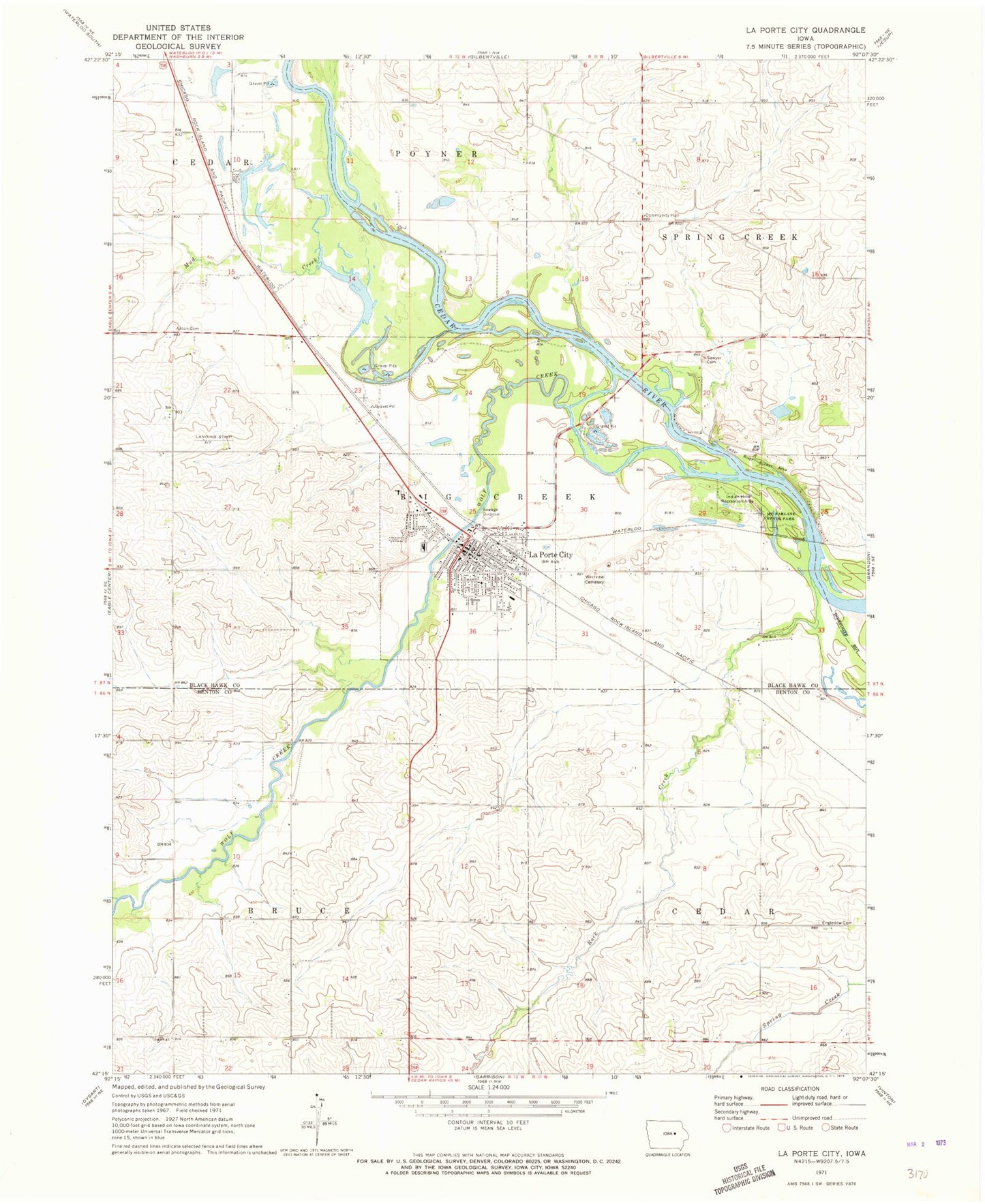
Classic USGS La Porte City Iowa 7.5'x7.5' Topo Map
Couldn't load pickup availability
Historical USGS topographic quad map of La Porte City in the state of Iowa. Map scale may vary for some years, but is generally around 1:24,000. Print size is approximately 24" x 27"
This quadrangle is in the following counties: Benton, Black Hawk.
The map contains contour lines, roads, rivers, towns, and lakes. Printed on high-quality waterproof paper with UV fade-resistant inks, and shipped rolled.
Contains the following named places: American Lutheran Church, Anton Cemetery, Bruce Townhall, Cedar River Access Area, City of La Porte City, Eliza Post Office, Engledow Cemetery, Enterprise, Enterprise Post Office, FFA Historical and Ag Museum, First United Presbyterian Church, Hawkins Memorial Library, Heartland Community Church, Indian Hills Recreation Area, La Porte City, La Porte City Clinic, La Porte City Elementary School, La Porte City Fire Department, La Porte City Hall, La Porte City Nursing and Rehabilitation Center, La Porte City Police Department, La Porte City Post Office, McFarlane State Park, Mud Creek, Rock Creek, Sacred Heart Catholic Church, Saint Paul United Methodist Church, Sawyer Cemetery, Township of Big Creek, Township of Bruce, Trinity Wesleyan Church, Union High School, Westview Cemetery, Wolf Creek, Zeien Sand and Gravel Pit, ZIP Code: 50651