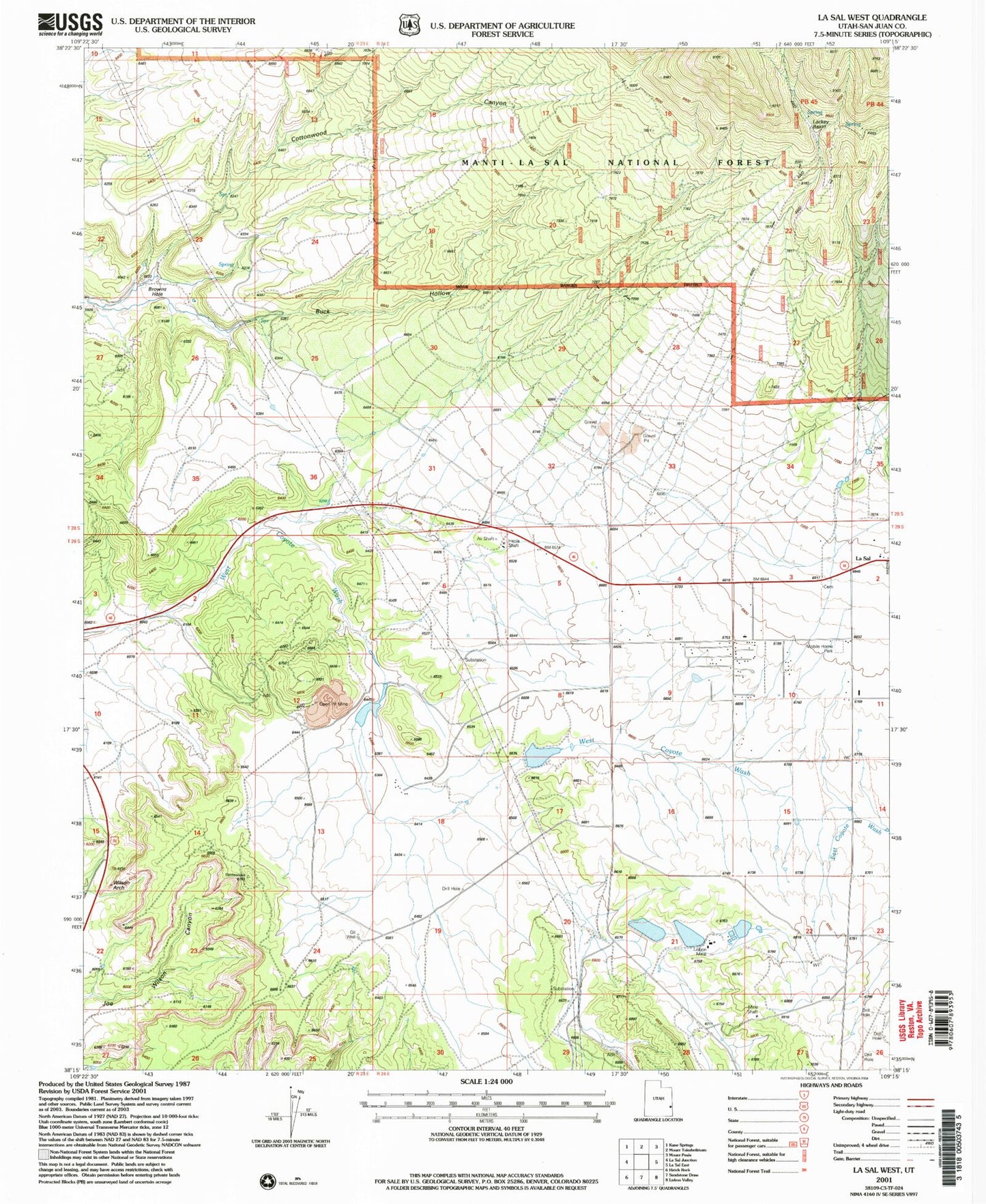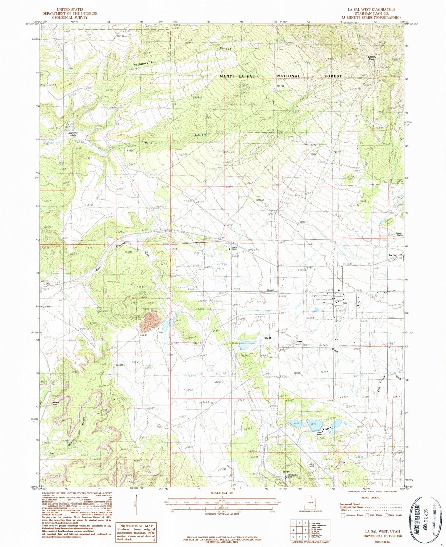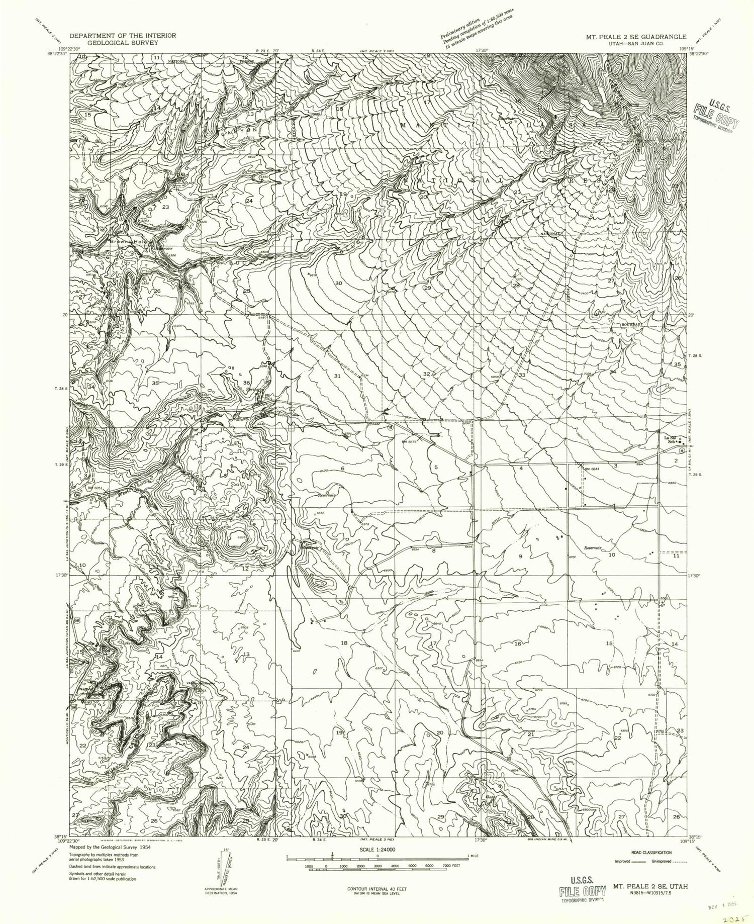
MyTopo
Classic USGS La Sal West Utah 7.5'x7.5' Topo Map
Couldn't load pickup availability
Historical USGS topographic quad map of La Sal West in the state of Utah. Map scale may vary for some years, but is generally around 1:24,000. Print size is approximately 24" x 27"
This quadrangle is in the following counties: San Juan.
The map contains contour lines, roads, rivers, towns, and lakes. Printed on high-quality waterproof paper with UV fade-resistant inks, and shipped rolled.
Contains the following named places: Alice Mine, Beaver Shaft, Browns Hole, Buck Hollow, Cottonwood Canyon, Hecla Shaft, Homestake Mine, La Sal Cemetery, La Sal Census Designated Place, La Sal Elementary School, La Sal Post Office, Lackey Basin, Lisbon Mine, Lower Bankhead Dam, Lower Bankhead Reservoir, Rattlesnake Ranch Number Two Dam, Rattlesnake Ranch Number Two Reservoir, Rio Algom Lower Tailings Pond, Rio Algom Lower Tailings Pond Dam, Rio Algom Upper Tailings Pond, Rio Algom Upper Tailings Pond Dam, San Juan Emergency Medical Services - La Sal, San Juan Fire Department - La Sal, The Church of Jesus Christ of Latter Day Saints, Upper Bankhead Dam, Upper Bankhead Reservoir, Upper Rattlesnake Ranch Number One Reservoir, Wilson Arch