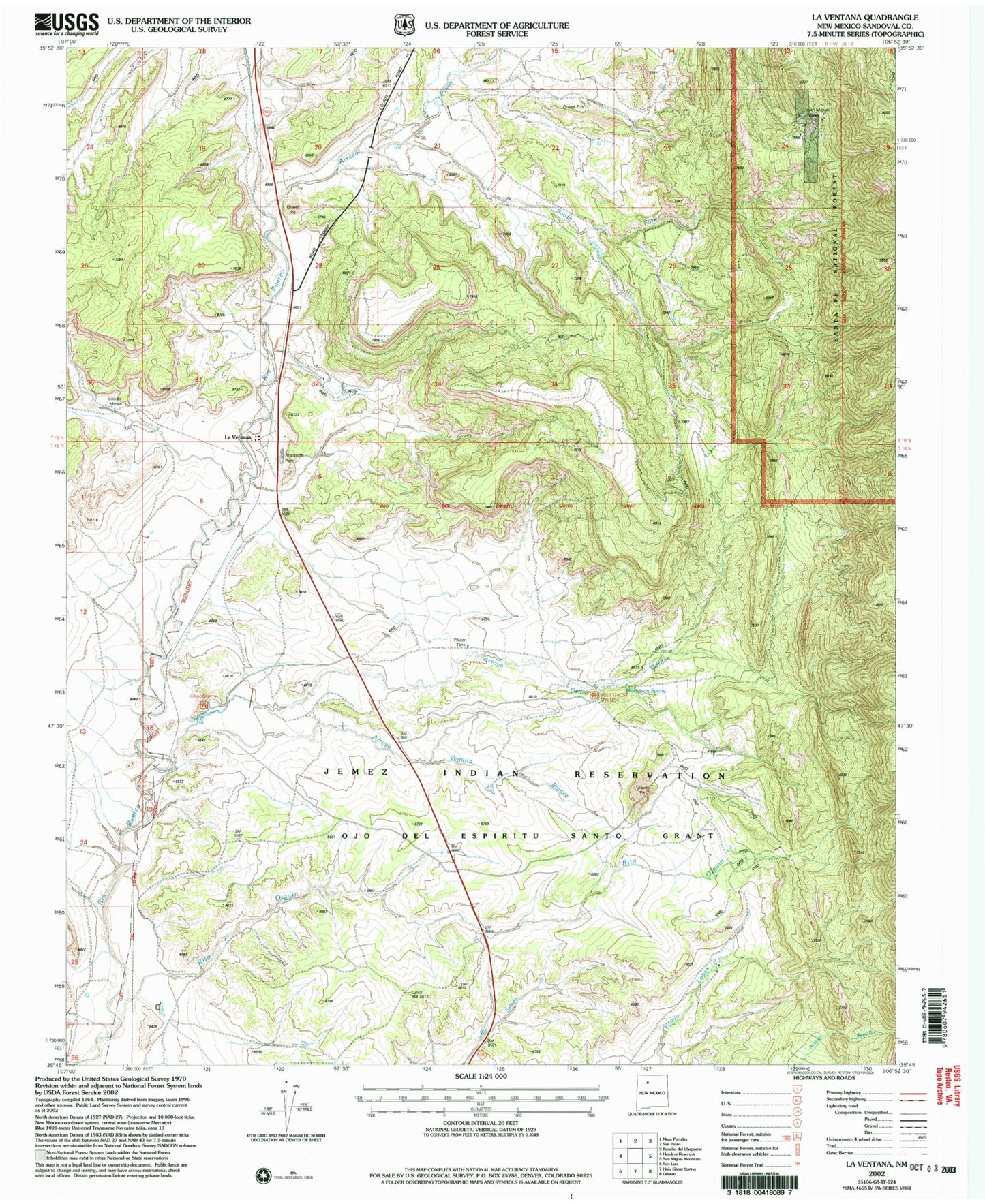
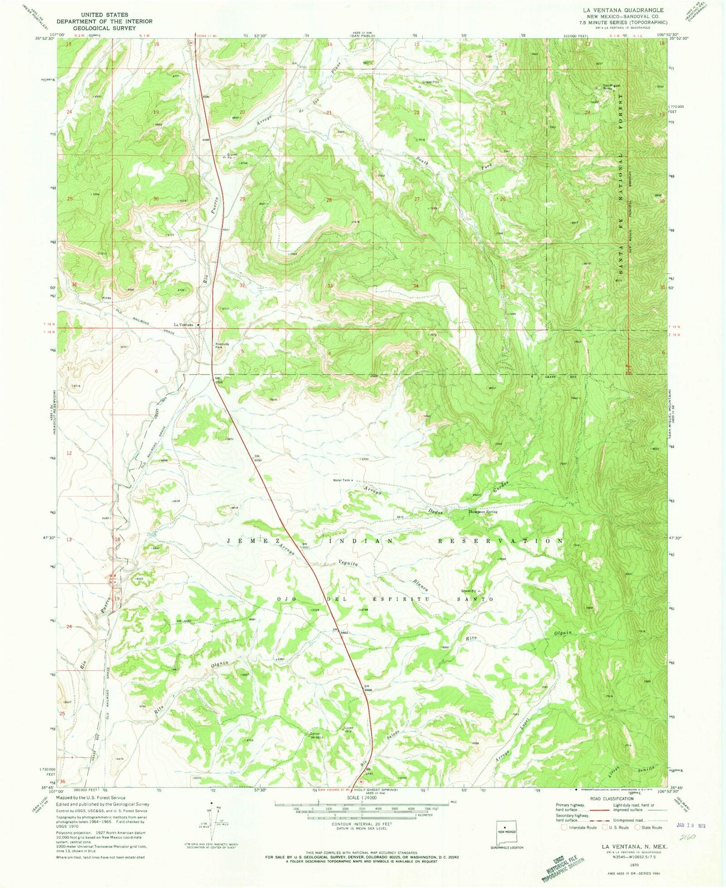
MyTopo
Classic USGS La Ventana New Mexico 7.5'x7.5' Topo Map
Couldn't load pickup availability
Historical USGS topographic quad map of La Ventana in the state of New Mexico. Map scale may vary for some years, but is generally around 1:24,000. Print size is approximately 24" x 27"
This quadrangle is in the following counties: Sandoval.
The map contains contour lines, roads, rivers, towns, and lakes. Printed on high-quality waterproof paper with UV fade-resistant inks, and shipped rolled.
Contains the following named places: Arroyo de los Pinos, Arroyo Dedos Gordos, Arroyo Veguita Blanca, Carlisle Prospect, De Dos Gordos Prospect, Hoye Mine, J Herrera Springs, Jones Prospect, La Ventana, LaVentana, Luciani Mines, Mitchell Prospect, Nance Mine, North Butte Prospect, Ojo del Espiritu Santo Grant, Peacock Number Three, Rio Puerco Mine, Rito Olguin, RWP 7 Water Well, RWP-8 Water Well, San Juan Mine, San Miguel Group, San Miguel Mines, Sandoval Coal Company Prospect, South Butte Prospect, South Fork Arroyo de los Pinos, Thompson Spring, Wilkins Number 2 Mine, Wilkins Number Two Mine