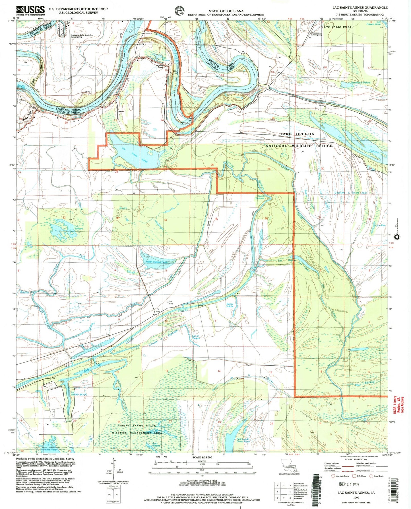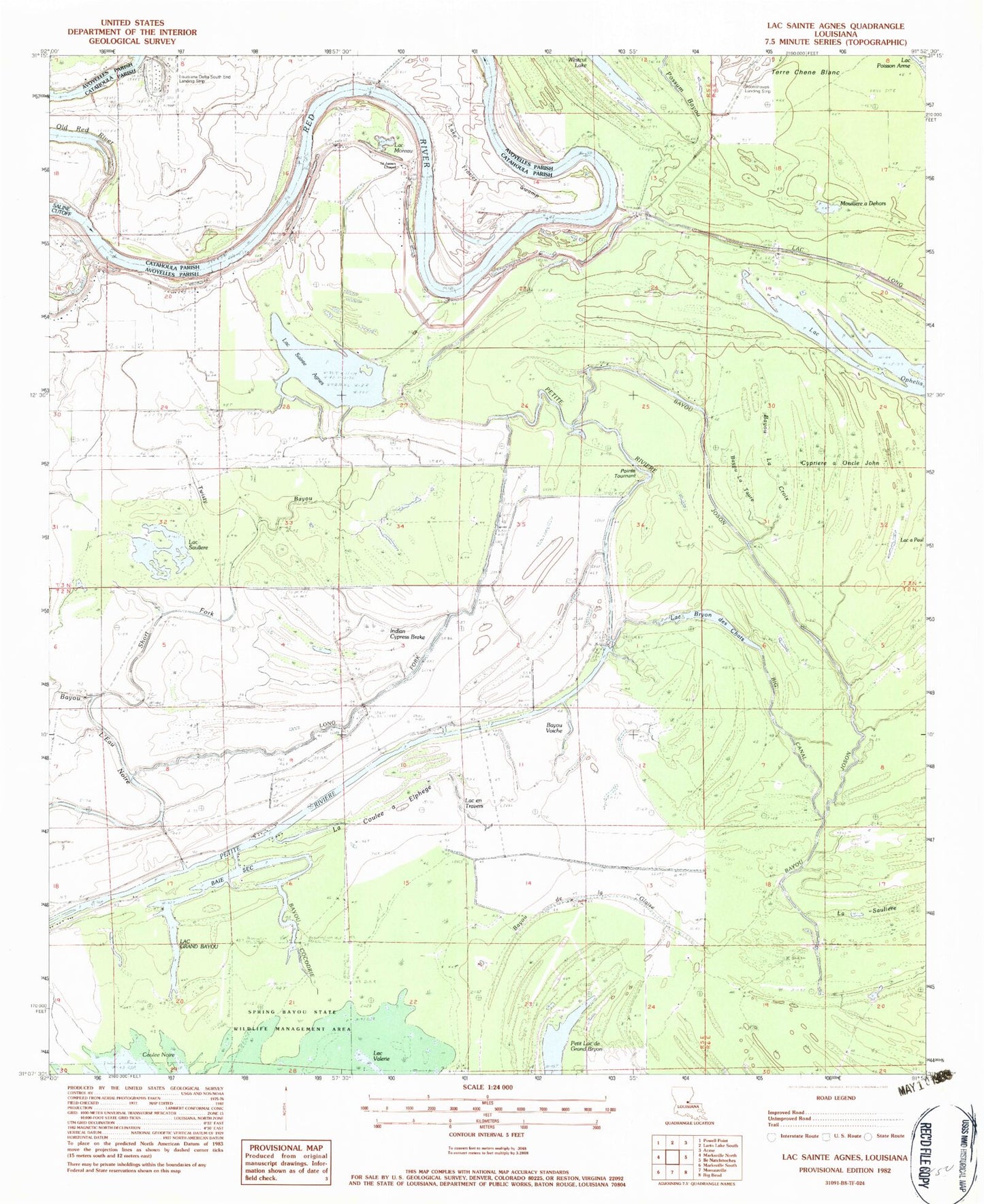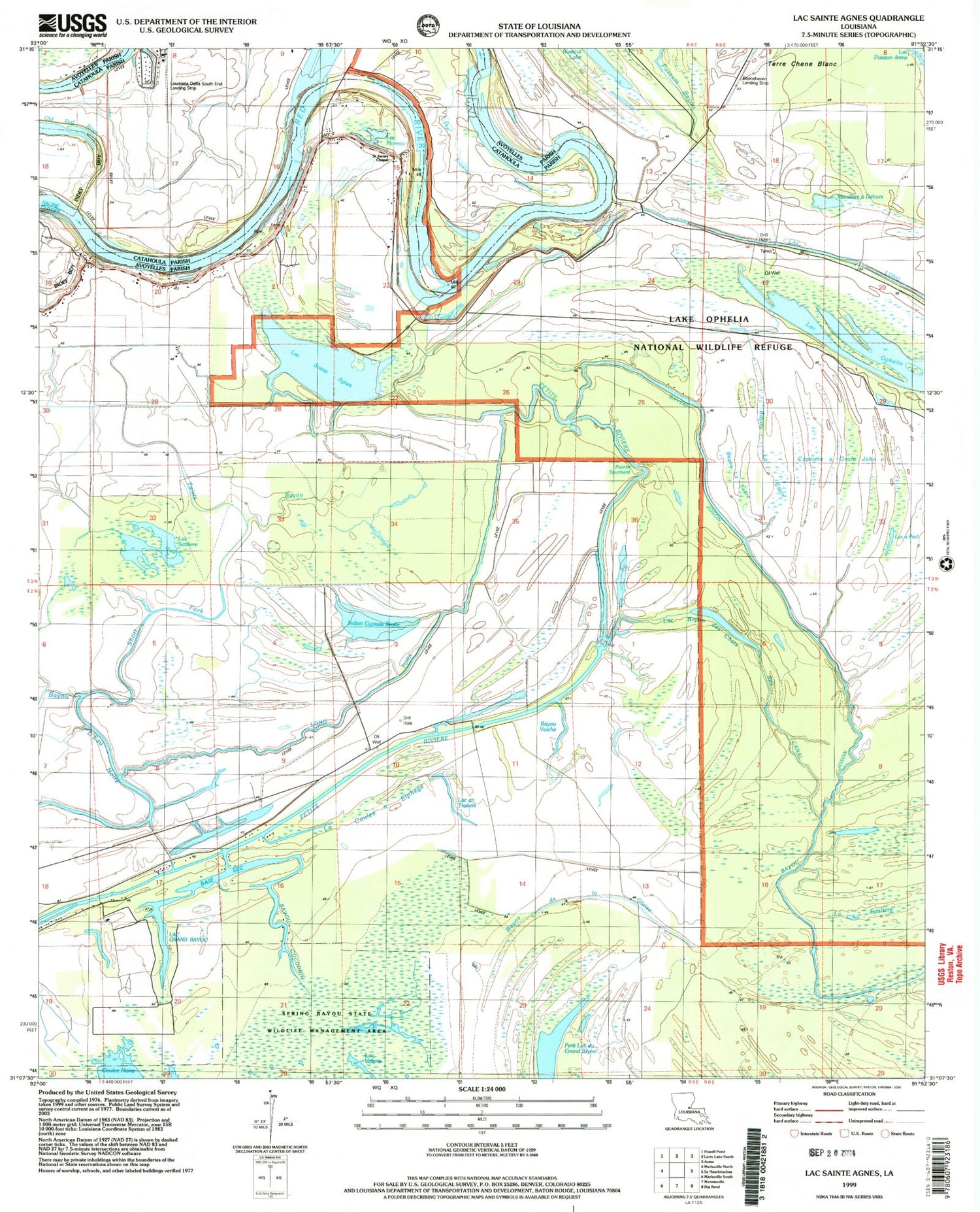

MyTopo
Classic USGS Lac Sainte Agnes Louisiana 7.5'x7.5' Topo Map
Couldn't load pickup availability
Historical USGS topographic quad map of Lac Sainte Agnes in the state of Louisiana. Map scale may vary for some years, but is generally around 1:24,000. Print size is approximately 24" x 27"
This quadrangle is in the following counties: Avoyelles, Catahoula.
The map contains contour lines, roads, rivers, towns, and lakes. Printed on high-quality waterproof paper with UV fade-resistant inks, and shipped rolled.
Contains the following named places: Baie Sec, Bayou Chambre, Bayou Cocodrie, Bayou de la Glaise, Bayou La Croix, Bayou La Taure, Bayou Voiche, Bayou Voinche, Big Canal, Bill Book Lake, Cypriere a Oncle John, Grand Cypriere, Indian Cypress Brake, La Coulee a Elphege, La Paries Church, La Sauliere, Lac a Paul, Lac Ambroise, Lac Barbue, Lac Bryon de Chats, Lac Clair, Lac en Travers, Lac Grand Bayou, Lac Moreau, Lac Ophelia, Lac Sainte Agnes, Lac Sauliere, Lac Valerie, Lake Frazier Swamp, Lake Little Solier, Lake Ophelia National Wildlife Refuge, Lake Ophelia Oil Field, Little River Oil Field, Long Fork, Louisiana Delta South End Landing Strip, Mouillere a Dehors, Old Red River, Parish Governing Authority District 3, Petit Lac du Grand Bryon, Petit Lac Sauliere, Pointe Tournant, Saint James Chapel, Short Fork, Twisty Bayou, Westcut Lake, ZIP Code: 71351