
MyTopo
Classic USGS Laconia Arkansas 7.5'x7.5' Topo Map
Couldn't load pickup availability
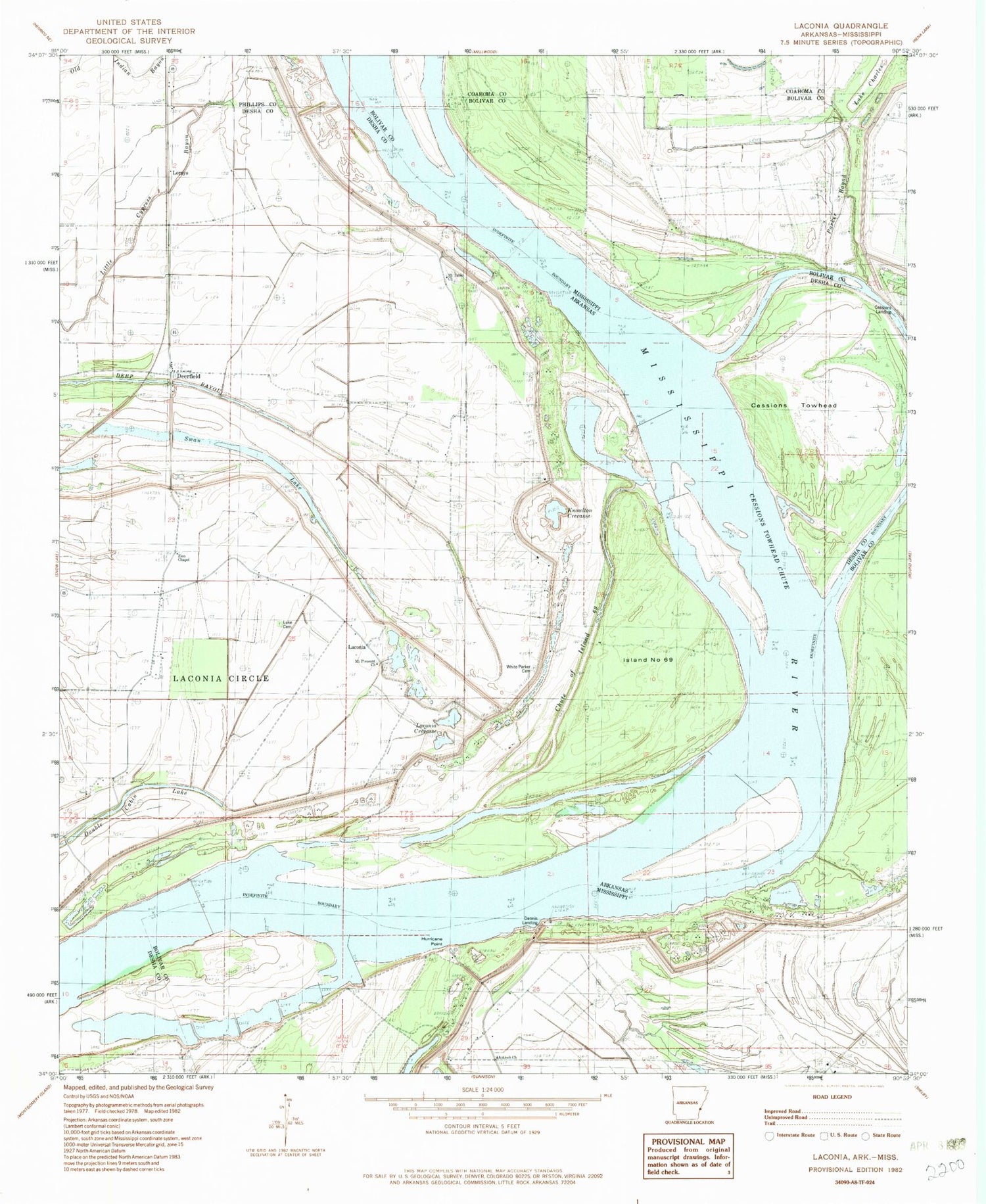
Historical USGS topographic quad map of Laconia in the states of Arkansas, Mississippi. Map scale may vary for some years, but is generally around 1:24,000. Print size is approximately 24" x 27"
This quadrangle is in the following counties: Bolivar, Coahoma, Desha, Phillips.
The map contains contour lines, roads, rivers, towns, and lakes. Printed on high-quality waterproof paper with UV fade-resistant inks, and shipped rolled.
Contains the following named places: Anarke School, Antioch Church, Australia Landing, Beith Landing, Below Knowlton Dikes, Brushy Lake, Cessions Landing, Cessions Towhead, Cessions Towhead Chute, Cessions Towhead Revetment, Chute of Island 69, Deerfield, Dennis Landing, Dennis Revetment, Double Cabin Lake, Fish Lake, Henrico Revetment, Hurricane Point, Island Number 69, Knowlton, Knowlton Crevasse, Knowlton Landing, Knowlton Revetment, Laconia, Laconia Crevasse, Laconia Landing, Lake Charles, Lorays, Luke Cemetery, Mason Landing, Mount Pleasant Church, Mount Table Church, Parker Branch, Pleasant Valley Church, Swan Lake, White Parker Cemetery, Wood Cottage Bar, Zion Chapel


