MyTopo
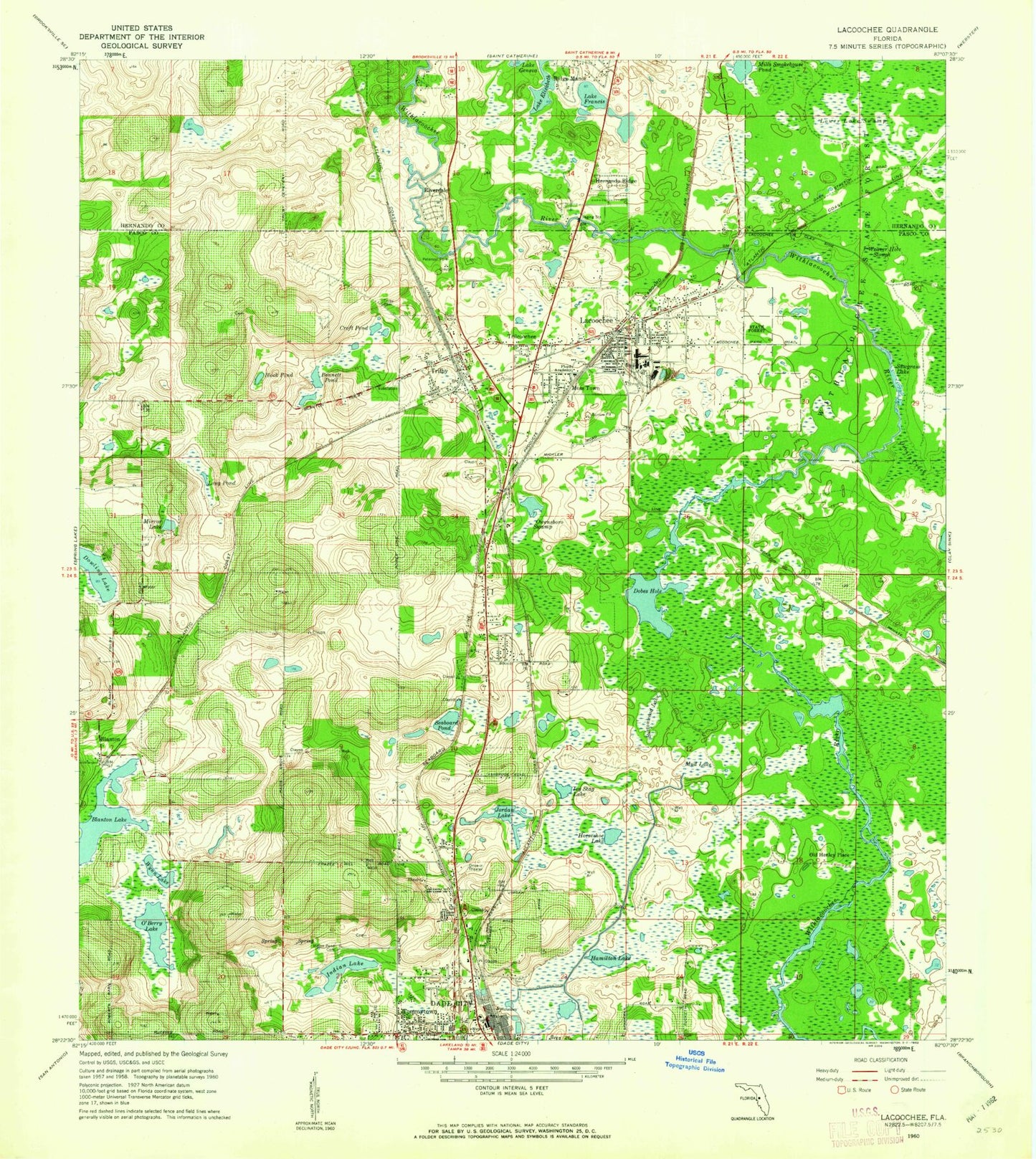
Classic USGS Lacoochee Florida 7.5'x7.5' Topo Map
Couldn't load pickup availability
Historical USGS topographic quad map of Lacoochee in the state of Florida. Map scale may vary for some years, but is generally around 1:24,000. Print size is approximately 24" x 27"
This quadrangle is in the following counties: Hernando, Pasco.
The map contains contour lines, roads, rivers, towns, and lakes. Printed on high-quality waterproof paper with UV fade-resistant inks, and shipped rolled.
Contains the following named places: Alderman, Blanton, Blanton Lake, Block Pond, Bonnett Pond, Buttonwood Lake, Croft Pond, Cub Haven Airport, Dade City North Census Designated Place, Devils Creek, Dobes Hole, Dowling Lake, Dusty Airpatch Airport, Dutton Still, Field of Dreams Airport, Floyd Academy, Fort Dade, Hamilton Lake, Higate Square, Horseshoe Lake, Indian Lake, Indian Pond Cemetery, Ivy Stag Lake, Jordan Lake, Joy-Lan Drive-In, Lacoochee, Lacoochee Census Designated Place, Lacoochee Division, Lacoochee Elementary School, Lacoochee Post Office, Lake Elizabeth, Lake Francis, Long Pond, Lower Lake Swamp, Mills Smokehouse Pond, Mirror Lake, Moss Town, Mud Lake, O'Berry Lake, Old Henley Place, Owensboro Swamp, Pasco County Fire Rescue Station 34, Pasco County Fire Rescue Station 36, Pasco-Hernando Community College, Peterson Park, Ridge Manor Census Designated Place, Riverdale, Sawgrass Lake, Seaboard Pond, Talisman, Tommytown, Trilby, Trilby Cemetery, Trilby Census Designated Place, Trilby Post Office, Trilcoochee, Two J's Flying Ranch Airport, Weaver Hole Slough, Wynn Lake, ZIP Code: 33523