MyTopo
Classic USGS Lacour Louisiana 7.5'x7.5' Topo Map
Couldn't load pickup availability
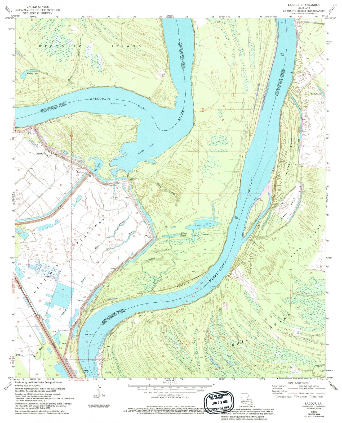
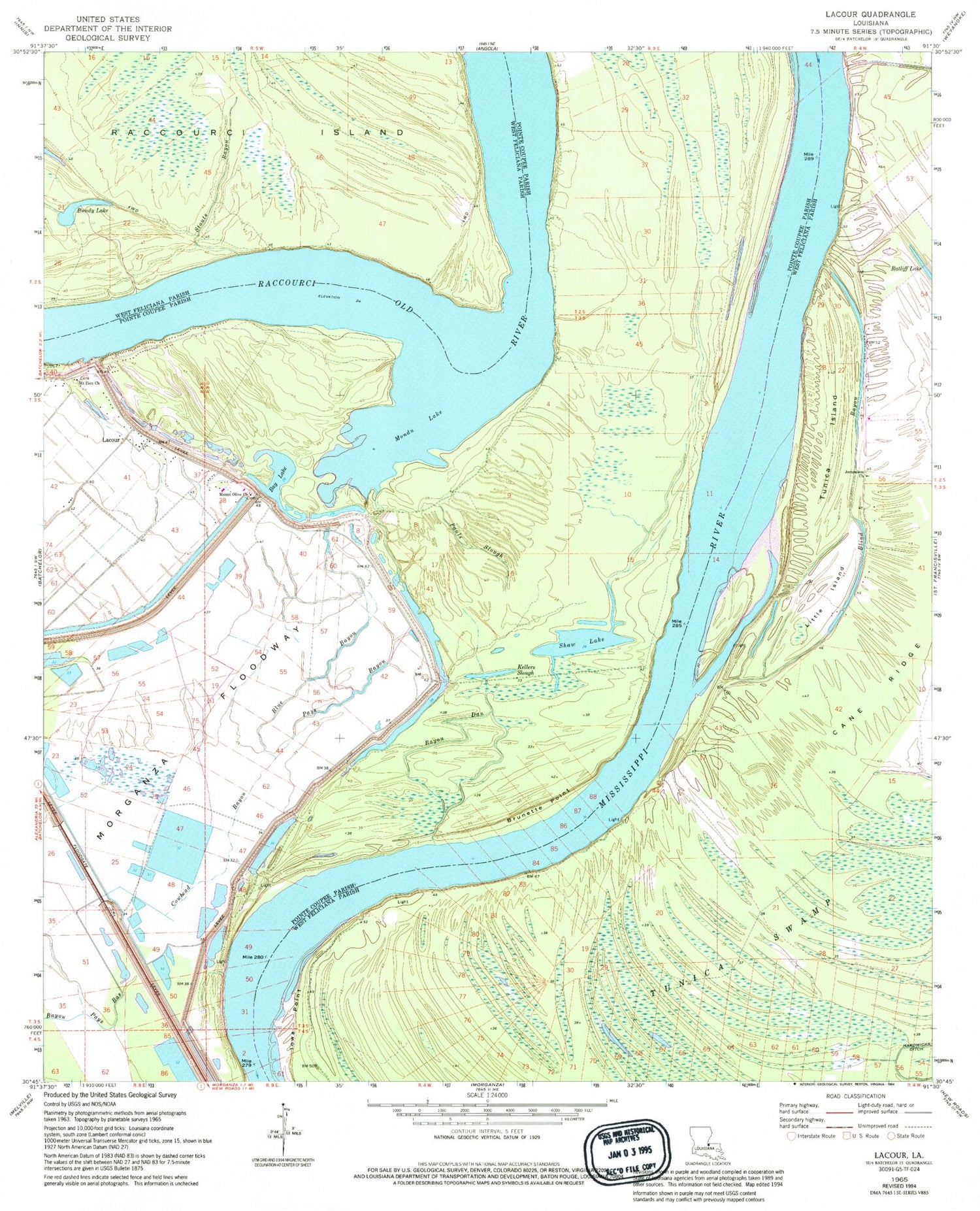
Historical USGS topographic quad map of Lacour in the state of Louisiana. Map scale may vary for some years, but is generally around 1:24,000. Print size is approximately 24" x 27"
This quadrangle is in the following counties: Pointe Coupee, West Feliciana.
The map contains contour lines, roads, rivers, towns, and lakes. Printed on high-quality waterproof paper with UV fade-resistant inks, and shipped rolled.
Contains the following named places: Bay Lake, Bayou Dam Landing, Bayou Dan, Blind Bayou, Blue Bayou, Brownville, Brunette Point, Brunette Point Revetment, Bundy Lake, Cane Ridge, Cat Island National Wildlife Refuge, Catfish Landing, Cowhead Bayou, Greenwood Bend Revetment, Greenwood Landing, Iowa Point, Iowa Point Landing, Iowa Point Revetment, Jerusalem School, Kellers Slough, Killarny Farm Airport, Lacour, Lacour Plantation, Little Island, Little Rock Cemetery, Little Rock Church, Little Rock School, Monday Lake, Morganza Spillway, Mount Olive Cemetery, Mount Olive Church, Mount Zion Cemetery, Mount Zion Church, New Jerusalem Church, New Texas Landing, Pauls Slough, Pays Bayou, Raccourci, Ryans Landing, Saint Francisville Gas Field, Sebastopol Landing, Shaw Lake, Star Light Church, Stouts Bayou, Tunica Island