MyTopo
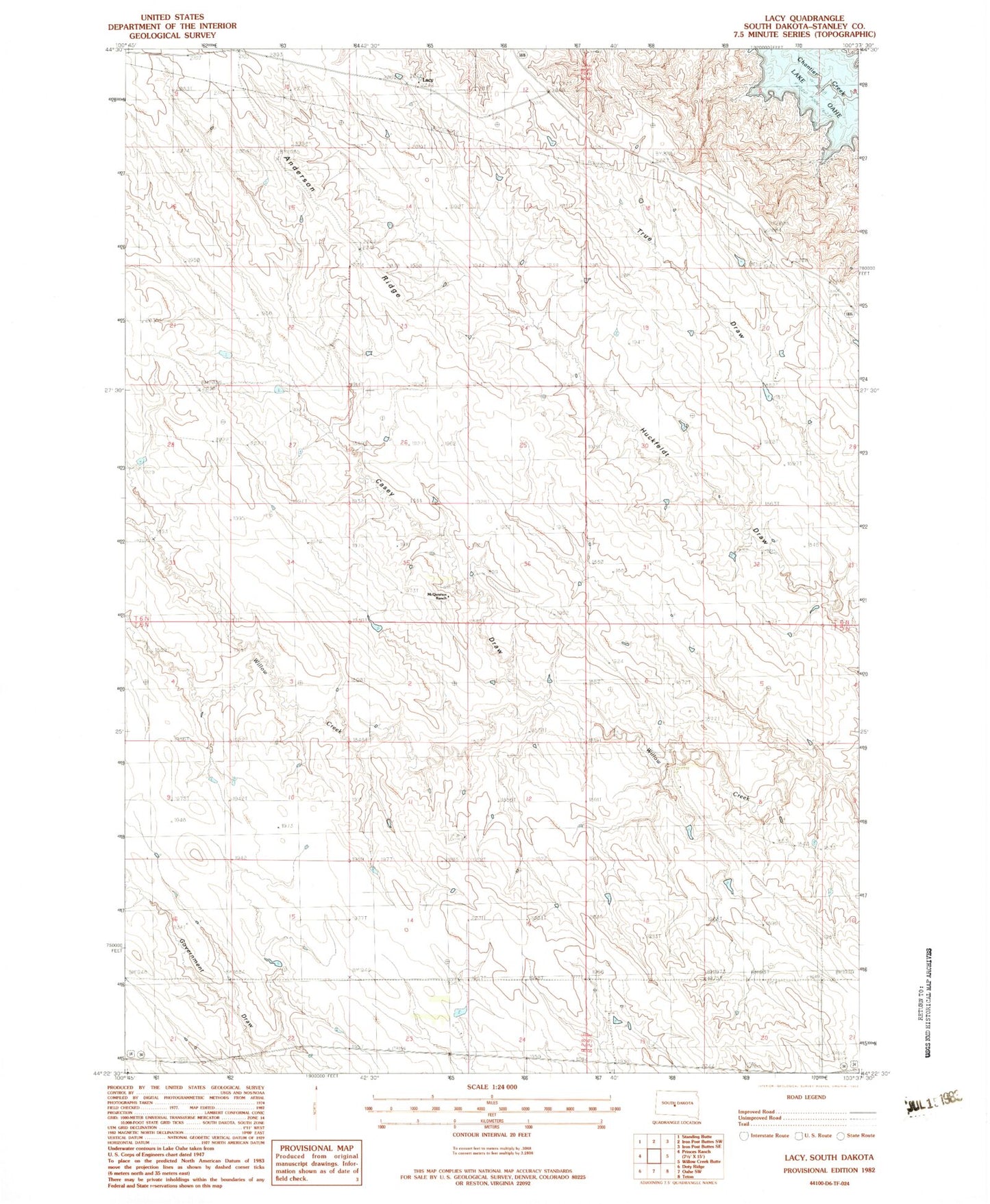
Classic USGS Lacy South Dakota 7.5'x7.5' Topo Map
Regular price
$16.95
Regular price
Sale price
$16.95
Unit price
per
Couldn't load pickup availability
Historical USGS topographic quad map of Lacy in the state of South Dakota. Map scale may vary for some years, but is generally around 1:24,000. Print size is approximately 24" x 27"
This quadrangle is in the following counties: Stanley.
The map contains contour lines, roads, rivers, towns, and lakes. Printed on high-quality waterproof paper with UV fade-resistant inks, and shipped rolled.
Contains the following named places: Allen Stirling Number 1 Dam, Anderson Ranch, Anderson Ridge, Casey Draw, Charles Frazier Dam, Lacy, Lewis Ranch, Madison Ranch, Monks Ranch, Rhodes School, Sonnenschein Number 1 Dam, Stanley County, Township of Meers, Township of Shaner, Willow Creek School, ZIP Code: 57532