MyTopo
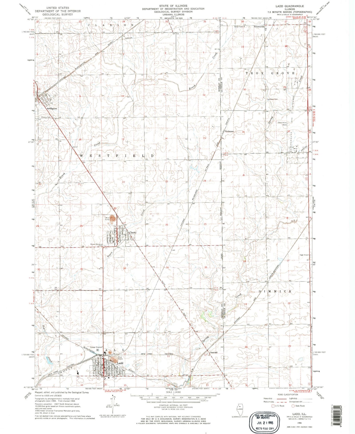
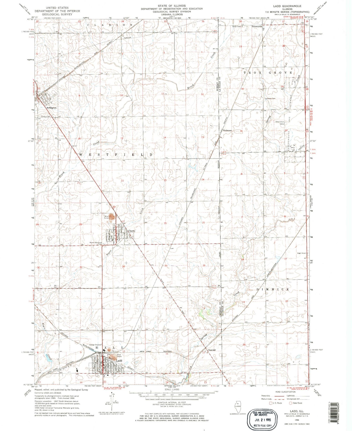
Classic USGS Ladd Illinois 7.5'x7.5' Topo Map
Couldn't load pickup availability
Historical USGS topographic quad map of Ladd in the state of Illinois. Map scale may vary for some years, but is generally around 1:24,000. Print size is approximately 24" x 27"
This quadrangle is in the following counties: Bureau, LaSalle.
The map contains contour lines, roads, rivers, towns, and lakes. Printed on high-quality waterproof paper with UV fade-resistant inks, and shipped rolled.
Contains the following named places: Arlington, Arlington Cemetery, Arlington Elementary School, Arlington Fire Protection District, Arlington Lost Grove Cemetery, Barrett School, Calvary Catholic Cemetery, Cherry, Cherry Fire Department, Cherry Grade School, Cherry Post Office, Churchill, Corley School, First Presbyterian Church of Ladd, Fitchmoor, Flaherty Field, Funfsinn Airport, Gerald H Hamer Airport, Hahn Airport, Holy Trinity Roman Catholic Church, Ladd, Ladd Cemetery, Ladd Community Consolidated School, Ladd Fire Protection District, Ladd Police Department, Ladd Post Office, Ladd Public Library, Lutheran Cemetery, Miners Memorial Cemetery, Peterstown, Pottinger RLA Airport, Saint Benedict Catholic Church, Township of Westfield, Village of Arlington, Village of Cherry, Village of Ladd, ZIP Codes: 61312, 61317, 61329