MyTopo
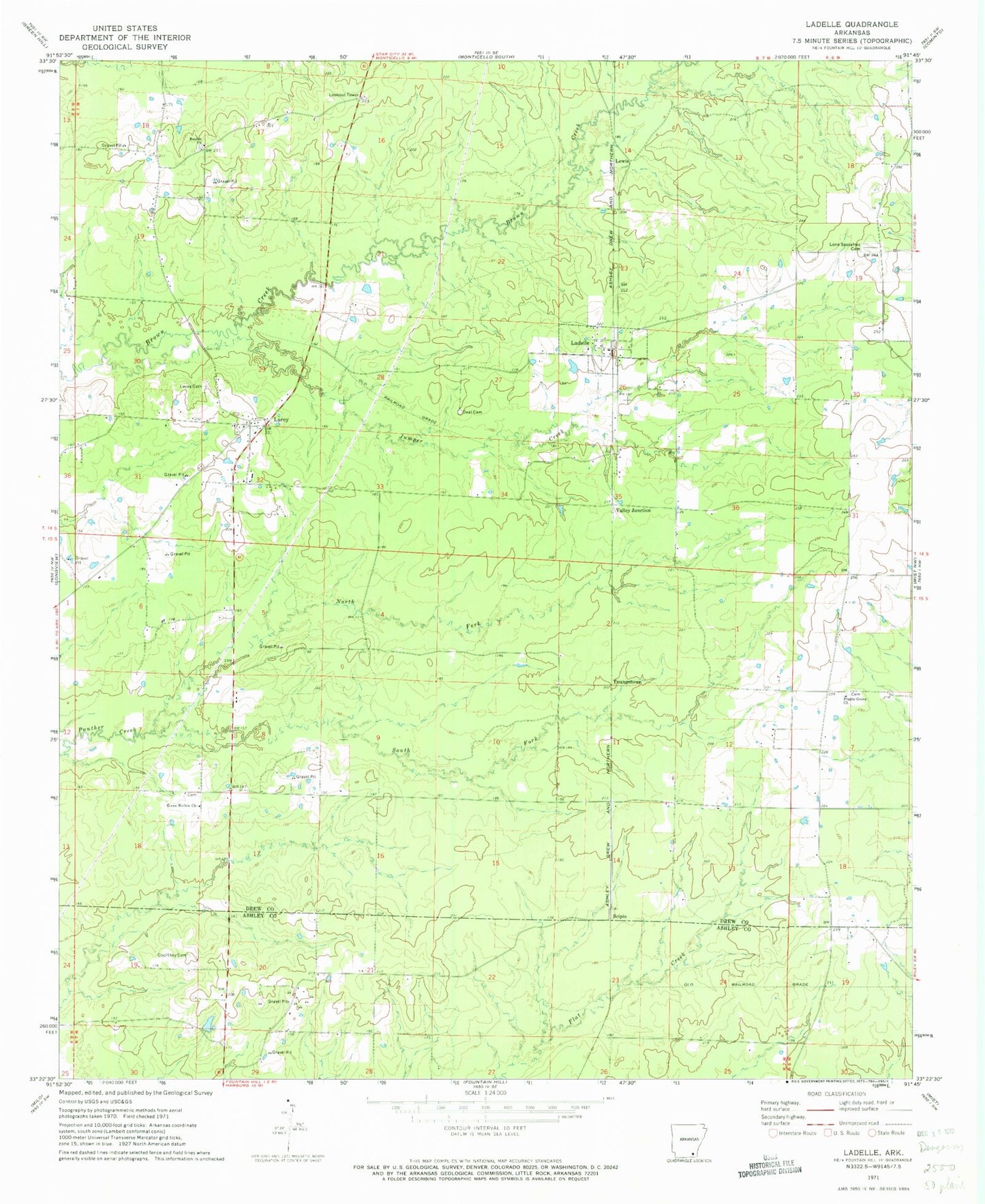
Classic USGS Ladelle Arkansas 7.5'x7.5' Topo Map
Couldn't load pickup availability
Historical USGS topographic quad map of Ladelle in the state of Arkansas. Map scale may vary for some years, but is generally around 1:24,000. Print size is approximately 24" x 27"
This quadrangle is in the following counties: Ashley, Drew.
The map contains contour lines, roads, rivers, towns, and lakes. Printed on high-quality waterproof paper with UV fade-resistant inks, and shipped rolled.
Contains the following named places: Beulah, Beulah Baptist Church, Beulah Cemetery, Carpenter, Courtney Cemetery, Deal Cemetery, Goose Hollow, Goose Hollow Church, Gray Cemetery, Jumper Creek, Lacey, Lacey Cemetery, Lacey Census Designated Place, Lacey Ladelle Volunteer Fire Department Station 1, Lacey Ladelle Volunteer Fire Department Station 2, Lacey Ladelle Volunteer Fire Department Station 3, Lacey School, Ladelle, Ladelle Baptist Church, Lewis, Lone Sasafras, Lone Sassafras Cemetery, Long Prairie, North Fork Panther Creek, Prairie Grove, Prairie Grove Baptist Church, Prairie Grove Cemetery, Scipio, South Fork Panther Creek, Township of Veasey, Valley Junction, Youngstown