MyTopo
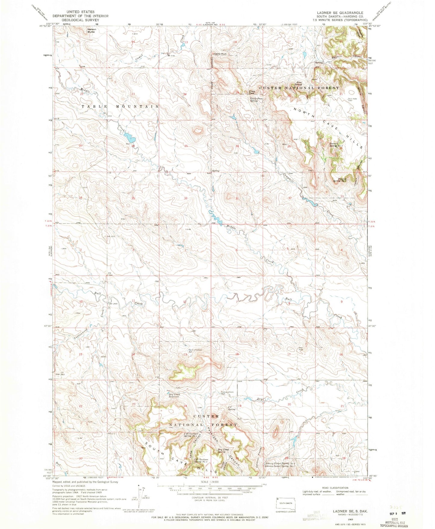
Classic USGS Ladner SE South Dakota 7.5'x7.5' Topo Map
Couldn't load pickup availability
Historical USGS topographic quad map of Ladner SE in the state of South Dakota. Map scale may vary for some years, but is generally around 1:24,000. Print size is approximately 24" x 27"
This quadrangle is in the following counties: Harding.
The map contains contour lines, roads, rivers, towns, and lakes. Printed on high-quality waterproof paper with UV fade-resistant inks, and shipped rolled.
Contains the following named places: Alice Spring, Castle Rock, Cottonwood Creek, Craig Pass, Craig Pass Spring, Devils Canyon, Dry Creek Reservoir, Dry Creek Spring, East Clarkson Well, Ewing County, Icebox Canyon, J B Clarkson Spring Number Two, J C Spring, J Clarkson Ranch, Johnny Pocket Spring Number One, Johnny Pocket Spring Number Two, Johnnys Pocket, Lane Canyon, M Clarkson Ranch, Middle Creek, North Bull Creek, North Clarkson Well, Peterson Canyon, Sawmill Canyon, Schleichart Draw, South Bull Creek, Timber Canyon, Travers Spring, Travers Spring Number One, W J Johnson Ranch