MyTopo
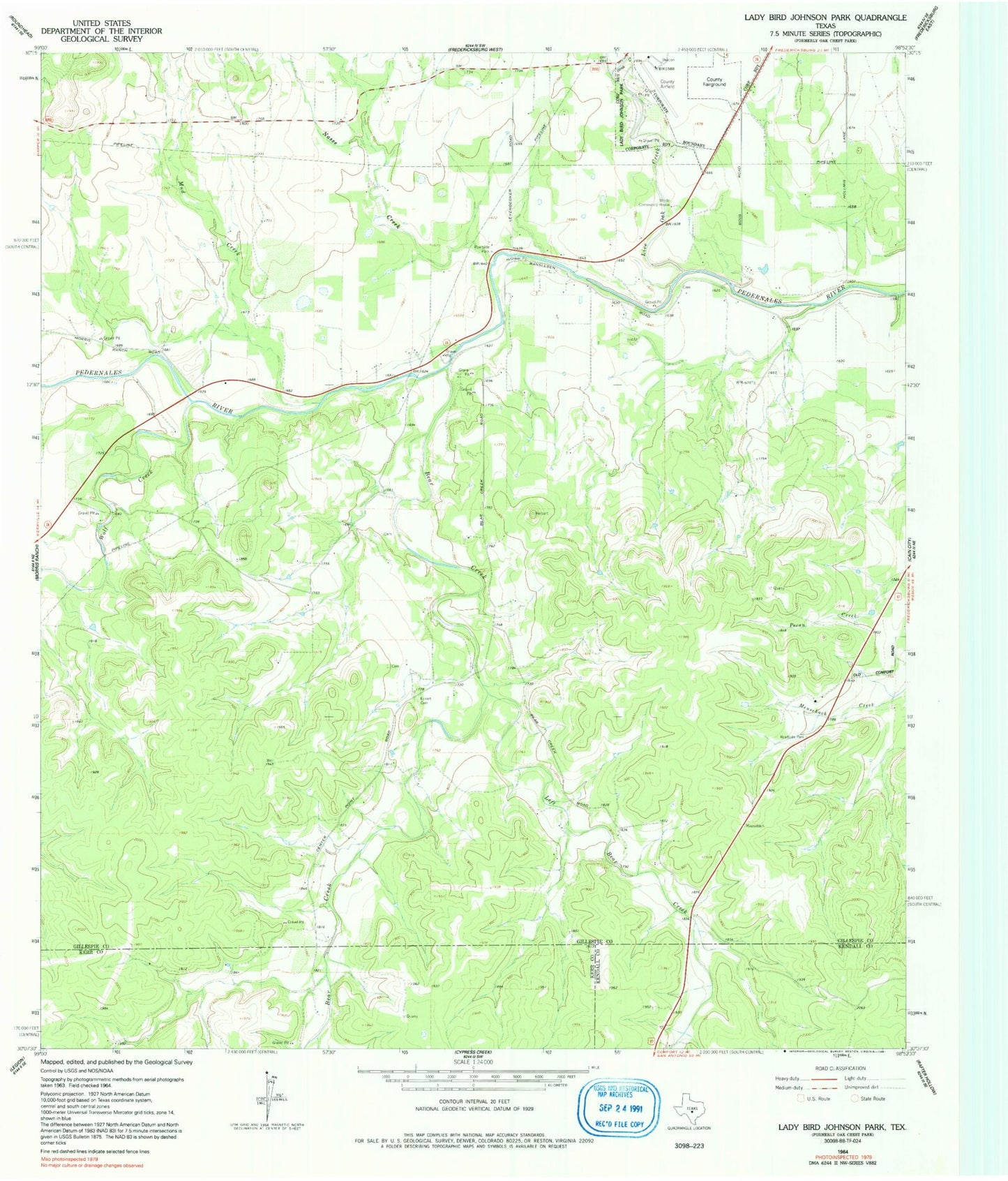
Classic USGS Lady Bird Johnson Park Texas 7.5'x7.5' Topo Map
Couldn't load pickup availability
Historical USGS topographic quad map of Lady Bird Johnson Park in the state of Texas. Map scale may vary for some years, but is generally around 1:24,000. Print size is approximately 24" x 27"
This quadrangle is in the following counties: Gillespie, Kendall, Kerr.
The map contains contour lines, roads, rivers, towns, and lakes. Printed on high-quality waterproof paper with UV fade-resistant inks, and shipped rolled.
Contains the following named places: Bear Creek, Cameron Ranch Airport, Eckert Cemetery, Gillespie County Airport, Lady Bird Johnson Municipal Park, Lady Bird Johnson Park Dam, Lady Bird Johnson Park Reservoir, Lady Bird Johnson Park Trail, Left Bear Creek, Live Oak Creek, Meusebach Creek, Mud Creek, Nasse Creek, Oak Crest Park, Stink Creek, Wolf Creek, Wrede Community House