MyTopo
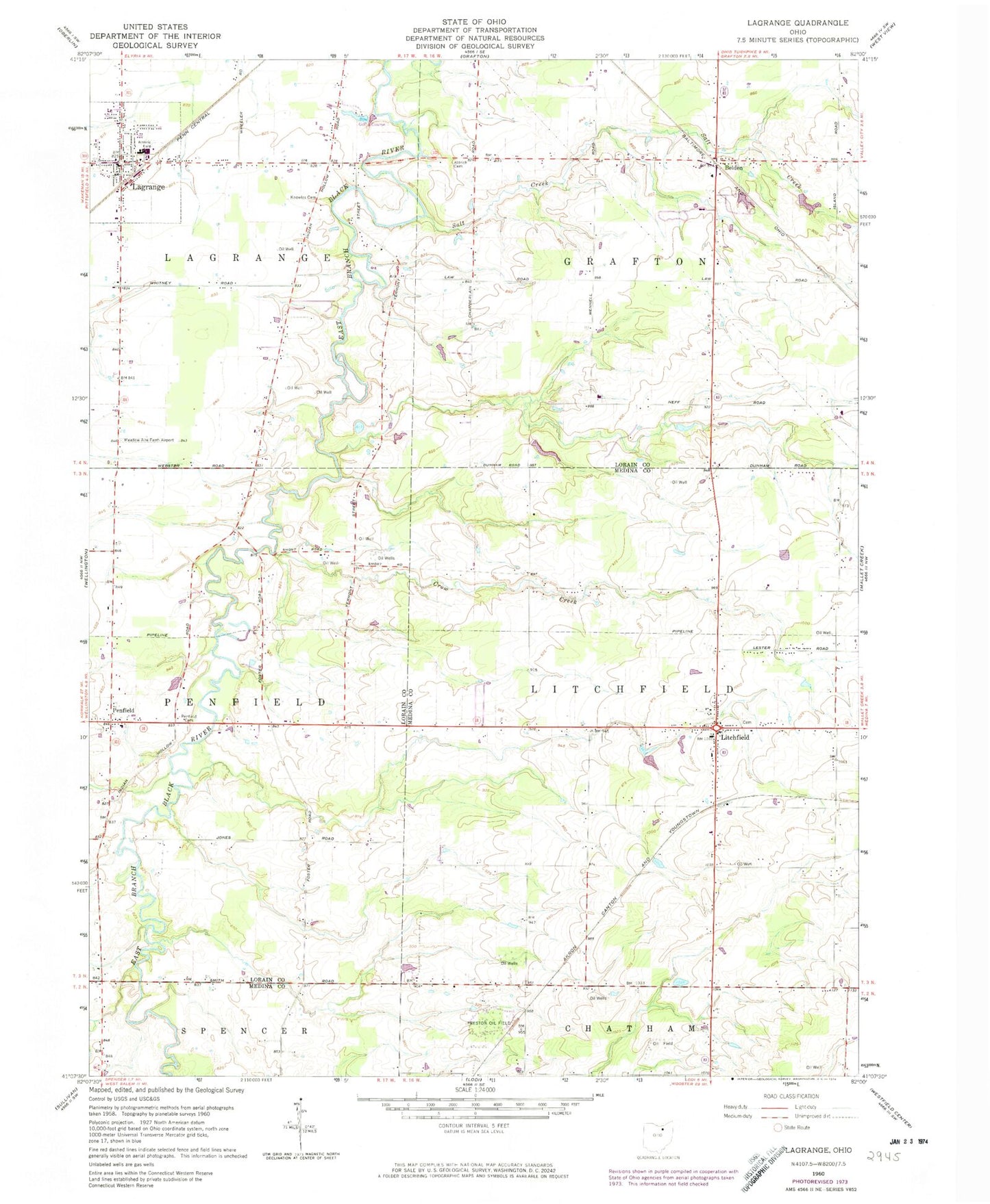
Classic USGS Lagrange Ohio 7.5'x7.5' Topo Map
Couldn't load pickup availability
Historical USGS topographic quad map of Lagrange in the state of Ohio. Map scale may vary for some years, but is generally around 1:24,000. Print size is approximately 24" x 27"
This quadrangle is in the following counties: Lorain, Medina.
The map contains contour lines, roads, rivers, towns, and lakes. Printed on high-quality waterproof paper with UV fade-resistant inks, and shipped rolled.
Contains the following named places: Aldrich Cemetery, Belden, Belden Cemetery, Belden Post Office, Blue Barn Farms, Center Creek, Conrad Farms, Crow Creek, Eppley Pond, Eppley Pond Dam, Grafton Township Fire Department, Grafton Township Hall, Harris Corn Field Airport, Keystone High School, Keystone Middle School, Knowles Cemetery, Kruggel Airport, Kruggel Farms, Lagrange, Lagrange Airport, Lagrange Fire and Rescue, Lagrange Police Department, LaGrange Post Office, Lagrange Township Hall, Litchfield, Litchfield Center Cemetery, Litchfield Elementary School, Litchfield Fire Department, Litchfield Post Office, Penfield, Penfield Cemetery, Penfield Community Church, Penfield Community Park, Penfield Elementary School, Penfield Post Office, Penfield Township Hall, Preston Oil Field, Risley, Salt Creek, Township of Grafton, Township of Lagrange, Township of Litchfield, Township of Penfield, Village of LaGrange, ZIP Code: 44253