MyTopo
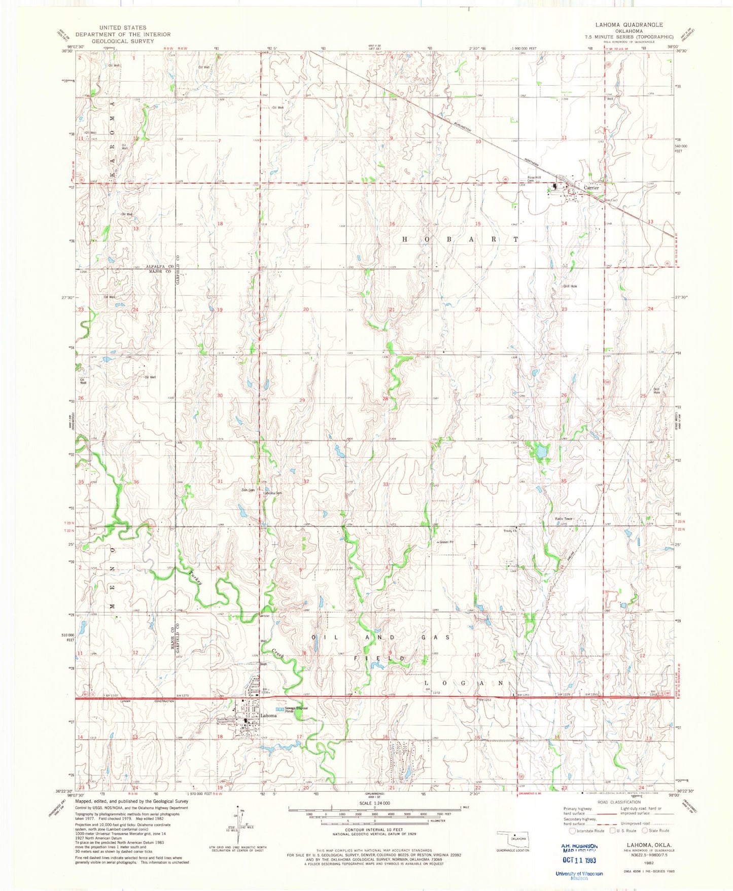
Classic USGS Lahoma Oklahoma 7.5'x7.5' Topo Map
Couldn't load pickup availability
Historical USGS topographic quad map of Lahoma in the state of Oklahoma. Map scale may vary for some years, but is generally around 1:24,000. Print size is approximately 24" x 27"
This quadrangle is in the following counties: Alfalfa, Garfield, Major.
The map contains contour lines, roads, rivers, towns, and lakes. Printed on high-quality waterproof paper with UV fade-resistant inks, and shipped rolled.
Contains the following named places: Baumagartner Cemetery, Black I Ranch Airport, Carrier, Carrier Post Office, Cimarron Elementary School, Cimarron High School, Lahoma, Lahoma Cemetery, Lahoma Fire Department, Lahoma Police Department, Lahoma Post Office, Oknoname 04702 Dam, Oknoname 04702 Reservoir, Rose Hill Cemetery, Town of Carrier, Town of Lahoma, Township of Hobart, Township of Logan, Trinity Church, Trinity Lutheran Cemetery, Vernon School, Zion Lutheran Cemetery, ZIP Codes: 73727, 73754