MyTopo
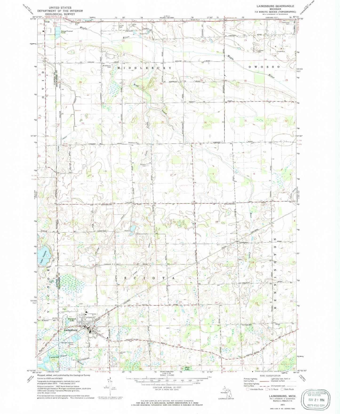
Classic USGS Laingsburg Michigan 7.5'x7.5' Topo Map
Couldn't load pickup availability
Historical USGS topographic quad map of Laingsburg in the state of Michigan. Map scale may vary for some years, but is generally around 1:24,000. Print size is approximately 24" x 27"
This quadrangle is in the following counties: Clinton, Shiawassee.
The map contains contour lines, roads, rivers, towns, and lakes. Printed on high-quality waterproof paper with UV fade-resistant inks, and shipped rolled.
Contains the following named places: Alder Creek, Bates Scout Park, Bear Creek, Church of the Nazarene, City of Laingsburg, Clinton Area Fire and Rescue Station 4, Coon Creek, Diamond Lake, First Baptist Church, First Congregational Church, Laingsburg, Laingsburg Cemetery, Laingsburg Christian School, Laingsburg City Hall, Laingsburg City Library, Laingsburg City Police Dept, Laingsburg Elementary School, Laingsburg High School, Laingsburg Middle School, Laingsburg Post Office, Laingsburg Sciota Woodhull Emergency Services Fire station, Laingsburg Station, Laingsburg United Methodist Church, Lake Victoria, Lake Victoria Census Designated Place, Lee Field Airport, McClintock Park, Middlebury Cemetery, Middlebury Church, Mount Olivet Catholic Cemetery, Mulder Dairy Farm, Oak Grove Cemetery, Pine Hills Golf Course, Putnam Cemetery, Putnam Drain, Saint Isidore Catholic Church, Stork Drain, Township of Middlebury, Township of Sciota, Vermilion Creek, ZIP Code: 48848