MyTopo
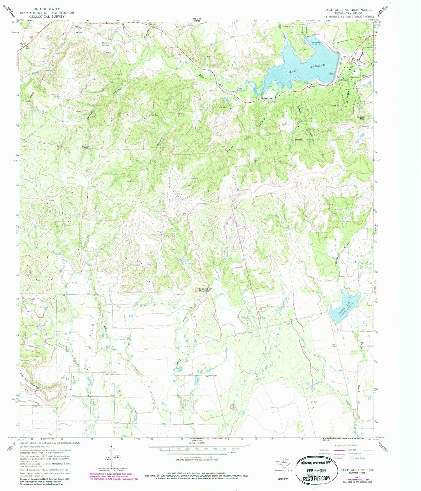
Classic USGS Lake Abilene Texas 7.5'x7.5' Topo Map
Couldn't load pickup availability
Historical USGS topographic quad map of Lake Abilene in the state of Texas. Typical map scale is 1:24,000, but may vary for certain years, if available. Print size: 24" x 27"
This quadrangle is in the following counties: Taylor.
The map contains contour lines, roads, rivers, towns, and lakes. Printed on high-quality waterproof paper with UV fade-resistant inks, and shipped rolled.
Contains the following named places: Abilene State Park, Lake Abilene, Brock Hollow, Cedar Creek, Coon Hollow, Horse Fall Creek, Indian Mountain, Jordan Hollow, Little Elm Creek, Pleasant Run, Puckett Springs, Scott Hollow, Steamboat Mountain, Tenant Hollow, Lake Bulger Dam, Graham Lake, Lake Abilene Dam, Abilene State Park Trail, Elm Creek Citizens Association Volunteer Fire Department Station 2