MyTopo
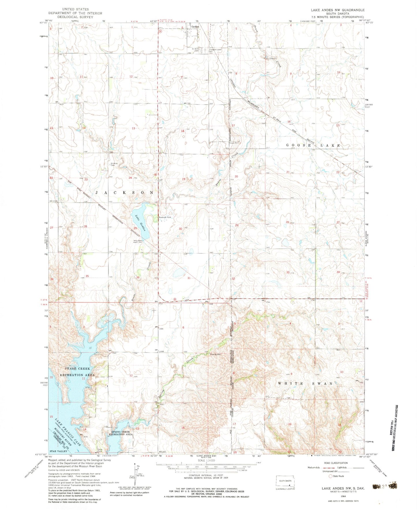
Classic USGS Lake Andes NW South Dakota 7.5'x7.5' Topo Map
Couldn't load pickup availability
Historical USGS topographic quad map of Lake Andes NW in the state of South Dakota. Map scale may vary for some years, but is generally around 1:24,000. Print size is approximately 24" x 27"
This quadrangle is in the following counties: Charles Mix, Gregory.
The map contains contour lines, roads, rivers, towns, and lakes. Printed on high-quality waterproof paper with UV fade-resistant inks, and shipped rolled.
Contains the following named places: Bartholdi, Geddes Dam, Jackson Township Cemetery, Lake Geddes, Pease Creek, Pease Creek Recreation Area, Pleasant Lawn Cemetery, Saint Anns Catholic Cemetery, Saint Anns Cemetery, Spring Creek Recreation Area, Township of Jackson, Varilek Fishpond Number 1 Dam, Varilek Fishpond Number 2 Dam, Varilek Fishpond Number One, Varilek Fishpond Number Two, ZIP Code: 57342