MyTopo
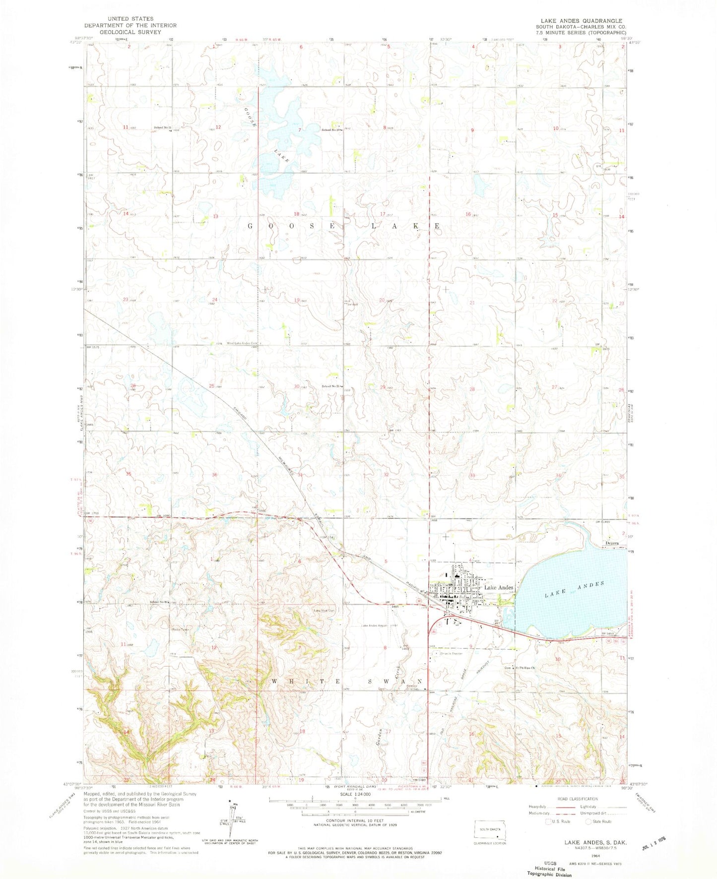
Classic USGS Lake Andes South Dakota 7.5'x7.5' Topo Map
Couldn't load pickup availability
Historical USGS topographic quad map of Lake Andes in the state of South Dakota. Map scale may vary for some years, but is generally around 1:24,000. Print size is approximately 24" x 27"
This quadrangle is in the following counties: Charles Mix.
The map contains contour lines, roads, rivers, towns, and lakes. Printed on high-quality waterproof paper with UV fade-resistant inks, and shipped rolled.
Contains the following named places: Andes Central Elementary School, Andes Central High School, Andes Central Junior High School, Charles Mix County, Charles Mix County Courthouse, Charles Mix County Jail, Charles Mix County Sheriff's Office, City of Lake Andes, Dezera, Goose Lake, Lake Andes, Lake Andes Carnegie Library, Lake Andes City Hall, Lake Andes Municipal Airport, Lake Andes Post Office, Lake Andes Volunteer Fire Department, Lake View Cemetery, Saint Philip Deacon Cemetery, Saint Phillips Church, School Number 20, School Number 21, School Number 25, School Number 86, Township of Goose Lake, Wagner - Lake Andes Ambulance District Main Station, West Lake Andes Cemetery, ZIP Code: 57356