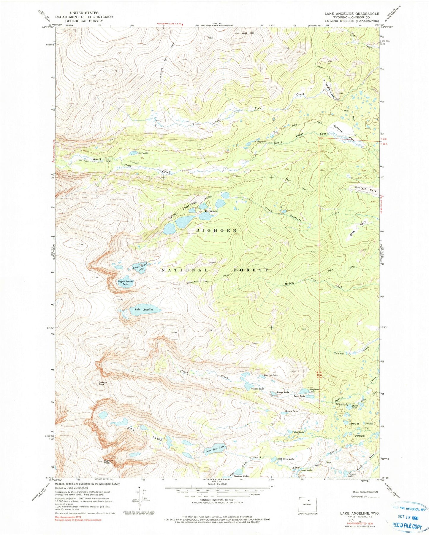
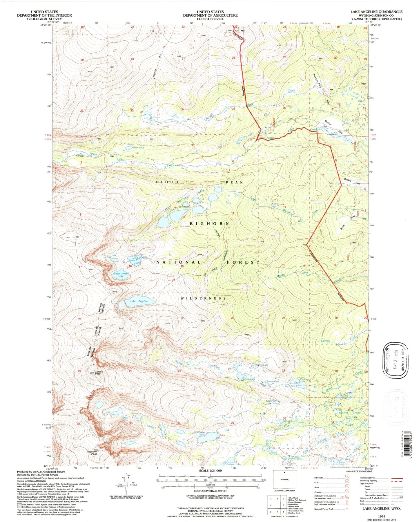
MyTopo
USGS Classic Lake Angeline Wyoming 7.5'x7.5' Topo Map
Couldn't load pickup availability
Historical USGS topographic quad map of Lake Angeline in the state of Wyoming. Scale: 1:24000. Print size: 24" x 27"
This quadrangle is in the following counties: Johnson.
The map contains contour lines, roads, rivers, towns, lakes, and grids including latitude / longitude and UTM / MGRS. Printed on high-quality waterproof paper with UV fade-resistant inks.
Contains the following named places: Angeline Trail, Lake Angeline, Ant Hill, Bighorn Peak, Chill Lakes, Darton Peak, Deer Lake, Her Lake, Lame Deer Lake, Long Lake, Lower Frozen Lake, Martin Lake, Old Crow Lake, Otter Lake, Pass Creek, Rainy Lake, Ringbone Lake, Romeo Lake, Sawmill Creek, Seven Brothers Lakes, Sherd Lake, Slab Park, Soldier Park, South Fork Ponds, Triangle Park, Trigger Lake, Upper Frozen Lake, Willow Lake, North Fork Trailhead, South Fork Pond Dam, South Fork Ponds, Soldier Park Cemetery