MyTopo
Classic USGS Lake Arbuckle Florida 7.5'x7.5' Topo Map
Regular price
$16.95
Regular price
Sale price
$16.95
Unit price
per
Couldn't load pickup availability
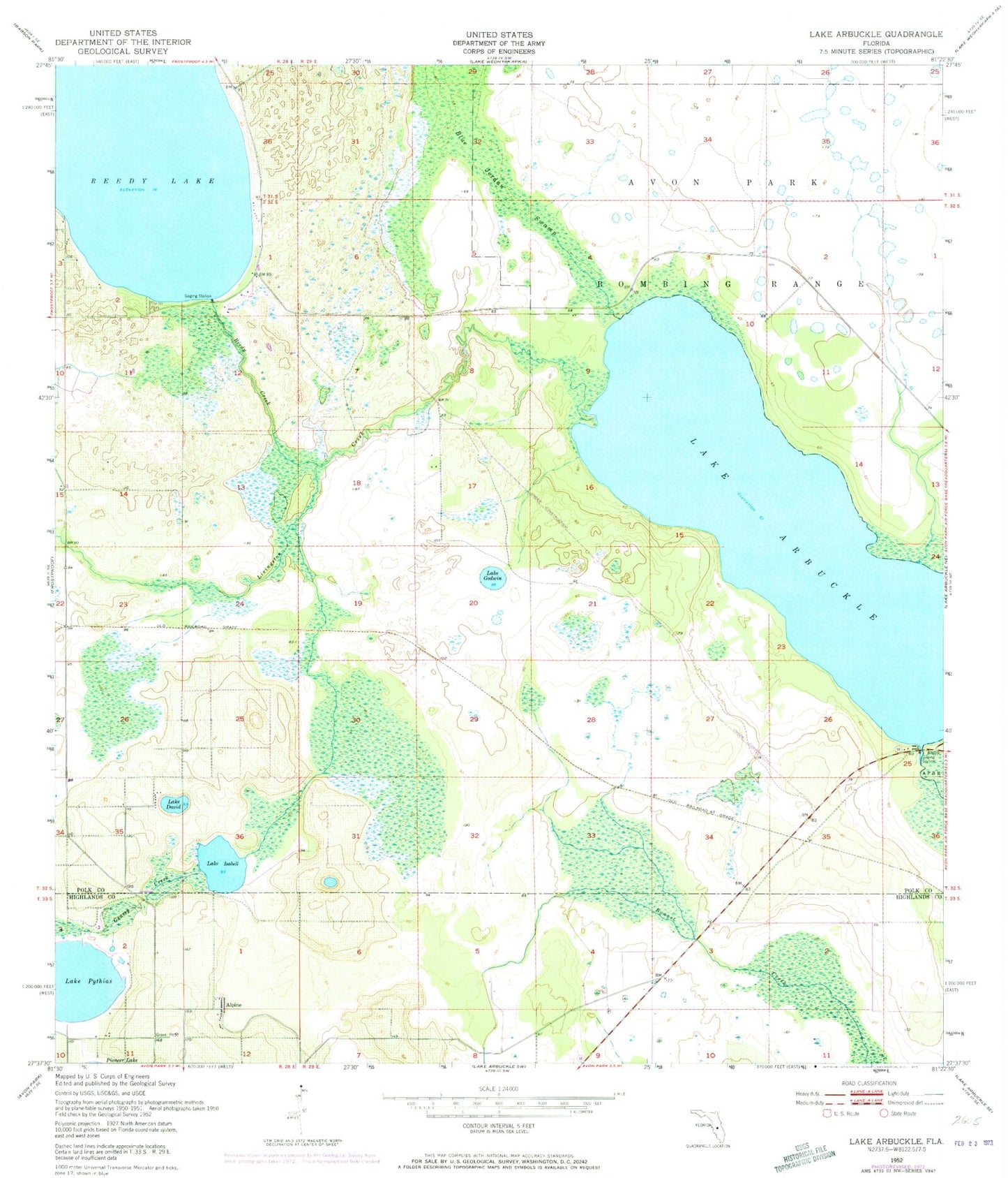
Historical USGS topographic quad map of Lake Arbuckle in the state of Florida. Map scale may vary for some years, but is generally around 1:24,000. Print size is approximately 24" x 27"
This quadrangle is in the following counties: Highlands, Polk.
The map contains contour lines, roads, rivers, towns, and lakes. Printed on high-quality waterproof paper with UV fade-resistant inks, and shipped rolled.
Contains the following named places: Alpine, Blue Jordan Swamp, Country Baptist Church, Frostproof Division, Grassy Creek, Lake Arbuckle, Lake David, Lake Godwin, Lake Isabell, Lake Pythias, Livingston Creek, Reedy Creek, Reedy Lake, Rucks Dairy Airport