
MyTopo
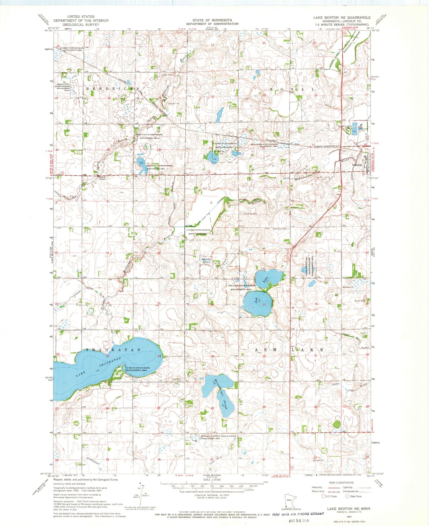
Classic USGS Lake Benton NE Minnesota 7.5'x7.5' Topo Map
Couldn't load pickup availability
Historical USGS topographic quad map of Lake Benton NE in the state of Minnesota. Map scale may vary for some years, but is generally around 1:24,000. Print size is approximately 24" x 27"
This quadrangle is in the following counties: Lincoln.
The map contains contour lines, roads, rivers, towns, and lakes. Printed on high-quality waterproof paper with UV fade-resistant inks, and shipped rolled.
Contains the following named places: Ash Lake, Ash Lake State Wildlife Management Area, Blue Wing State Wildlife Management Area, Chain-O-Sloughs State Wildlife Management, City of Ivanhoe, County Ditch Number Thirtyseven, East Elim Cemetery, Expectation State Wildlife Management Areas, Herschberger Slough, Iron Horse State Wildlife Management Area, Ivanhoe State Wildlife Management Area, Judicial Ditch Number Twentytwo, Lake Shaokatan, Lincoln County, Lincoln County Courthouse, Lincoln County Jail, Lincoln County Sheriff's Office, Lincoln Public High School, Muskrat Junction State Wildlife Management A, Saint Peter and Paul Catholic Church, Shaokatan Cemetery, Shaokotan Lake, Shaokotan Lake Dam, Suhr State Wildlife Management Area, Swenson Lakebed, Township of Ash Lake, West Elim Cemetery


