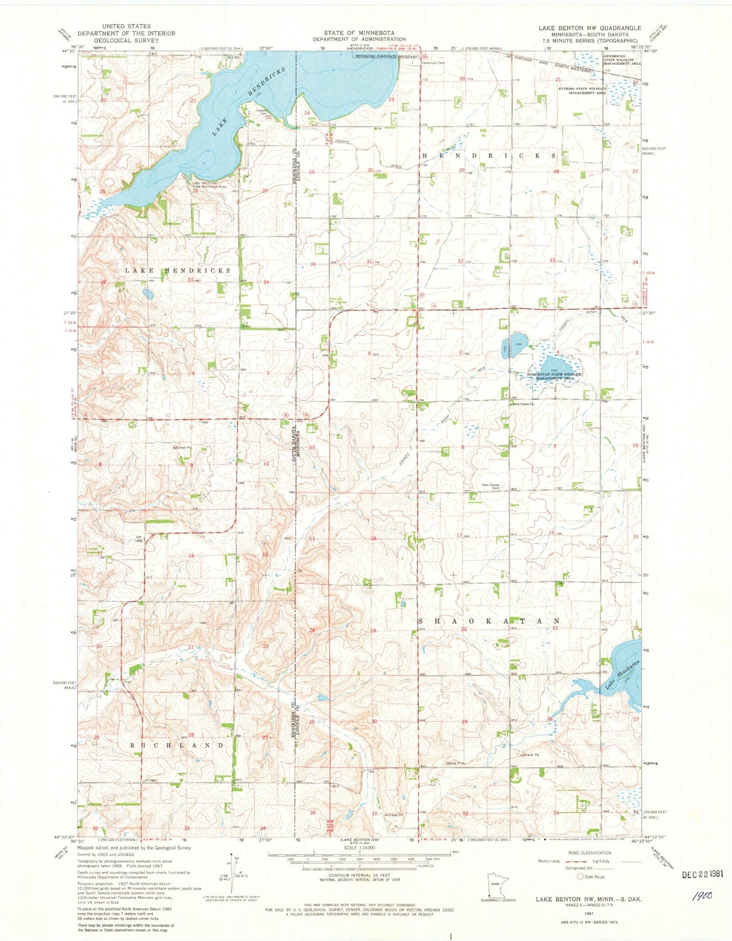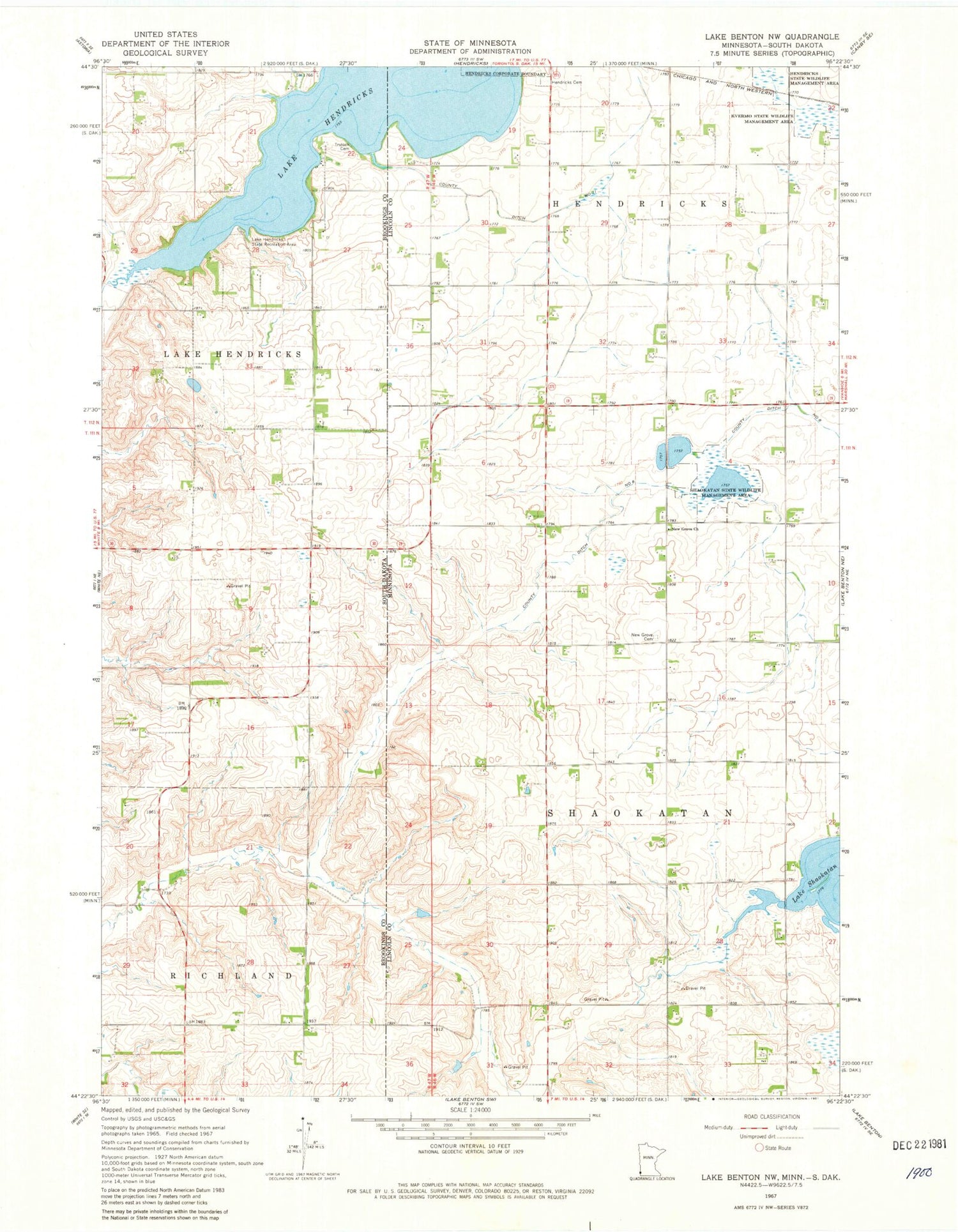
MyTopo
Classic USGS Lake Benton NW Minnesota 7.5'x7.5' Topo Map
Couldn't load pickup availability
Historical USGS topographic quad map of Lake Benton NW in the states of Minnesota, South Dakota. Map scale may vary for some years, but is generally around 1:24,000. Print size is approximately 24" x 27"
This quadrangle is in the following counties: Brookings, Lincoln.
The map contains contour lines, roads, rivers, towns, and lakes. Printed on high-quality waterproof paper with UV fade-resistant inks, and shipped rolled.
Contains the following named places: County Ditch Number Eight, County Ditch Number Eleven, Hendricks Cemetery, Kvermo State Wildlife Management Area, Lake Hendricks, Lake Hendricks State Recreation Area, New Grove Cemetery, New Grove Church, Shaokatan State Wildlife Management Area, Township of Lake Hendricks, Township of Shaokatan, Trulock Cemetery, ZIP Code: 56136