MyTopo
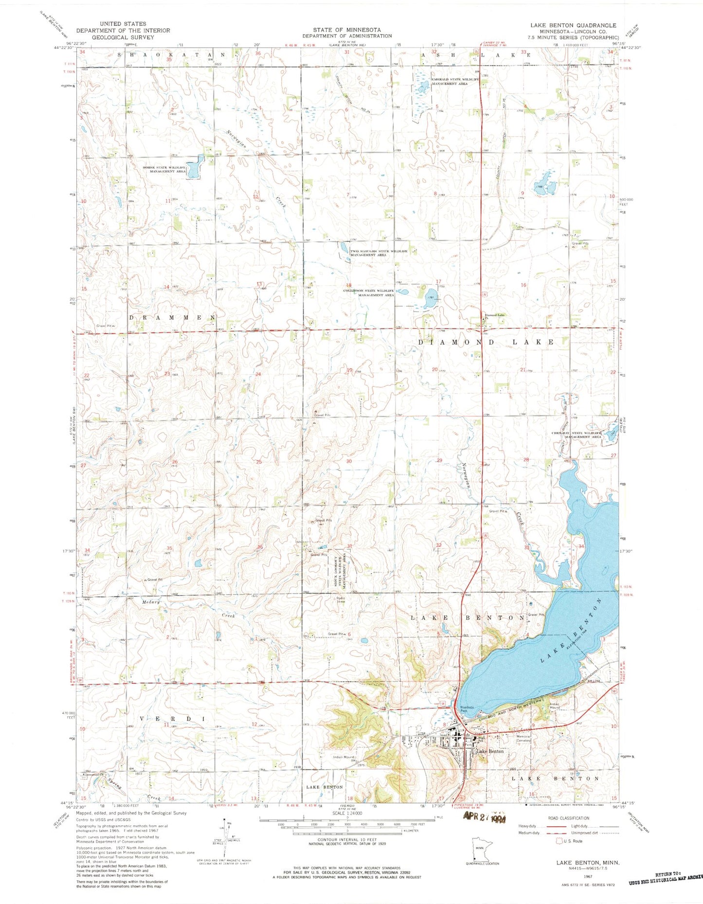
Classic USGS Lake Benton Minnesota 7.5'x7.5' Topo Map
Couldn't load pickup availability
Historical USGS topographic quad map of Lake Benton in the state of Minnesota. Map scale may vary for some years, but is generally around 1:24,000. Print size is approximately 24" x 27"
This quadrangle is in the following counties: Lincoln.
The map contains contour lines, roads, rivers, towns, and lakes. Printed on high-quality waterproof paper with UV fade-resistant inks, and shipped rolled.
Contains the following named places: Briffett Family Cemetery, Church of Saint Genevieve, City of Lake Benton, Collinson State Wildlife Management Area, County Ditch Number Thirtyfive, County Ditch Number Thirtyfour, County Ditch Number Twenty, Danish Evangelical Cemetery, Diamond Lake Church, Emerald State Wildlife Management Area, First Baptist Church, Grace Lutheran Church, Horse State Wildlife Management Area, Immanuel Cemetery, Immanuel Church, Kingdom Hall of Jehovahs Witnesses, KKCK-FM (Marshall), Lake Benton, Lake Benton Fire Department, Lake Benton Health Clinic, Lake Benton Library, Lake Benton Police Department, Lake Benton Post Office, Lake Benton Public School, Memorial Hill Cemetery, Minnesota Noname Number 4 Dam, Norwegian Creek, Saint John's Evangelical Lutheran Church, Sioux Lookout State Wildlife Management Area, Township of Diamond Lake, Two Sloughs State Wildlife Management Area, United Methodist Church, ZIP Code: 56149