MyTopo
Classic USGS Lake Berryessa California 7.5'x7.5' Topo Map
Couldn't load pickup availability
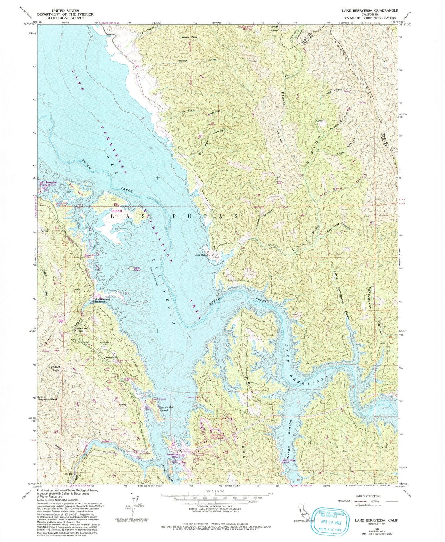
Historical USGS topographic quad map of Lake Berryessa in the state of California. Typical map scale is 1:24,000, but may vary for certain years, if available. Print size: 24" x 27"
This quadrangle is in the following counties: Napa, Yolo.
The map contains contour lines, roads, rivers, towns, and lakes. Printed on high-quality waterproof paper with UV fade-resistant inks, and shipped rolled.
Contains the following named places: Alfalfa Patch Reservoir, Apple Tree Canyon, Berryessa Marina, Brushy Canyon, Dardon Canyon, Gosling Canyon, Gunn Ranch, Jackson Creek, Jackson Peak, Lake Berryessa Park Headquarters, Lion Canyon, Little Portuguese Canyon, Monticello Cemetery, Oil Well Canyon, Oil Well Canyon, Portuguese Canyon, Quarry Canyon, Right-Hand Canyon, Las Putas, Spanish Flat, Steel Canyon, Sugarloaf Park, Sugarloaf Peak, Tin Can Canyon, Wallet Canyon, Wragg Canyon, Lake Berryessa, Tully Canyon, Rocky Ridge, Lake Berryessa Recreation Area, Goat Island, Big Island, Small Island, Smittle Creek Picnic Area, South Shore Resort, Oak Shores Park, Berryessa Highlands, Capell Cove Boat Ramp, Spanish Flat Resort, Steel Canyon Resort, Camp North (historical), Meeks Ranch (historical), Monticello (historical), Redbud Park (historical), Sidwell Ranch (historical), Sugarloaf Hunting Club (historical), Tibipa Ranch (historical), Weiss Ranch (historical), Napa County Fire Department Station 24 Spanish Flat, Dufer Point