MyTopo
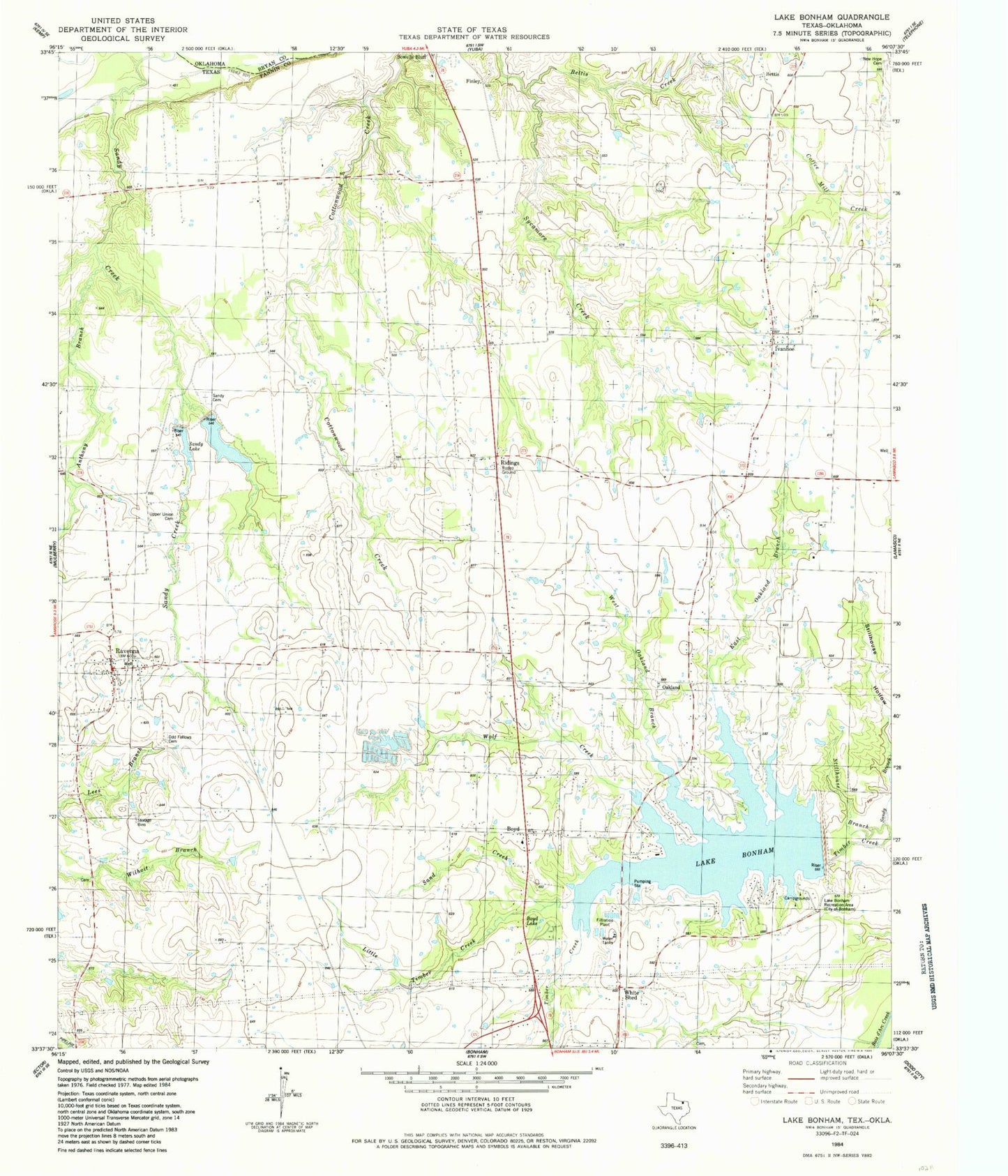
Classic USGS Lake Bonham Texas 7.5'x7.5' Topo Map
Couldn't load pickup availability
Historical USGS topographic quad map of Lake Bonham in the state of Texas. Map scale may vary for some years, but is generally around 1:24,000. Print size is approximately 24" x 27"
This quadrangle is in the following counties: Bryan, Fannin.
The map contains contour lines, roads, rivers, towns, and lakes. Printed on high-quality waterproof paper with UV fade-resistant inks, and shipped rolled.
Contains the following named places: Anthony Branch, Bettes Cemetery, Bettis, Bettis Creek, Boyd, Boyd Lake, Brown Cemetery, Brue - Rostine Cemetery, City of Ravenna, Corrigan Lake Number 1, Corrigan Lake Number 1 Dam, Corrigan Lake Number 2, Corrigan Lake Number 2 Dam, East Oakland Branch, Eminence Cemetery, Finley, Ivanhoe, Ivanhoe Post Office, Lake Bonham, Lake Bonham Dam, Lake Bonham Park, Lake Bonham Recreation Area, Little Timber Creek, Macedoniaqchurch, New Hope Cemetery, New Union Cemetery, Oakland, Odd Fellows Cemetery, Pioneer Grave Yard, Ravenna, Ravenna City Hall, Ravenna Post Office, Ravenna Volunteer Fire Department, Ridings, Sand Creek, Sandy Cemetery, Sandy Church, Sandy Creek Ranch Airport, Sandy Lake, Stillhouse Branch, Stillhouse Hollow, Union Church, Upper Union Cemetery, West Oakland Branch, White Cemetery, White Shed, Wolf Creek, ZIP Code: 75476